WaterfallNear Me

Maine waterfall visits

Compare 52 Maine waterfall visits by the approach, terrain, and where to start. Some routes have closures or unresolved details; read the individual guide before travelling.

52 visit options

Billings Falls, ME

Trail network, trailhead and access fee documented

Maine

Billings Falls

About 1.7 miles one way to the Rim Trail, then a short way east to the falls (distance not published)

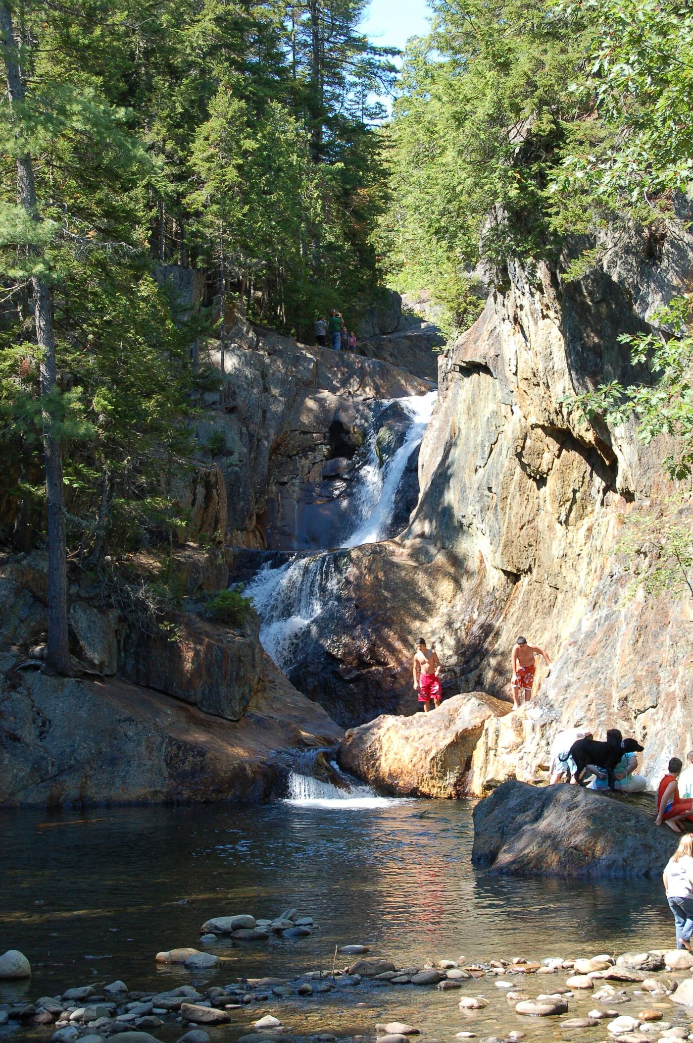
Billings Falls is one of the waterfalls in Gulf Hagas on the West Branch of the Pleasant River. From the west trailhead (Head of the Gulf parking area), hike about 1.7 miles to the Rim Trail near the Head of the Gulf. The Rim Trail runs east to west past Screw Auger Falls, Lower Falls, Hammond Street Pitch, The Jaws, Buttermilk Falls, Stair Falls, Billings Falls and the Head of the Gulf, so from the west end Billings Falls comes before Stair Falls. Return the same way or by the Pleasant River Tote Road. The east trailhead requires fording the river.
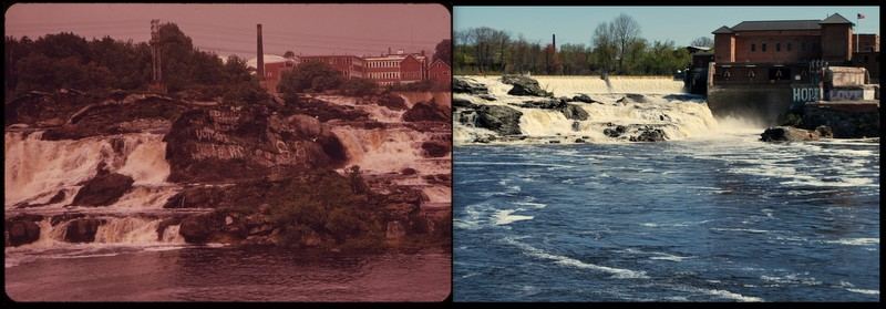
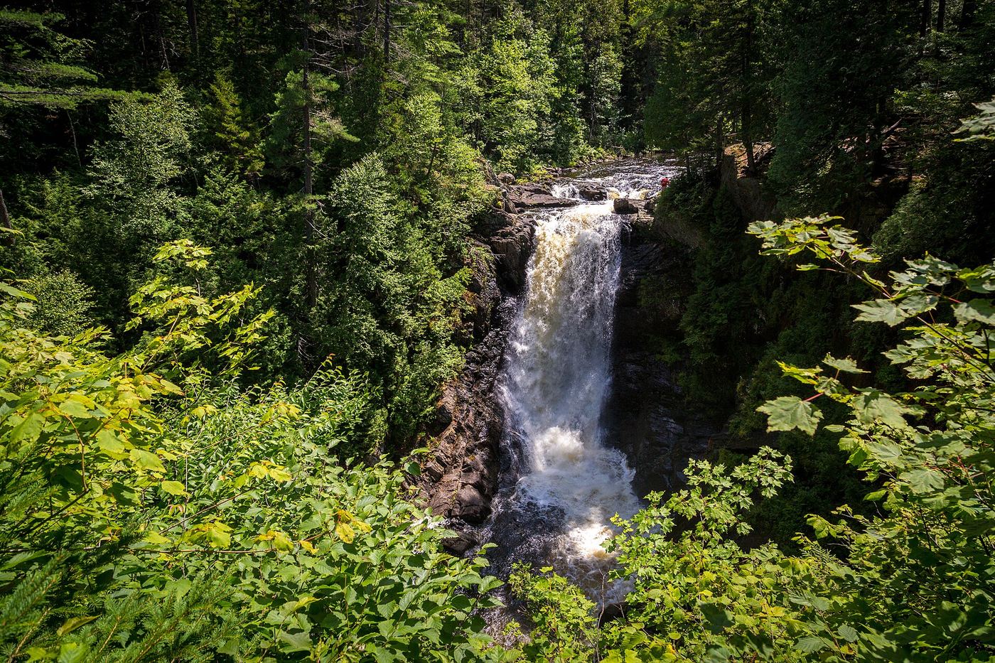
Photo creditPhoto: Fredlyfish4, CC BY-SA 4.0, via Wikimedia Commons
Great Falls, ME

Urban riverwalk to a public overlook; easy

Maine

Great Falls

About 0.95 mile one way from Moulton Park

Great Falls, also called Lewiston Falls, is a 37-foot urban waterfall on the Androscoggin River between Auburn and Lewiston, still used for hydroelectric power. On the Auburn Riverwalk, start just past the skate park in Moulton Park and follow the gravel path about 0.25 mile to a fork in Bonney Park. Take the left fork north along the river for 0.7 mile on a brick-paved path with benches to the overlook at West Pitch Park.

Photo creditPhoto: USEPA Environmental-Protection-Agency, Public domain, via Wikimedia Commons
Smalls falls, ME

State rest area with a short gorge trail

Maine

Smalls falls

About 0.3 mile to the upper end of the falls

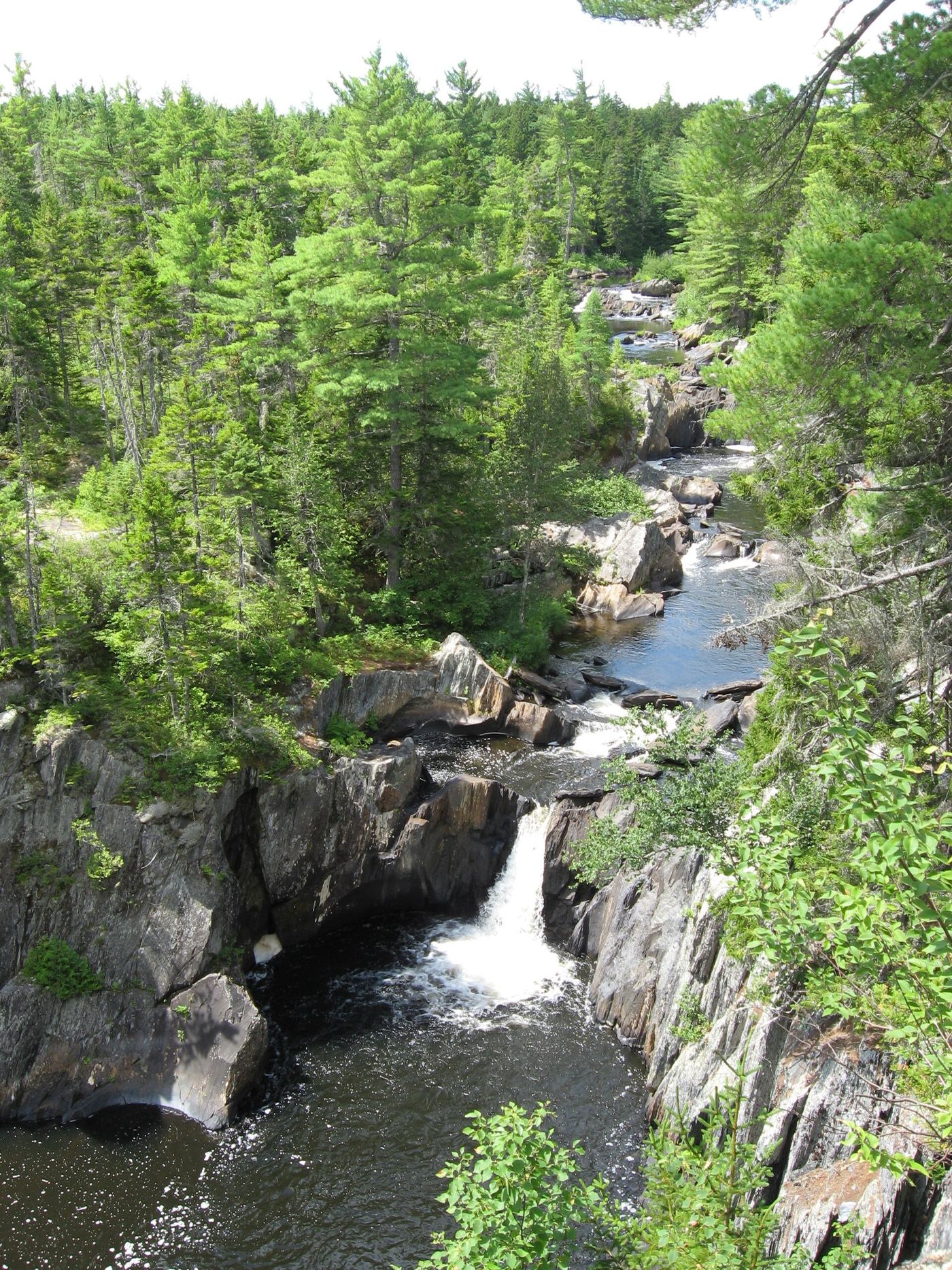
Smalls Falls is a series of waterfalls, chutes and pools on the Sandy River in a colorful gorge, with a 54-foot total drop. From the Maine DOT rest area on Route 4, walk down stairs and cross a small bridge over the Sandy River. Turn right and follow the river upstream past several viewpoints, using either the rocks near the fence or the interior trails, until you reach a dirt road in about 0.3 mile. Going straight about 50 feet after the bridge instead leads to the Chandler Mill Stream falls.

Photo creditPhoto: Tim Pierce, Public domain, via Wikimedia Commons
Stair Falls, ME

Trail network, trailhead and access fee documented

Maine

Stair Falls

About 1.7 miles one way to the Rim Trail, then a short way east past Billings Falls (distance not published)

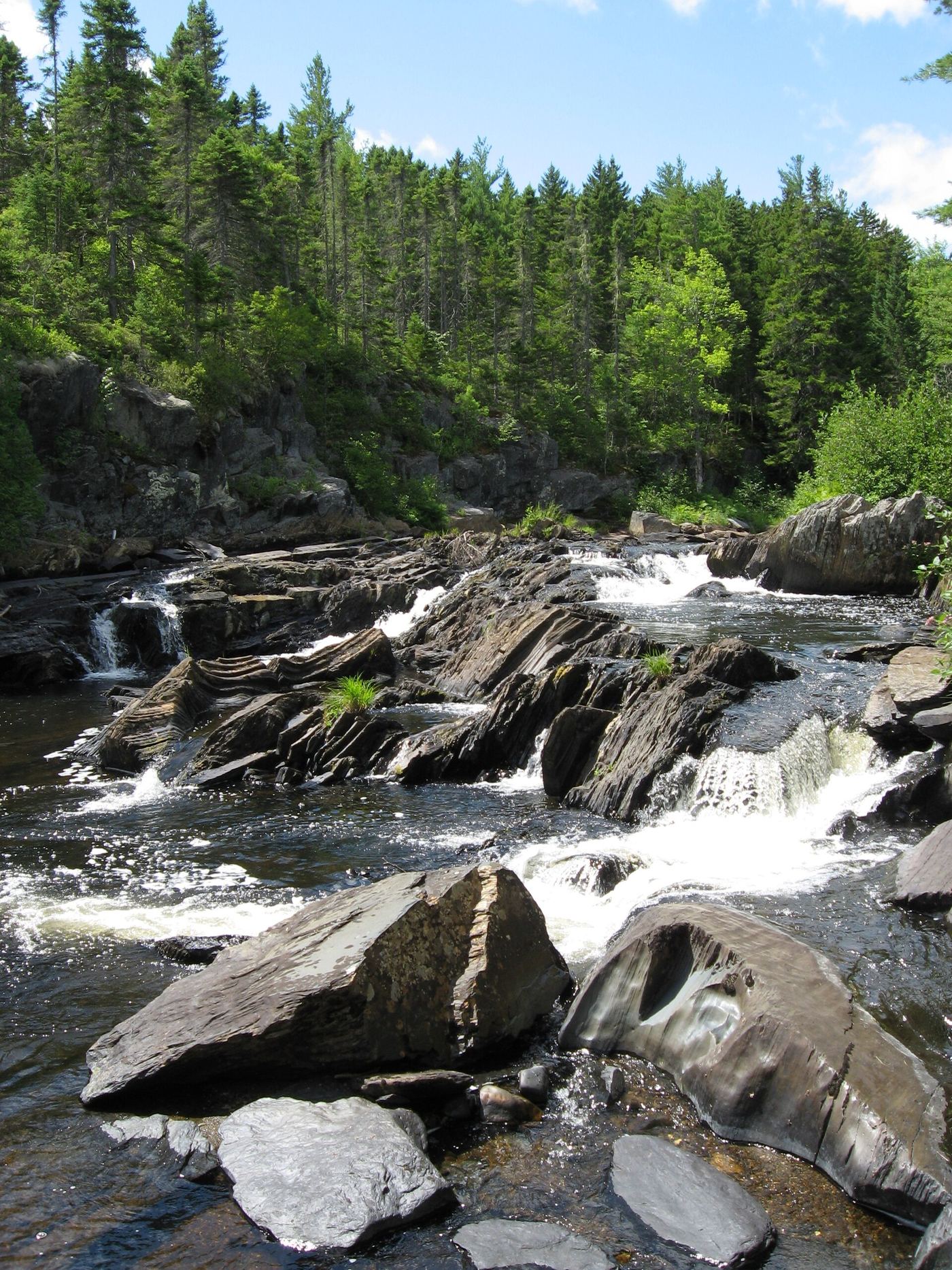
Stair Falls is one of the waterfalls in Gulf Hagas on the West Branch of the Pleasant River. From the west trailhead (Head of the Gulf parking area), hike about 1.7 miles to the Rim Trail near the Head of the Gulf. The Rim Trail runs east to west past Screw Auger Falls, Lower Falls, Hammond Street Pitch, The Jaws, Buttermilk Falls, Stair Falls, Billings Falls and the Head of the Gulf, so from the west end you pass Billings Falls and then reach Stair Falls. Return the same way or by the Pleasant River Tote Road. The east trailhead requires fording the river.
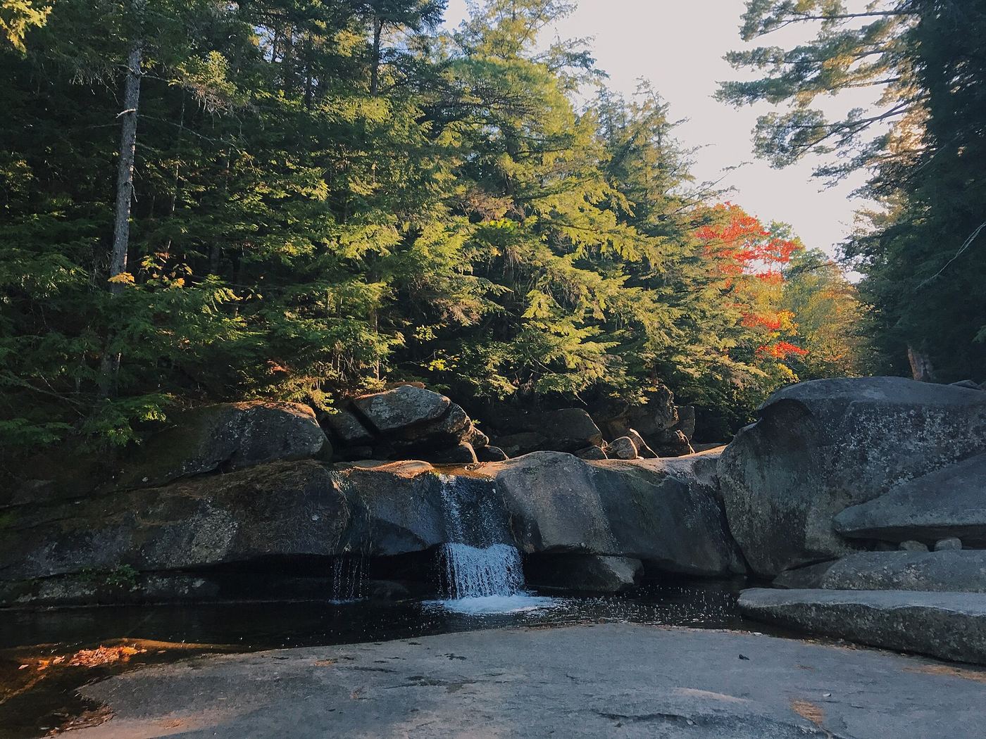
Photo creditPhoto: Fredlyfish4, CC BY-SA 4.0, via Wikimedia Commons

Partial guide: firsthand route documented; land ownership and parking permission unconfirmed

Maine

Abol Falls

About 100 feet one way

Cross the one-lane Abol Bridge westbound, go 200 feet, and turn left onto an unmarked dirt road. After 0.7 mile, park at the pull-off on the right. Cross the road and walk about 100 feet on a path to the river; the falls are slightly upstream. In summer the falls are class II or III rapids; in spring flood they are a wide, powerful cascade.

Location map; no photo available.

Published trail with parking coordinates; stream crossings and logging road

Maine

Angel Falls

About 1.1 miles return (Maine Trail Finder)

From the parking area in the old gravel pit, follow red blazes on a logging path across Berdeen Stream, then follow the red-blazed trail to Mountain Brook. The trail goes upstream and rock hops the brook several times before reaching the 90-foot falls. Return the same way.

Location map; no photo available.

Short walk on private timber land; current permission not confirmed

Maine

Austinm Stream Falls

About 0.2 mile one way, about 0.4 mile return

Austin Stream Falls is a set of cascades with a 12-foot main drop on Austin Stream, on timber company land northeast of Bingham. From the roadside parking on Dead Water Road, walk 0.2 mile down the spur road to its end, then follow rough paths on the left about 50 feet downhill to the stream. Views from the top are partly blocked; reaching the base takes a moderate scramble. The falls are on private Weyerhaeuser land; the guidebook said in 2017 that the public appeared welcome, but current permission was not confirmed.

Location map; no photo available.

Town park viewpoint documented by visitor accounts

Maine

Bad Little Falls

Short walk inside a small town park; measured distance not published

Bad Little Falls Park in downtown Machias has a pedestrian bridge and an observation platform over the falls where the Machias River meets tidewater. One side of the park has steps and the other side is flat. Picnic seating is available.

Location map; no photo available.

Appalachian Trail hike in Baxter State Park; park entry fee for non-residents

Maine

Big Niagara Falls

About 1.2 miles one way, about 2.4 miles return

Big Niagara Falls is a 20-foot cascade and slide on Nesowadnehunk Stream in Baxter State Park. From the Daicey Pond day-use parking, follow the white-blazed Appalachian Trail south. Turn right at the 4-way junction with the Daicey Pond Nature Trail at 0.2 mile. Pass the Toll Dam spur at 0.8 mile and the Little Niagara Falls spur just after it. Continue 0.3 mile further and turn right on the rooty spur that leads about 150 feet to Big Niagara Falls. Views are from the side and top ledges. Return the same way.

Location map; no photo available.

Partial guide: parking pull-off documented; path and land permission not confirmed

Maine

Big Wilson Falls

Short approach; exact path and distance not published online

Big Wilson Falls is a set of cascades and pools on Big Wilson Stream that drop 15 feet over about 75 feet. Drive Elliotsville Road 7.6 miles from Route 6/15 north of Monson. The visitor pull-off is on Elliotsville Road directly across from the dirt road to Little Wilson Falls, just before the bridge. The path from the pull-off is not described in the online sources.

Location map; no photo available.

Trail manager route and checkpoint fee documented; river ford

Maine

Buttermilk Falls

About 3.3 miles one way (about 6.6 miles return)

From the Gulf Hagas Parking Area, walk 0.2 mile to the Appalachian Trail and turn right. Ford the West Branch of the Pleasant River, then continue 1.3 miles to the blue-blazed Rim Trail on the left. Follow the Rim Trail past Screw Auger Falls to Buttermilk Falls, a 10-foot horsetail with a large pool. The Pleasant River Tote Road is a faster way back.

Location map; no photo available.

Published trail system and parking

Maine

Cascade Falls Waterfall

Short walk; the Trout Pond Loop is 0.25 mile

From the parking lot at 61 Cascade Road, start just to the right of the kiosk. Turn left and follow the stone-dust Trout Pond Loop along Cascade Brook to an open area. For the base of the falls, take the steep path marked FALLS on the left. Return by the loop. Other paths reach the top of the falls and a viewing point across the footbridge.

Location map; no photo available.

Public land trail with logging-road access

Maine

Cold Stream Falls

About 1.2 miles one way, about 2.4 miles return

Cold Stream Falls is a small waterfall with a plunge pool on Cold Stream in the state-owned Cold Stream Forest Public Land between The Forks and Jackman. From the trailhead on Mountain Brook Road, the blue-blazed trail drops toward the stream, then runs roughly parallel to it and levels out before reaching the falls in a deepening ravine. Return by the same trail.

Location map; no photo available.

Short route documented; private road and land, permission not reconfirmed

Maine

Cowyard Falls

Less than 0.1 mile one way

Cowyard Falls is a 10-foot cascade on Ship Pond Stream. From the pull-off, cross the bridge on foot and turn right onto a rough path down the east side of the stream. The base of the falls is less than 100 feet along. The falls can also be seen by looking downstream from the bridge. The guidebook author reports the road and land are private, with the public allowed at the time of the 2017 visit.

Location map; no photo available.

Bridge and staircase confirmed by NPS; parking and exact falls not confirmed

Maine

Duck Brook Waterfall

Distance from parking not confirmed

Duck Brook Bridge carries the Witch Hole Pond Loop carriage road over Duck Brook in Acadia National Park. A staircase on the upstream side of the bridge leads down to the brook. Visitor comments describe a small waterfall at the bridge. The parking start and the exact position of the mapped waterfall were not confirmed.

Location map; no photo available.

Trail listing with parking documented; private land open by courtesy

Maine

Fish River Falls

Trail network is 0.8 mile; one way distance to the falls not stated separately

Drive south from Fort Kent on Route 161 (Caribou Road), turn right on Strip Road and right on Airport Road to a small lot at the end by a grass airstrip. A short woods trail leads down to Fish River Falls, a Class IV rapid. Paths along the river give views; there is a large campsite with a picnic table by the falls.

Location map; no photo available.

Roadside falls on private logging roads; checkpoint fee

Maine

Gauntlet Falls

A few steps from the parking lot

Gauntlet Falls is a swimming spot with high ledges in the North Maine Woods south of Jo-Mary Lake. Drive the Jo-Mary Road from Route 11 between Millinocket and Brownville Junction and pay at the Jo-Mary Checkpoint. About 6 miles on, continue onto Johnson Pond Road for about 2.6 miles, then turn left onto B Pond Road for about 3.5 miles to the parking lot. Short trails from the lot lead to the falls and to the lower section and Mud Gauntlet Falls.

Location map; no photo available.

Short hike from a rafting put-in on a long dirt road

Maine

Grand Falls

About 0.5 mile one way, about 1 mile return

Grand Falls is a large waterfall on the Dead River. From the lot at the end of Lower Enchanted Road, follow the road down to Spencer Stream and cross the bridge. Continue on the ATV and snowmobile trail for 0.2 mile, cross a small footbridge onto the Maine Huts trail, and climb a steep pitch for 0.3 mile to the Grand Falls lookout. To avoid the steep pitch, stay on the ATV trail 0.6 mile past the footbridge and loop around to the viewpoint.

Location map; no photo available.

Trail manager route, parking and distance documented

Maine

Grand Pitch

About 1 mile one way (2.2 miles round trip per Maine Trail Finder)

From Patten, follow Route 159 west 5.7 miles past Shin Pond to the parking area on the right, just before the bridge over the Seboeis River. The trailhead is across the road. The trail follows the river for about a mile to the gorge at Grand Pitch, with a small picnic area just below the pitch where Shin Brook enters.

Location map; no photo available.

Published trail route in a national monument

Maine

Grand Pitch

About 3.5 miles each way to the Grand Pitch Lean-to, plus a short path

From the trailhead, follow the double-track road toward the East Branch Penobscot River, then the narrower trail to Haskell Rock Pitch at 2 miles. Follow the river for another mile to Pond Pitch and a half mile more to the Grand Pitch Lean-to. A short path leads to Grand Pitch, the highest falls on this section of the river. Portage trails give views along the falls.

Location map; no photo available.

Trail route, parking and park fee documented

Maine

Hadlock Falls

Just under 1 mile one way

Hadlock Falls, about 40 feet, runs under Waterfall Bridge on the Acadia carriage roads. The Hadlock Brook Trail starts across Route 198 from the parking area for the Goat Trail up Norumbega Mountain. It crosses a low, wet area, climbs beside the brook, passes under Waterfall Bridge and climbs beside the falls to the carriage road. You can also walk the carriage road from the Parkman Mountain parking area.

Location map; no photo available.

Official monument route with published distance

Maine

Haskell Rock Pitch

About 2 miles each way; NPS gives 4 miles out and back

From the trailhead, follow the double-track road toward the East Branch Penobscot River for about a mile, passing an old rock pit and the side trail to Stair Falls. Continue past the side trail to Haskell Hut. The trail narrows and reaches the river at Haskell Rock Pitch, named for a tall rock pillar in the river. Return the same way.

Location map; no photo available.

Visitor route and parking documented; private timber land open to the public

Maine

Houston Brook Falls

About 0.2 mile one way (about 0.4 mile return)

From Route 201 in Bingham, take Route 16 across the Kennebec River and turn right onto Pleasant Ridge Road. Drive 3.5 miles to the transfer station; the signed trail is on the right just after it. The worn path goes downhill to the brook and the 32-foot falls, which drop toward Wyman Lake.

Location map; no photo available.

Park trail route documented; park fees and rules apply

Maine

Howe Falls

About 1.2 miles one way to the lower falls; 3 miles one way to the end of the trail

Start on the Pogy Notch Trail at the east end of South Branch Pond Campground and follow the pond shore for 1 mile. Turn left on the blue-blazed Howe Brook Trail. After 0.2 mile the first smooth chutes, deep pools and potholes begin, with falls continuing for about half a mile. At 1.8 miles an unmarked side trail leads right to falls in a deep ravine, and at 2.0 miles the trail ends at a 20-foot sheer waterfall. The mapped point is near the lower part of the brook, so it most likely marks the lower falls and pools.

Location map; no photo available.

Recent visitor route; land owner and trail status not confirmed

Maine

Indian Stream Falls

About 2.4 miles return

From the parking area off Morkill Road, the path goes straight back and crosses an active railroad line at 0.3 mile. It heads mainly south for about a mile through brushy and overgrown forest, marked only with some flagging tape and small cairns. Just around the mile mark, it turns sharply left and goes down into the Indian Stream valley to the falls. Return the same way.

Location map; no photo available.

National forest trail route and trailhead documented

Maine

Kees Falls

About 2.1 miles one way

From the shared trailhead parking area on Route 113, follow the Caribou Trail. It follows Morrison Brook through northern hardwood forest, crossing the brook several times and passing several waterfalls before reaching the 25-foot Kees Falls at 2.1 miles. Return the same way, or continue to the Mud Brook Trail junction at 3.1 miles for a longer loop over Caribou Mountain.

Location map; no photo available.

Guidebook route with matching coordinates; land owner not confirmed

Maine

Kezar Falls

Less than 0.1 mile (guidebook figure)

From the parking area, follow one of several rough paths a few feet down to an old fence along the rim of the gorge. Views of the gorge and small falls start there. Return the same way.

Location map; no photo available.

Roadside park viewpoint with designated parking documented

Maine

Ledge Falls

About 100 feet; the falls are visible from the road

Enter Baxter State Park at the Togue Pond gate, register, and drive the Park Tote Road 7.3 miles west of Katahdin Stream Campground to the designated Ledge Falls parking area. The natural waterslides on Nesowadnehunk Stream are about 100 feet north of the lot and visible from the road.

Location map; no photo available.

Parking at the falls mentioned by two sources; owner and path not confirmed

Maine

Little Falls

Short walk; distance not published

Little Falls is a Class 3 rapid on Grand Lake Stream between Grand Lake Stream village and Big Lake, known as a fishing pool. American Whitewater says paddlers can take out at the maintained lots by Little Falls, and a 2019 Bangor Daily News fishing account describes the parking lot there. Who owns the lots and the bank, and the exact path to the falls, were not confirmed.

Location map; no photo available.

Appalachian Trail hike in Baxter State Park; park entry fee for non-residents

Maine

Little Niagara Falls

About 0.9 mile one way, about 1.8 miles return

Little Niagara Falls is a 20-foot cascade with a swimming pool on Nesowadnehunk Stream in Baxter State Park. From the Daicey Pond day-use parking, follow the white-blazed Appalachian Trail south. Turn right at the 4-way junction with the Daicey Pond Nature Trail at 0.2 mile. At 0.8 mile a spur leads to the old Toll Dam site; 75 feet further south, take the 150-foot spur on the right to Little Niagara Falls. The easiest way to the base is along the rock ledges at the edge of the woods. Return the same way.

Location map; no photo available.

Trailhead parking and short path documented

Maine

Little Wilson Lower Falls

About 200 feet from the trailhead parking; up to 1.1 miles one way if parking at the lower lot

From Monson, drive Route 6/15 north 0.6 mile and turn right onto Elliotsville Road. After 7.6 miles, before the Big Wilson Stream bridge, turn left onto the rough dirt road. Low clearance cars park just after the turn; others continue to the gravel lot or the trailhead lot 0.3 mile further. The lower falls are visible from the trailhead, about 200 feet away, by a nearly level path.

Location map; no photo available.

Trail route, parking and land ownership documented

Maine

Little Wilson Upper Falls

About 1.2 miles one way from the day use lot; add about 0.8 mile each way from the lower lot

The upper falls of Little Wilson Stream is a 40-foot drop in a slate gorge, and the Appalachian Trail passes directly by it. From the trailhead near the lower falls, follow the blue-blazed access trail along the stream and up a couple of steep switchbacks. After about 0.8 mile, turn left on the white-blazed Appalachian Trail to the falls. Two short paths give views above and below the falls. The trail runs at the top of a steep drop to the stream; use extra caution.

Location map; no photo available.

Partial guide: trail and lookout documented; sources name cliffs and rapids, not a waterfall

Maine

Lovers Leap

Short walk on the Kenduskeag Stream Trail; distance to the lookout not published

From I-95 northbound, take exit 184 toward Ohio Street, turn right on Ohio Street and left on Fourteenth Street Extension. Park on the left at the bottom of the hill by the covered picnic table and kiosk. The Kenduskeag Stream Trail has a lookout on an old sawmill foundation with views of the Lovers' Leap cliffs and the rapids below them.

Location map; no photo available.

Guidebook route with matching coordinates; seasonal road

Maine

Mad River Falls

About 1.6 miles one way

From the trailhead across ME 113 from Brickett Place, follow the yellow-blazed Royce Trail generally north. At 0.3 mile the trail forks right at a field clearing; watch for markers. Cross the Mad River four times, then climb steeply about 150 feet to a signed spur on the left at about 1.6 miles. The spur leads 50 feet to an elevated, partly hidden view of the 70-foot falls. Return the same way.

Location map; no photo available.

Guidebook route and national park fees documented

Maine

Man O War Waterfall

Distance to the falls alone not published; the Acadia Mountain loop that passes it is 2.6 miles round trip

Park at the Acadia Mountain parking area off Route 102, about two miles north of Southwest Harbor, and cross the road to the trailhead. Follow the trail to the wide Man O' War fire road and continue on the road to the base of Acadia Mountain. A short trail leads to Man O' War Brook Waterfall, which tumbles into Somes Sound. Return on the fire road.

Location map; no photo available.

Land trust preserve route and parking documented

Maine

Mariaville Falls

About 1.3 miles return

Mariaville Falls is a stair falls on the West Branch of the Union River in Frenchman Bay Conservancy's Mariaville Falls Preserve. From the parking area, the trail goes through the woods and over a small brook. At the bottom of a hill it meets a trail along the river. Turn right for about 0.3 mile to the falls, seen from an overlook on the path. Return the same way.

Location map; no photo available.

Roadside falls identified; parking and private land permission not confirmed

Maine

Nesowadnehunk Falls

Short walk from the road; exact distance not published

Nesowadnehunk Falls is a 7-foot, 100-foot-wide horseshoe drop on the West Branch of the Penobscot River beside the Golden Road. It is a known portage spot, and whitewater rafts often run its north end around midday in rafting season. The exact parking spot and path were not published in the reviewed page.

Location map; no photo available.

National monument trail on an old logging road

Maine

Orin Falls

About 3 miles one way, 6 miles return

Orin Falls is a set of cascades over large glacial boulders on Wassataquoik Stream. From the Wassataquoik Gate parking, hike northwest on a former gravel logging road. In about 0.4 mile, cross Katahdin Brook on a footbridge and pass Wassataquoik Campsite and Lean-to. After about 0.6 mile more, keep going northwest at a junction (left is the International Appalachian Trail to Barnard Mountain). After another 1.5 miles, turn right onto a narrow signed trail with boardwalks and a small footbridge to the falls. Return the same way.

Location map; no photo available.

Land trust trailhead, route and distance documented

Maine

Orris Falls

About 0.75 mile one way (1.5 miles round trip per Maine Trail Finder)

Park at the Thurrell Road trailhead and walk around the gate on the old woods road, a right-of-way across private land. Bear left at the forks, pass the Big Bump junction and old foundations, and just before a footbridge turn right downstream. The falls drop into a 90-foot ravine about 300 feet along. Views are limited; there is no safe way into the ravine.

Location map; no photo available.

National monument trail route and trailhead documented

Maine

Pond Pitch

About 3 miles one way

Pond Pitch is a drop on the East Branch Penobscot River in Katahdin Woods and Waters National Monument. From the trailhead, follow a double-track road toward the river for about a mile, past side trails to Stair Falls and Haskell Hut. The trail narrows and reaches the river at Haskell Rock Pitch at 2 miles, then follows the river closely for about another mile to Pond Pitch. A riverside campsite is just downriver. Return the same way, or loop back by the Lookout Trail.

Location map; no photo available.

Published town and Portland Trails route to a viewpoint

Maine

Presumpscot Falls

Less than 0.5 mile each way

From the trailhead on the north side of the Allen Avenue Extension bridge, follow the packed-earth trail upriver along the north side of the Presumpscot River. It climbs above and drops near the shore and ends at a viewpoint of Presumpscot Falls near the former Smelt Hill dam site. Private property beyond the end is marked; turn back there.

Location map; no photo available.

Town park overlook named; parking and path not confirmed

Maine

Pumgustuck

Short walk; distance not published

Pumgustuk, also called the First Falls or Lower Falls, is the lowest of four falls on the Royal River in Yarmouth, about a mile above the harbor and about 0.35 mile downstream of the Second Falls. The overlook of Grist Mill Park sits on the foundations of an 1813 grist mill at the falls, and the East Main Street (Route 88) bridge spans the river at the falls. The parking spot for the overlook and the exact path to it were not confirmed from a town or trail source.

Location map; no photo available.

Roadside view in town; flow controlled by dams

Maine

Rumford Falls

Roadside view from the parking area

Rumford Falls is a series of cascades below dams on the Androscoggin River in downtown Rumford, with a total drop of 176 feet. The upper falls, at the mapped point, are seen in the distance across a reservoir beside a dam from J. Eugene Boivin Park and the Bridge Street bridge sidewalks. Most water is diverted from the upper falls, so they flow best in spring. When they are flowing well, a dirt road on the east side of the river upstream from Bridge Street gives closer views.

Location map; no photo available.

Roadside rest area viewpoint documented

Maine

Sarampus Falls

About 40 feet from the western edge of the rest area

From the Route 16 and Route 27 junction in Stratton (Eustis), drive Route 27 north 15.0 miles to the Sarampus Falls Rest Area on the right. Walk to the western edge of the rest area and follow a nearly level path about 40 feet to the brook. The low cascade is seen across a large pool.

Location map; no photo available.

Short trail and pull-off documented by two visitor sources

Maine

Sawtelle Falls

About 0.5 mile one way

Sawtelle Falls is a 12-foot, two-tier horsetail on Sawtelle Brook. From the pull-off just after the bridge, follow the unsigned trail on the same side of the road, heading downstream (east). It starts as an old logging road and narrows. After about 0.5 mile the trail curves right to a small bluff at the top of the falls. The bank down to the base is steep; the view from the top is the safer choice.

Location map; no photo available.

Published trail route and access fee; river ford

Maine

Screw Auger Falls

About 3.5 miles return (Maine Trail Finder)

From the Gulf Hagas Parking Area, walk 0.2 mile on the blue-blazed trail to the Appalachian Trail and turn right. Ford the West Branch of the Pleasant River; there is no bridge. Pass through the Hermitage pines. About 1.3 miles from the river, turn left on the blue-blazed Rim Trail, cross Gulf Hagas Brook, and take the short side trail to Screw Auger Falls 0.2 mile along. Return the same way.

Location map; no photo available.

Visitor route and parking documented; private land open to the public

Maine

Shin Falls

About 0.4 mile one way (about 0.8 mile return)

Follow Grand Lake Road 4.5 miles west from Shin Pond Village and turn left onto the dirt Shin Brook Road at a handmade sign. Park at the end of the quarter-mile road and take the trail from the southwest corner of the clearing. The path is easy until the falls, then you can stay on a bluff over the 30-foot main drop or descend a steep, eroded path to the base.

Location map; no photo available.

Firsthand route and designated parking documented; state park rules apply

Maine

South Branch Falls

About 0.45 mile one way (about 0.9 mile return)

Enter Baxter State Park at Matagamon Gate, drive the Park Tote Road 7.0 miles and turn left toward South Branch Pond Campground. After 1.2 miles, park at the marked lot on the right. The blue-blazed trail descends about 0.45 mile to a junction near the river; bear right across a ledge and the falls are just downstream.

Location map; no photo available.

Partial guide: paddling access and fee documented; no walking viewpoint described

Maine

Swans Falls

Short walk from the canoe access parking; distance not published

From US 302 in Fryeburg, take Swans Falls Road 0.7 mile to the Swan's Falls take-out on the right, run by the Saco River Recreation Council. Swan's Falls Dam is just downstream of the take-out, where paddlers portage on the right bank. No marked viewing path is described.

Location map; no photo available.

Public land trail route documented; gate fee applies

Maine

Tumbledown Dick Falls

About 2 miles one way

Tumbledown Dick Falls is a narrow drop into a pool in the Nahmakanta Public Reserved Land. From the Appalachian Trail trailhead on Nahmakanta Stream Road, follow the AT for about one mile along Nahmakanta Stream, then turn south on the blue-blazed Tumbledown Dick Trail. Briefly follow an old road and cross a newer forest management road before reaching the falls. Short side trails lead to viewpoints above and below the falls.

Location map; no photo available.

Choose another state All mapped waterfalls in Maine