Abol Falls
Piscataquis County, Maine
Your visit at a glance
- Waterfall height
- 5 ft (1.5 m)
- Location
- Piscataquis County, Maine
- Access status
- Partial guide: firsthand route documented; land ownership and parking permission unconfirmed
- The walk
- About 100 feet one way
- Ground & access
- Short path to the riverbank. Swimming is dangerous here; do not enter the river.
Cross the one-lane Abol Bridge westbound, go 200 feet, and turn left onto an unmarked dirt road. After 0.7 mile, park at the pull-off on the right. Cross the road and walk about 100 feet on a path to the river; the falls are slightly upstream. In summer the falls are class II or III rapids; in spring flood they are a wide, powerful cascade.
Plan your visit
Roadside pull-off on the dirt road south of Abol Bridge to a river viewpoint below Abol Falls
New England Waterfalls gives a 100-foot path from the parking pull-off to the river. The 0.7 mile and longer figures in its directions are driving distances.
Short path to the riverbank. Swimming is dangerous here; do not enter the river.
Where to start
Small roadside pull-off on the unmarked dirt road per New England Waterfalls. Land ownership is unknown; the author says the public currently appears welcome. Current permission is not confirmed by a land manager.
Timing & water
May to October per New England Waterfalls. Flow depends on releases from Ripogenus Dam.
Before you go
Free per New England Waterfalls (2017). Current fees unverified.
Visitor informationVisit sources
More waterfalls nearby
Within 40 straight-line miles. Road and trail distances will differ.
- Nesowadnehunk FallsRoadside falls identified; parking and private land permission not confirmed7 ft (2.1 m) · Piscataquis County, ME3.3 miNW
- Big Niagara FallsAppalachian Trail hike in Baxter State Park; park entry fee for non-residentsPiscataquis County, ME4.5 miNW
- Little Niagara FallsAppalachian Trail hike in Baxter State Park; park entry fee for non-residentsPiscataquis County, ME4.7 miNW
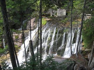 Katahdin FallsPiscataquis County, ME4.8 miN
- Tumbledown Dick FallsPublic land trail route documented; gate fee appliesPiscataquis County, ME9.4 miSW
- Ledge FallsRoadside park viewpoint with designated parking documentedPiscataquis County, ME10 miNW
- Lower FallsPiscataquis County, ME11 miW
- Upper FallsPiscataquis County, ME11 miW
- Ledge FallsPiscataquis County, ME12 miN