Steep Falls
Oxford County, Maine
Your visit at a glance
- Waterfall height
- Not recorded
- Location
- Oxford County, Maine
- Ground elevation
- About 347 ft above sea level
- Nearby mapped access
- Unnamed parking area
A nearby mapped parking area or trailhead may not connect to this waterfall. Confirm the route and public access before travelling.
Steep Falls is mapped in Oxford County, Maine, 0.9 miles southeast of Norway. This entry shows its location and nearby mapped places; a visitor route has not been confirmed.
About this location
Land & access
No named land ownership record was found at this location. This does not establish whether the land is public or private.
Sources for these details
Nearby streams and paths: OpenStreetMap. Land names: USGS PAD-US ownership records, with planning boundaries used only where ownership has no usable name. Ground elevation: USGS 3D Elevation Program.
Map records do not verify a walking route or current access conditions.
Before you make the trip
The closest mapped parking is 0.0 mi away in a straight line. This is not a walking distance.
Trail length, parking rules and current conditions have not been confirmed for this entry.
More waterfalls nearby
Within 40 straight-line miles. Road and trail distances will differ.
- Bisco FallsOxford County, ME5.5 miN
- Kezar FallsGuidebook route with matching coordinates; land owner not confirmedOxford County, ME14 miW
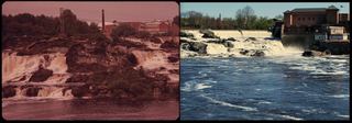 Great FallsUrban riverwalk to a public overlook; easyAndroscoggin County, ME17 miSE
- Kees FallsNational forest trail route and trailhead documentedOxford County, ME23 miNW
- Rumford FallsRoadside view in town; flow controlled by damsOxford County, ME23 miN
- Mad River FallsGuidebook route with matching coordinates; seasonal roadOxford County, ME24 miW
- Emerald PoolResearched route and starting areaCarroll County, NH25 miW
- Brickett FallsNational forest trail from a small roadside trailheadCarroll County, NH25 miW
- Chandler GorgeNational forest trails and a signed side loopCarroll County, NH25 miW