Waterfalls near Berryville, AR
21 named waterfalls within 30 miles of Berryville, closest first. Distances are straight-line from the town center.
Visits with route details
Read the walking route, starting point and current access notes.
- Road 299 FallsResearched walking route21 ft (6.4 m) · Madison County, AR
- Tea Kettle FallsPartial: route is poorly marked and two reviewers reported a private-property problem near the access road46 ft (14 m) · Madison County, AR
- Eagle's Nest FallsSource-reviewed route and parking41 ft (12.5 m) · Madison County, AR
- Glory B FallsCurrent parking access unconfirmed16 ft (4.9 m) · Madison County, AR
- Paige FallsParking and short approach documented by hiking sources8 ft (2.4 m) · Newton County, AR
- Broadwater Hollow FallsResearched walking route21 ft (6.4 m) · Newton County, AR
- Diamond FallsPartial guide: unsafe historical ledge approach; no verified safe current route148 ft (45.1 m) · Newton County, AR
- Hemmed-In-Hollow FallsResearched walking route209 ft (63.7 m) · Newton County, AR
- Fishtrap Hollow FallsPartial guide: historical trailhead documented; off-trail junction and bluff descent unverified83 ft (25.3 m) · Newton County, AR
- Hideout Hollow FallsSource-reviewed route and parking37 ft (11.3 m) · Newton County, AR
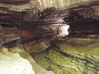 Eden FallsResearched visit notes53 ft (16.2 m) · Newton County, AR
- Thunder Canyon FallsCurrent final approach unconfirmed71 ft (21.7 m) · Newton County, AR
- Middle Armadillo FallsPartial guide: hazardous historical off-trail approach; NPS advises designated trails18 ft (5.5 m) · Newton County, AR
- Lower Armadillo FallsLocation only: waterfall tier mismatch24 ft (7.3 m) · Newton County, AR
- Triple FallsSource-reviewed route and parking48 ft (14.6 m) · Newton County, AR
- Sweden Creek FallsOfficial trail and current designated parking documented81 ft (24.7 m) · Madison County, AR
- Copperhead FallsPartial: current unmaintained approach conditions unverified13 ft (4 m) · Newton County, AR
- Tunnel Cave FallsCurrent approach and parking unconfirmed31 ft (9.5 m) · Newton County, AR
- Hammerschmidt FallsResearched walking route43 ft (13.1 m) · Newton County, AR
- Liles FallsPartial guide: permitted approach under NPS trail restrictions unconfirmed41 ft (12.5 m) · Newton County, AR
All 21 waterfalls
- Road 299 FallsResearched walking route21 ft (6.4 m) · Madison County, AR9.0 miSW
- Tea Kettle FallsPartial: route is poorly marked and two reviewers reported a private-property problem near the access road46 ft (14 m) · Madison County, AR11 miSW
- Eagle's Nest FallsSource-reviewed route and parking41 ft (12.5 m) · Madison County, AR11 miSW
- Glory B FallsCurrent parking access unconfirmed16 ft (4.9 m) · Madison County, AR13 miSW
- Paige FallsParking and short approach documented by hiking sources8 ft (2.4 m) · Newton County, AR25 miSE
- Broadwater Hollow FallsResearched walking route21 ft (6.4 m) · Newton County, AR25 miSE
- Diamond FallsPartial guide: unsafe historical ledge approach; no verified safe current route148 ft (45.1 m) · Newton County, AR25 miSE
- Hemmed-In-Hollow FallsResearched walking route209 ft (63.7 m) · Newton County, AR25 miSE
- Fishtrap Hollow FallsPartial guide: historical trailhead documented; off-trail junction and bluff descent unverified83 ft (25.3 m) · Newton County, AR26 miSE
- Hideout Hollow FallsSource-reviewed route and parking37 ft (11.3 m) · Newton County, AR26 miSE
- Eden FallsResearched visit notes53 ft (16.2 m) · Newton County, AR26 miSE
- Thunder Canyon FallsCurrent final approach unconfirmed71 ft (21.7 m) · Newton County, AR26 miSE
- Upper Armadillo FallsNewton County, AR26 miSE
- Middle Armadillo FallsPartial guide: hazardous historical off-trail approach; NPS advises designated trails18 ft (5.5 m) · Newton County, AR26 miSE
- Lower Armadillo FallsLocation only: waterfall tier mismatch24 ft (7.3 m) · Newton County, AR26 miSE
- Triple FallsSource-reviewed route and parking48 ft (14.6 m) · Newton County, AR28 miSE
- Sweden Creek FallsOfficial trail and current designated parking documented81 ft (24.7 m) · Madison County, AR28 miS
- Copperhead FallsPartial: current unmaintained approach conditions unverified13 ft (4 m) · Newton County, AR28 miSE
- Tunnel Cave FallsCurrent approach and parking unconfirmed31 ft (9.5 m) · Newton County, AR28 miSE
- Hammerschmidt FallsResearched walking route43 ft (13.1 m) · Newton County, AR28 miSE
- Liles FallsPartial guide: permitted approach under NPS trail restrictions unconfirmed41 ft (12.5 m) · Newton County, AR30 miSE