Waterfalls in Massachusetts
35 named waterfalls in 8 counties. Browse mapped locations and recorded heights. A map listing does not confirm public access or a walking route.
Visits with route details
Read the walking route, starting point and current access notes.
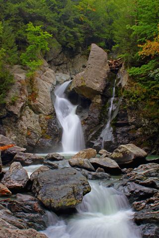 Bash Bish FallsSource-reviewed route and parkingBerkshire County, MA
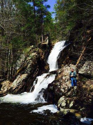 Campbell FallsShort steep state park trail from the Massachusetts lot49 ft (15 m) · Berkshire County, MA
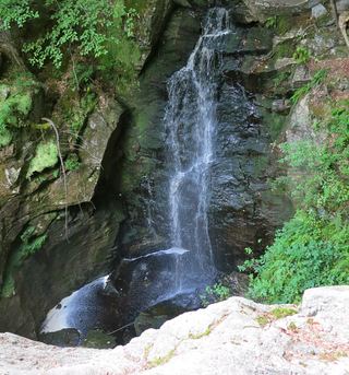 Royalston FallsOfficial trailhead and fees documented; visitor account gives distanceWorcester County, MA
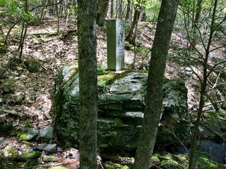 Sages Ravine Brook FallsAppalachian Trail route documented; exact mapped drop not confirmedBerkshire County, MA
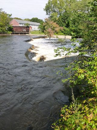 Wamesit FallsOverlook named on a city greenway; exact position not confirmedMiddlesex County, MA
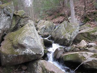 Goldmine Brook FallsShort unsigned path from Route 20; pull-off rules unconfirmedHampden County, MA
- Bear Rock FallsTrail hike on the Appalachian Trail; view from top only; short bushwhack299 ft (91 m) · Berkshire County, MA
- Cascade FallsShort trail route and street parking documentedMiddlesex County, MA
- Doane's FallsOfficial trail, parking and rules documentedWorcester County, MA
- Trap FallsShort walk in a state forest; parking spot and fees unconfirmed10 ft (3 m) · Middlesex County, MA
- Tannery FallsPublished short trail from the state forest lot; seasonal roadBerkshire County, MA
- Cascade on South BrookVery short path from parking area in a wildlife management area7 ft (2 m) · Berkshire County, MA
- Spirit FallsOfficial property and parking confirmed; trail distance not publishedWorcester County, MA
- Hobo FallsShort walk; final section on private land, stay on the trailFranklin County, MA
- Upper FallsOfficial trailhead and trail documented; exact upper drop not confirmedBerkshire County, MA
- Rock FallsTown walkway and boardwalk to a viewing platform; easyNorfolk County, MA
- March Cataract FallsMarked trail route documented; parking per visitor accountsBerkshire County, MA
- Deer Hill FallsSigned state reservation trail; road access seasonalBerkshire County, MA
- Bear's Den FallsOfficial land trust route, hours and parkingFranklin County, MA
- Twin CascadePartial guide: private land, parking and current trail condition not confirmedBerkshire County, MA
- Lower FallsClub-documented trail from a free state trailheadBerkshire County, MA
- Glendale FallsOfficial land trust route, hours and parkingHampshire County, MA
- Sages Ravine FallsGuidebook route on the Appalachian Trail; exact cascade not confirmedBerkshire County, MA
- Sages Ravine FallsAppalachian Trail hike to a series of small falls; exact mapped drop not confirmedBerkshire County, MA
- Peck's FallsShort published trail from Gould Road; informal parkingBerkshire County, MA
- Haley FallsShort trail, platform and parking documentedBerkshire County, MA
- Money Brook FallsOfficial trail mileage and named trailhead documented; seasonal auto roadBerkshire County, MA
Closest to you
Recorded waterfall heights
- Bear Rock FallsTrail hike on the Appalachian Trail; view from top only; short bushwhack299 ft (91 m) · Berkshire County
- Campbell FallsShort steep state park trail from the Massachusetts lot49 ft (15 m) · Berkshire County
- Marguerite Falls13 ft (4 m) · Berkshire County
- Trap FallsShort walk in a state forest; parking spot and fees unconfirmed10 ft (3 m) · Middlesex County
- Silver Fox Falls10 ft (3 m) · Berkshire County
- falls10 ft (3 m) · Berkshire County
- Cascade on South BrookVery short path from parking area in a wildlife management area7 ft (2 m) · Berkshire County
Waterfalls near a town
By county
Berkshire County 20
- Bash Bish FallsSource-reviewed route and parkingBerkshire County
- Bear Rock FallsTrail hike on the Appalachian Trail; view from top only; short bushwhack299 ft (91 m) · Berkshire County
- Campbell FallsShort steep state park trail from the Massachusetts lot49 ft (15 m) · Berkshire County
- Cascade on South BrookVery short path from parking area in a wildlife management area7 ft (2 m) · Berkshire County
- Deer Hill FallsSigned state reservation trail; road access seasonalBerkshire County
- Haley FallsShort trail, platform and parking documentedBerkshire County
- Lower FallsClub-documented trail from a free state trailheadBerkshire County
- Lower Peck's FallsBerkshire County
- March Cataract FallsMarked trail route documented; parking per visitor accountsBerkshire County
- Marguerite Falls13 ft (4 m) · Berkshire County
- Money Brook FallsOfficial trail mileage and named trailhead documented; seasonal auto roadBerkshire County
- Peck's FallsShort published trail from Gould Road; informal parkingBerkshire County
- Sages Ravine Brook FallsAppalachian Trail route documented; exact mapped drop not confirmedBerkshire County
- Sages Ravine FallsGuidebook route on the Appalachian Trail; exact cascade not confirmedBerkshire County
- Sages Ravine FallsAppalachian Trail hike to a series of small falls; exact mapped drop not confirmedBerkshire County
- Silver Fox Falls10 ft (3 m) · Berkshire County
- Tannery FallsPublished short trail from the state forest lot; seasonal roadBerkshire County
- Twin CascadePartial guide: private land, parking and current trail condition not confirmedBerkshire County
- Upper FallsOfficial trailhead and trail documented; exact upper drop not confirmedBerkshire County
- falls10 ft (3 m) · Berkshire County
Worcester County 5
- CascadesWorcester County
- Doane's FallsOfficial trail, parking and rules documentedWorcester County
- Emerson FallsWorcester County
- Royalston FallsOfficial trailhead and fees documented; visitor account gives distanceWorcester County
- Spirit FallsOfficial property and parking confirmed; trail distance not publishedWorcester County