Doane's Falls
Worcester County, Massachusetts
Your visit at a glance
- Waterfall height
- Not recorded
- Location
- Worcester County, Massachusetts
- Access status
- Official trail, parking and rules documented
- The walk
- Half-mile trail along the falls
- Ground & access
- Moderate walking, strenuous in places. Access to the water is prohibited; no swimming, diving or wading.
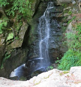
Doane's Falls on Lawrence Brook tumbles from under a stone bridge toward Tully Lake in a series of drops. The Trustees' half-mile trail descends the west side of the stream with views of the drops. An accessible 0.15-mile trail reaches the lower falls section from the lower lot on Doane Hill Road.
Plan your visit
Doane's Falls Reservation, Athol Road, Royalston: half-mile trail down the west side of Lawrence Brook
The Trustees describe a half-mile trail down the west side of the stream. A separate accessible trail of about 0.15 mile runs from the lower parking lot on Doane Hill Road to the lower falls section.
Moderate walking, strenuous in places. Access to the water is prohibited; no swimming, diving or wading.
Where to start
Entrance and parking for three cars on the left of Athol Road, about 4 miles north of the Rt. 32 intersection in Athol. Lower parking lot on Doane Hill Road for the accessible trail.
Timing & water
Open daily, sunrise to sunset. Hunting is permitted on the Coddings Meadow parcel except Sundays; wear bright colors in season.
Before you go
Free to all.
Visitor informationMore waterfalls nearby
Within 40 straight-line miles. Road and trail distances will differ.
- Spirit FallsOfficial property and parking confirmed; trail distance not publishedWorcester County, MA1.4 miN
 Royalston FallsOfficial trailhead and fees documented; visitor account gives distanceWorcester County, MA5.1 miNW
- Bear's Den FallsOfficial land trust route, hours and parkingFranklin County, MA9.7 miSW
- Falls Brook FallsCheshire County, NH12 miN
- Pulpit FallsCheshire County, NH12 miNW
- Hobo FallsShort walk; final section on private land, stay on the trailFranklin County, MA12 miW
- Emerson FallsWorcester County, MA19 miE
- Old Mill Falls33 ft (10 m) · Cheshire County, NH21 miNW
- CascadesWorcester County, MA21 miE