Glendale Falls
Hampshire County, Massachusetts
Your visit at a glance
- Waterfall height
- Not recorded
- Location
- Hampshire County, Massachusetts
- Access status
- Official land trust route, hours and parking
- The walk
- About a quarter mile to the bottom of the falls
- Ground & access
- Moderate hiking, strenuous in places, beside a long series of cascades.
From East River Road in Middlefield, turn onto Clark Wright Road right after the bridge and drive 0.4 mile to the parking lot on the right. The upper falls are close to the lot; a quarter-mile trail descends beside the falls to the bottom. Do not continue downstream past the property boundary.
Plan your visit
Clark Wright Road parking to the bottom of Glendale Falls
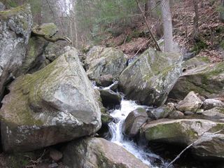
The Trustees give a quarter-mile trail to the bottom of the falls. The top of the falls is near the parking lot.
Moderate hiking, strenuous in places, beside a long series of cascades.
Where to start
Small lot for about 7 cars on Clark Wright Road.
Timing & water
Open daily, sunrise to sunset. Flow is strongest in spring.
Before you go
Free admission. No reservation needed.
Visitor informationMore waterfalls nearby
Within 40 straight-line miles. Road and trail distances will differ.
 Goldmine Brook FallsShort unsigned path from Route 20; pull-off rules unconfirmedHampden County, MA7.5 miS
- falls10 ft (3 m) · Berkshire County, MA12 miW
- Cascade on South BrookVery short path from parking area in a wildlife management area7 ft (2 m) · Berkshire County, MA17 miNW
- WaterfallHampden County, MA18 miS
- Tannery FallsPublished short trail from the state forest lot; seasonal roadBerkshire County, MA19 miN
- Silver Fox Falls10 ft (3 m) · Berkshire County, MA20 miNW
- Lower Peck's FallsBerkshire County, MA21 miNW
- Peck's FallsShort published trail from Gould Road; informal parkingBerkshire County, MA21 miNW
- Marguerite Falls13 ft (4 m) · Berkshire County, MA21 miS