Waterfalls in Vermont
42 named waterfalls in 11 counties. Browse mapped locations and recorded heights. A map listing does not confirm public access or a walking route.
Visits with route details
Read the walking route, starting point and current access notes.
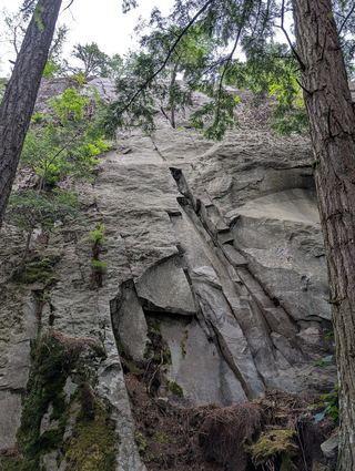 Falls of LanaResearched visit notesAddison County, VT
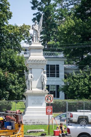 Middlebury FallsPartial guide: town footbridge view; parking not described18 ft (5.5 m) · Addison County, VT
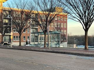 Winooski FallsGuide: city river walk beside the fallsChittenden County, VT
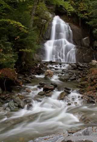 Moss Glen FallsPartial: state land viewpoint documented; footbridge on the trail reported closed, current status unconfirmedAddison County, VT
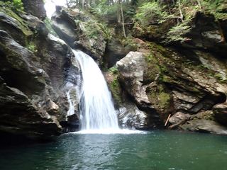 Bingham FallsResearched visit notesLamoille County, VT
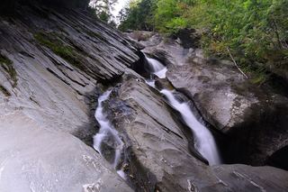 Hamilton FallsGuide: 6-mile state park round trip to a tall, dangerous fallsWindham County, VT
- Bartlett FallsRoadside falls on town land; small pull-offs, strict parking rules15 ft (4.6 m) · Addison County, VT
- Dog Head FallsTown-listed short path and roadside pull-off documentedLamoille County, VT
- Moss Glen FallsShort state forest trail from Moss Glen Falls RoadLamoille County, VT
- Warren FallsResearched walking routeWashington County, VT
- Thundering Brook FallsNational forest accessible trail route and parking documentedRutland County, VT
- Texas FallsResearched visit notesAddison County, VT
- Lye Brook FallsResearched route and starting areaBennington County, VT
- Sumner FallsPartial guide: town park beside the falls; path to a viewpoint not describedWindsor County, VT
- Fairfax FallsRoadside view from a marked picnic and fishing access areaFranklin County, VT
- Otter Creek FallsPartial: roadside viewpoint on private hydro property where the public is welcome to view, per a guidebook siteRutland County, VT
- Gerry's FallsState park trail route documented; distance to the falls not statedWindsor County, VT
- Huntington GorgePublic overlook above a dangerous gorge; path from parking not describedChittenden County, VT
- Mead's FallsPartial guide: short rough path from a street pull-off; land ownership not confirmedRutland County, VT
- Buttermilk Lower FallsPartial guide: public trail; parking spot and exact lower-falls position not describedWindsor County, VT
- Buttermilk Upper FallsShort public trail; position of the upper falls on the trail not describedWindsor County, VT
- LaPlatte River FallsPartial guide: short walk to an accessible deck; general parking spot not namedChittenden County, VT
- Glen FallsShort town forest trail from Lake Morey RoadOrange County, VT
Closest to you
Recorded waterfall heights
- McGinn Falls66 ft (20 m) · Rutland County
- Bittersweet Falls20 ft (6 m) · Addison County
- Cheever Falls20 ft (6 m) · Caledonia County
- Middlebury FallsPartial guide: town footbridge view; parking not described18 ft (5.5 m) · Addison County
- Bartlett FallsRoadside falls on town land; small pull-offs, strict parking rules15 ft (4.6 m) · Addison County
- Dog Team Falls7 ft (2 m) · Addison County
Waterfalls near a town
By county
Addison County 9
- Abbey Pond Cascades (lower)Addison County
- Abbey Pond Cascades (upper)Addison County
- Bartlett FallsRoadside falls on town land; small pull-offs, strict parking rules15 ft (4.6 m) · Addison County
- Bittersweet Falls20 ft (6 m) · Addison County
- Dog Team Falls7 ft (2 m) · Addison County
- Falls of LanaResearched visit notesAddison County
- Middlebury FallsPartial guide: town footbridge view; parking not described18 ft (5.5 m) · Addison County
- Moss Glen FallsPartial: state land viewpoint documented; footbridge on the trail reported closed, current status unconfirmedAddison County
- Texas FallsResearched visit notesAddison County
Lamoille County 6
Windsor County 6
- Buttermilk Lower FallsPartial guide: public trail; parking spot and exact lower-falls position not describedWindsor County
- Buttermilk Middle FallsWindsor County
- Buttermilk Upper FallsShort public trail; position of the upper falls on the trail not describedWindsor County
- Gerry's FallsState park trail route documented; distance to the falls not statedWindsor County
- Hidden FallsWindsor County
- Sumner FallsPartial guide: town park beside the falls; path to a viewpoint not describedWindsor County
Orange County 5
Rutland County 5
- Irene FallsRutland County
- McGinn Falls66 ft (20 m) · Rutland County
- Mead's FallsPartial guide: short rough path from a street pull-off; land ownership not confirmedRutland County
- Otter Creek FallsPartial: roadside viewpoint on private hydro property where the public is welcome to view, per a guidebook siteRutland County
- Thundering Brook FallsNational forest accessible trail route and parking documentedRutland County
Chittenden County 4
- Huntington GorgePublic overlook above a dangerous gorge; path from parking not describedChittenden County
- LaPlatte River FallsPartial guide: short walk to an accessible deck; general parking spot not namedChittenden County
- Olga's FallsChittenden County
- Winooski FallsGuide: city river walk beside the fallsChittenden County