Moss Glen Falls
Addison County, Vermont
Your visit at a glance
- Waterfall height
- Not recorded
- Location
- Addison County, Vermont
- Access status
- Partial: state land viewpoint documented; footbridge on the trail reported closed, current status unconfirmed
- The walk
- 0.2 mile round trip (Trail Finder)
- Ground & access
- Short, fairly level gravel path with a footbridge, described as accessible when the bridge is in place. Traffic on VT 100 is fast through the gulf.
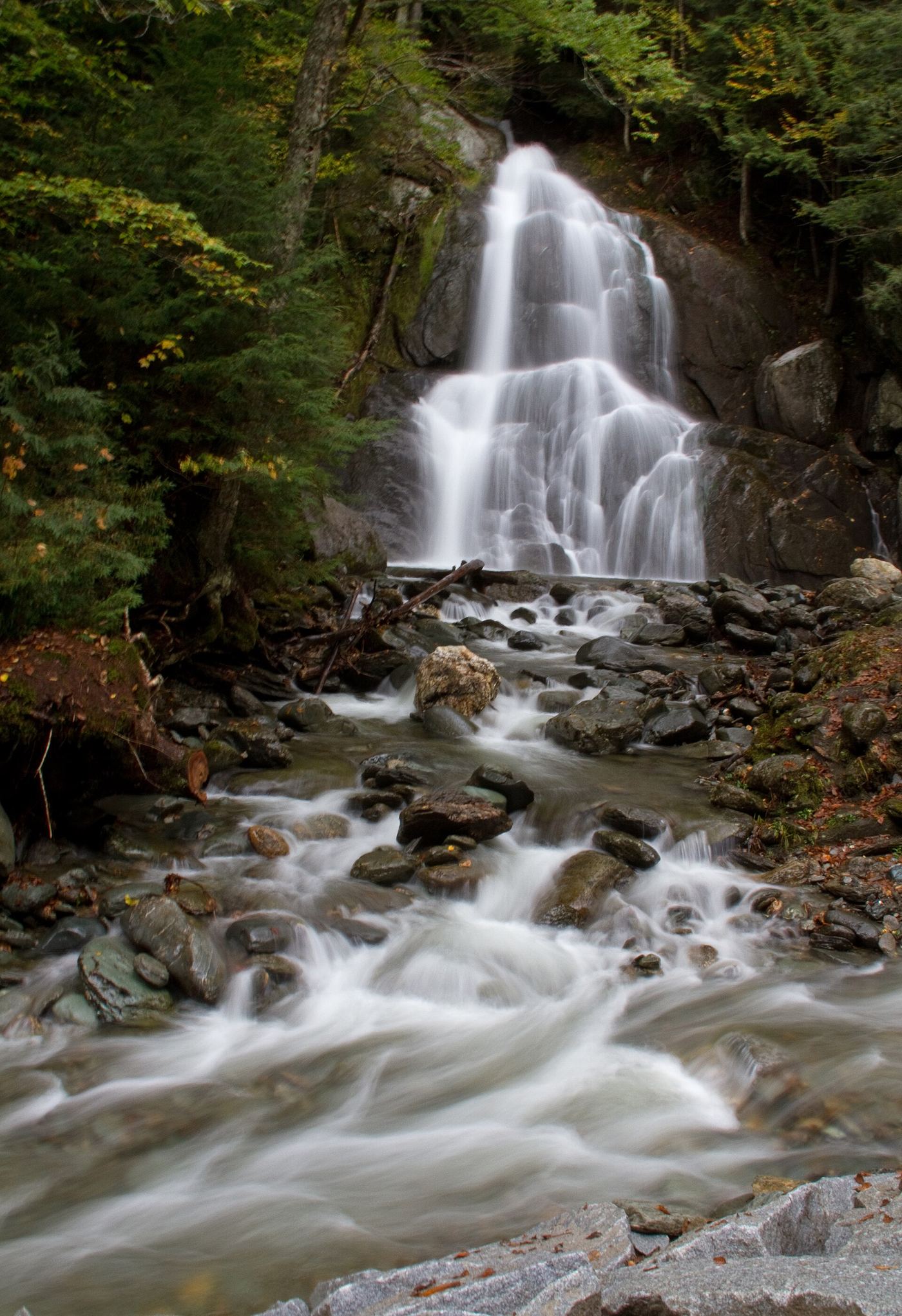
Moss Glen Falls in Granville drops about 80 feet where Deer Hollow Brook joins Alder Meadow Brook, in the state-owned Granville Gulf Reservation beside VT 100. The falls are visible from VT 100. A short trail starts from the parking pull-off on VT 100, crosses a wide wooden footbridge and continues on a fairly level gravel path to a viewing platform. A news report said the footbridge was closed after flood damage and a replacement was planned; whether the trail is open now is not confirmed. Without the bridge, visitors were viewing the falls from the side of busy VT 100.
Plan your visit
Parking pull-off on VT 100 in Granville Gulf Reservation, short trail over a footbridge to a viewing platform; the falls are also visible from VT 100
Trail Finder gives 0.20 mile round trip for the trail from the VT 100 pull-off to the viewing platform.
Short, fairly level gravel path with a footbridge, described as accessible when the bridge is in place. Traffic on VT 100 is fast through the gulf.
Where to start
Parking pull-off on VT 100 in Granville Gulf, about 18.4 miles south on VT 100 after the turn that keeps you on VT 100 south of Waterbury (Waterfall Hero Hikes).
Timing & water
No seasonal closure is mentioned. Check with Vermont Forests, Parks and Recreation (Rutland District, 802-786-0060) about the footbridge before visiting. Pets are permitted on a leash.
Before you go
Trail Finder lists no fee.
Visitor informationVisit sources
More waterfalls nearby
Within 40 straight-line miles. Road and trail distances will differ.
- Warren FallsResearched walking routeWashington County, VT5.4 miN
- Texas FallsResearched visit notesAddison County, VT6.3 miSW
- Abbey Pond Cascades (upper)Addison County, VT12 miW
- Abbey Pond Cascades (lower)Addison County, VT12 miW
- Bartlett FallsRoadside falls on town land; small pull-offs, strict parking rules15 ft (4.6 m) · Addison County, VT12 miNW
 Falls of LanaResearched visit notesAddison County, VT13 miSW
 Middlebury FallsPartial guide: town footbridge view; parking not described18 ft (5.5 m) · Addison County, VT16 miW
- Dog Team Falls7 ft (2 m) · Addison County, VT16 miW
- Bittersweet Falls20 ft (6 m) · Addison County, VT18 miW