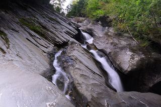
Lye Brook Falls
Bennington County, Vermont
Your visit at a glance
- Waterfall height
- Not recorded
- Location
- Bennington County, Vermont
- Access status
- Researched route and starting area
- The walk
- 1.8 miles to the spur junction; full waterfall distance unknown.
- Ground & access
- Gradual uphill railroad grades and woods roads; stream crossings and storm-damaged sections can be difficult.
Follow the blue-blazed trail, then take the falls spur on the right at 1.8 miles.
Plan your visit
Lye Brook Trail and right-hand falls spur
1.8 miles reaches the junction only. The spur length and full round trip were not verified.
Gradual uphill railroad grades and woods roads; stream crossings and storm-damaged sections can be difficult.
Where to start
Lot at the end of Lye Brook Access Road via Glen Road and East Manchester Road; trail starts east of the lot.
Timing & water
Season and current trail conditions not established by the reviewed source.
Before you go
Reservation requirements and current fees unknown.
Visitor informationVisit sources
More waterfalls nearby
Within 40 straight-line miles. Road and trail distances will differ.
- Natural Bridge FallsBennington County, VT11 miN
- McGinn Falls66 ft (20 m) · Rutland County, VT13 miN
 Hamilton FallsGuide: 6-mile state park round trip to a tall, dangerous fallsWindham County, VT14 miE
- Hoosick FallsVillage bridge viewpoint with greenway parkingRensselaer County, NY22 miSW
- Middle FallsView from the NY 29 bridge; public river-access lotWashington County, NY25 miW
- Dionondahowa FallsShort signed public trail to a railed viewpointWashington County, NY25 miW
- Buttermilk Upper FallsShort public trail; position of the upper falls on the trail not describedWindsor County, VT26 miNE
- Buttermilk Middle FallsWindsor County, VT26 miNE
- Buttermilk Lower FallsPartial guide: public trail; parking spot and exact lower-falls position not describedWindsor County, VT26 miNE