Waterfalls near Mammoth Lakes, CA
16 named waterfalls within 30 miles of Mammoth Lakes, closest first. Distances are straight-line from the town center.
Visits with route details
Read the walking route, starting point and current access notes.
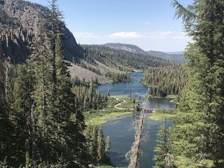 Twin FallsResearched walking routeMono County, CA
- Minarets FallsPublished trail route; mandatory shuttle fee; seasonal roadMadera County, CA
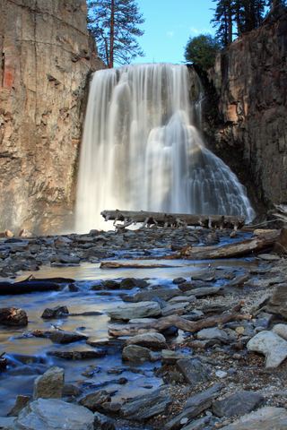 Rainbow FallsRoad closed weekdays through November 1, 2026; full road closure from November 2. Partial guide: day-use parking approach unverified.Madera County, CA
- Lower Rainbow FallsPublished monument trail with half-mile extension to Lower Falls; shuttle or entry feeMadera County, CA
- Horsetail FallsResearched route and starting areaMono County, CA
- Horsetail FallsPartial guide: viewing route documented; exact match to this listing probableMono County, CA
- Bunnell CascadeLong established trail route; very long day or overnightMariposa County, CA
- Cascade FallPartial guide: trailhead parking and a single published distance are not confirmedMariposa County, CA
- Rancheria FallsSource-reviewed route and parking40 ft (12.2 m) · Fresno County, CA
- Pywiack CascadeDistant viewpoint only; the cascade is not reached on foot591 ft (180 m) · Mariposa County, CA
All 16 waterfalls
- Twin FallsResearched walking routeMono County, CA3.3 miSW
- Minarets FallsPublished trail route; mandatory shuttle fee; seasonal roadMadera County, CA6.4 miW
- Rainbow FallsRoad closed weekdays through November 1, 2026; full road closure from November 2. Partial guide: day-use parking approach unverified.Madera County, CA6.9 miSW
- Lower Rainbow FallsPublished monument trail with half-mile extension to Lower Falls; shuttle or entry feeMadera County, CA7.4 miSW
- Horsetail FallsResearched route and starting areaMono County, CA11 miSE
- Horsetail FallsPartial guide: viewing route documented; exact match to this listing probableMono County, CA12 miNW
- Granite Creek FallsMadera County, CA19 miSW
- Twin FallsFresno County, CA20 miS
- Florence FallsMariposa County, CA22 miW
- Bunnell CascadeLong established trail route; very long day or overnightMariposa County, CA28 miW
- Cascade FallPartial guide: trailhead parking and a single published distance are not confirmedMariposa County, CA28 miW
- Rancheria FallsSource-reviewed route and parking40 ft (12.2 m) · Fresno County, CA29 miS
- Camino FallsMadera County, CA29 miSW
- Tenaya Creek WaterslideMariposa County, CA29 miW
- Pywiack CascadeDistant viewpoint only; the cascade is not reached on foot591 ft (180 m) · Mariposa County, CA30 miW
- Line Creek FallsFresno County, CA30 miSW