Minarets Falls
Madera County, California
Your visit at a glance
- Waterfall height
- Not recorded
- Location
- Madera County, California
- Access status
- Published trail route; mandatory shuttle fee; seasonal road
- The walk
- Approximately 3 miles return
- Ground & access
- Forest trail with about 125 feet of elevation change per Hikespeak. The falls slide down a granite slope and shrink to a thin cascade at low water. Leashed dogs are allowed per Hikespeak.
Start at the trailhead by the Devils Postpile ranger station. After a quarter mile, turn right toward Minaret Falls, then bear right over the bridge across the Middle Fork San Joaquin River. Turn right at the junction 0.35 miles from the start and again onto the Pacific Crest Trail at 0.85 miles. After about 0.6 miles on the Pacific Crest Trail you reach the log crossing of Minaret Creek. Walk back about 200 feet to a path that leads to the base of the falls. Return the same way, turning left at each junction.
Plan your visit
Devils Postpile ranger station trailhead to Minaret Falls on the Pacific Crest Trail
Hikespeak gives 3 miles round trip from the main trailhead in Devils Postpile National Monument, with the Minaret Creek log crossing 1.45 miles from the start.
Forest trail with about 125 feet of elevation change per Hikespeak. The falls slide down a granite slope and shrink to a thin cascade at low water. Leashed dogs are allowed per Hikespeak.
Where to start
Most day visitors must park at Mammoth Mountain and ride the Reds Meadow shuttle bus to the monument. Driving in is allowed only for listed exceptions or when the shuttle is not running, with a Forest Service vehicle fee.
Timing & water
Reds Meadow Road is the only road to the monument. NPS lists a June 13, 2026 opening and no 2026 closing date; in past years it closed between September and November. Road reconstruction in 2026 can bring delays and closures. Check Inyo National Forest before going.
Before you go
NPS lists shuttle day passes at $15 per adult and $7 per child age 3 to 15, and a $10 per vehicle Reds Meadow Valley day pass for vehicles allowed to drive in. That NPS fee page was last updated in 2023; check current prices.
Visitor informationVisit sources
More waterfalls nearby
Within 40 straight-line miles. Road and trail distances will differ.
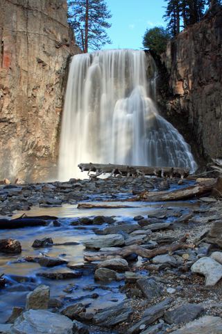 Rainbow FallsRoad closed weekdays through November 1, 2026; full road closure from November 2. Partial guide: day-use parking approach unverified.Madera County, CA2.6 miS
- Lower Rainbow FallsPublished monument trail with half-mile extension to Lower Falls; shuttle or entry feeMadera County, CA3.1 miS
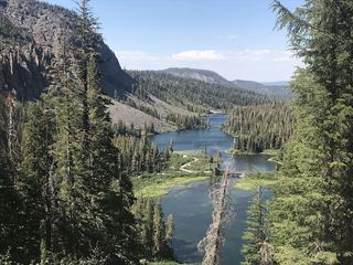 Twin FallsResearched walking routeMono County, CA4.8 miSE
- Horsetail FallsPartial guide: viewing route documented; exact match to this listing probableMono County, CA8.7 miN
- Granite Creek FallsMadera County, CA14 miSW
- Horsetail FallsResearched route and starting areaMono County, CA16 miSE
- Florence FallsMariposa County, CA17 miNW
- Twin FallsFresno County, CA21 miSE
- Bunnell CascadeLong established trail route; very long day or overnightMariposa County, CA22 miW