Mystery Canyon Falls
Washington County, Utah
Your visit at a glance
- Waterfall height
- 131 ft (40 m)
- Location
- Washington County, Utah
- Access status
- National park trail and river route documented; flash flood risk
- The walk
- 1.0 mile on the Riverside Walk, then 0.25 mile upstream in the river to Mystery Falls, per a Narrows trip guide; Zion Guru calls the walk from the end of the Riverside Walk to Mystery Falls and back 1/2 mile
- Ground & access
- Paved, level Riverside Walk, then wading in the Virgin River over slippery, uneven stones. Flash flood hazard in the river section.
Mystery Falls is where Mystery Canyon spills about 120 feet down the wall of Zion Canyon into the Virgin River, at the start of The Narrows in Zion National Park. From the Temple of Sinawava, walk the paved Riverside Walk for 1 mile to where the pavement ends. From there, wade upstream in the Virgin River for about a quarter mile to the falls. Return the same way. No Narrows permit is needed for the bottom-up hike from the Temple of Sinawava. The Narrows can be closed for high water, and flash floods can happen at any time; check conditions at a visitor center before entering the river.
Plan your visit
Temple of Sinawava (Zion Canyon shuttle stop 9), paved Riverside Walk to its end, then upstream in the Virgin River (bottom-up Narrows route) to Mystery Falls at the mouth of Mystery Canyon
A Narrows trip guide gives Temple of Sinawava to the end of the Riverside Walk as 1.0 mile and the end of the Riverside Walk to Mystery Falls as 0.25 mile. Zion Guru describes the trip from the end of the Riverside Walk to Mystery Falls and back as 1/2 mile. The National Park Service gives the Riverside Walk as 1 mile.
Paved, level Riverside Walk, then wading in the Virgin River over slippery, uneven stones. Flash flood hazard in the river section.
Where to start
The walk starts at the Temple of Sinawava, shuttle stop 9 at the end of the Zion Canyon Scenic Drive. Check the park's shuttle and parking information for how to reach it.
Timing & water
Year-round when the river is open. Afternoon thunderstorms are possible all year and can cause flash floods. The Narrows can be closed for high water.
Before you go
National park entrance pass required; the standard pass is 20 to 35 dollars. No permit is required for the bottom-up Narrows hike from the Temple of Sinawava.
Visitor informationVisit sources
More waterfalls nearby
Within 40 straight-line miles. Road and trail distances will differ.
- Menu FallsGuide: road walk from Big Bend to a viewing deckWashington County, UT1.3 miS
- Barrier FallsPartial guide: long off-trail creek route on a social trailWashington County, UT4.3 miW
- Double FallsPartial guide: long off-trail creek route on a social trailWashington County, UT4.5 miW
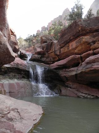 Lower Pine Creek WaterfallPartial guide: unsigned social trail with boulder-hoppingWashington County, UT5.8 miS
- R2 - Bolted Rappel Anchor: 6 ft.Washington County, UT5.8 miW
- R3 - Keyhole Falls - Bolted Rappel Anchor: 10 ft.Washington County, UT5.9 miW
- Archangel FallsPartial guide: off-trail wilderness route; permit requiredWashington County, UT6.1 miW
- Toquerville FallsRough dirt road to BLM falls; short walk without four-wheel drive10 ft (3 m) · Washington County, UT17 miW
- Cascade FallsSource-reviewed route and parkingKane County, UT17 miNE