Menu Falls
Washington County, Utah
Your visit at a glance
- Waterfall height
- Not recorded
- Location
- Washington County, Utah
- Access status
- Guide: road walk from Big Bend to a viewing deck
- The walk
- .6 mile one way from Big Bend, per a Zion hiking guide
- Ground & access
- Mostly level walk along the road edge, then a very short path and steps to a wooden deck.
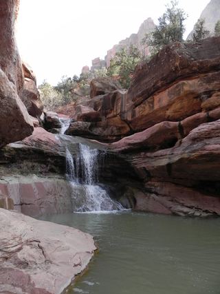
Menu Falls is a small seep and waterfall, about ten feet tall, in a forested alcove on the east side of the Zion Canyon Scenic Drive between the Big Bend and Temple of Sinawava shuttle stops. It is named for a picture once used on the Zion Lodge menu. There is no stop at the falls and no sign. Get off the shuttle at Big Bend and walk north along the road, then look to the right (east) for a short path to a wooden viewing deck. You can also walk south along the road from the Temple of Sinawava. Step aside for vehicles, especially shuttle buses. Return the same way or continue to the next stop.
Plan your visit
Big Bend shuttle stop on the Zion Canyon Scenic Drive, north along the road to a short unsigned path on the right (east) leading to a viewing deck
Joe's Guide to Zion gives .6 miles one way from Big Bend and .7 miles one way from the Temple of Sinawava.
Mostly level walk along the road edge, then a very short path and steps to a wooden deck.
Where to start
During the shuttle season, private vehicles cannot drive the Zion Canyon Scenic Drive; ride the park shuttle to Big Bend or the Temple of Sinawava. Outside the shuttle season, a trip blog says you can park in a wide spot at the side of the road.
Timing & water
Year round. Flow is small.
Before you go
Zion entrance fee: $35 per private vehicle. No reservation is needed to ride the park shuttle.
Visitor informationVisit sources
- Joe's Guide to Zion: Menu Falls
- Joe's Guide to Zion: Menu Falls
- Joe's Guide to Zion: Menu Falls
- Joe's Guide to Zion: Menu Falls
- Joe's Guide to Zion: Menu Falls
- Joe's Guide to Zion: Menu Falls
- Take My Trip: Menu Falls, Zion National Park
- Take My Trip: Menu Falls, Zion National Park
- Zion National Park: Shuttle System
- Zion National Park: Shuttle System
- Zion National Park: Fees and Passes
More waterfalls nearby
Within 40 straight-line miles. Road and trail distances will differ.
- Mystery Canyon FallsNational park trail and river route documented; flash flood risk131 ft (40 m) · Washington County, UT1.3 miN
- Barrier FallsPartial guide: long off-trail creek route on a social trailWashington County, UT4.2 miW
- Double FallsPartial guide: long off-trail creek route on a social trailWashington County, UT4.4 miW
 Lower Pine Creek WaterfallPartial guide: unsigned social trail with boulder-hoppingWashington County, UT4.5 miS
- R2 - Bolted Rappel Anchor: 6 ft.Washington County, UT6.2 miW
- R3 - Keyhole Falls - Bolted Rappel Anchor: 10 ft.Washington County, UT6.3 miW
- Archangel FallsPartial guide: off-trail wilderness route; permit requiredWashington County, UT6.4 miW
- Toquerville FallsRough dirt road to BLM falls; short walk without four-wheel drive10 ft (3 m) · Washington County, UT17 miW
- Cascade FallsSource-reviewed route and parkingKane County, UT18 miNE