Barrier Falls
Washington County, Utah
Your visit at a glance
- Waterfall height
- Not recorded
- Location
- Washington County, Utah
- Access status
- Partial guide: long off-trail creek route on a social trail
- The walk
- A quarter mile or so past Double Falls, which is about 4.3 miles from the Right/Left Fork confluence, per Road Trip Ryan; its whole route is a 10-mile round trip
- Ground & access
- Off-trail creek hiking on a braided social trail and in the stream bed, with many crossings and wet feet. Steep descent through lava cliffs to North Creek. Much of the route is in full sun, and there is a lot of poison ivy.
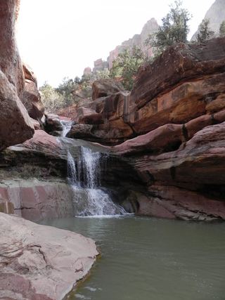
Barrier Falls blocks upstream travel in the Right Fork of North Creek in Zion National Park and is the end point for hikers. From the Right Fork Trailhead, follow the trail southeast to the canyon rim and carefully descend through lava cliffs to North Creek. Note where the trail climbs back to the rim, because it is hard to find on the way out. Turn left (upstream) along North Creek to where the Right Fork comes in, and take the right fork east. Follow the social trail and the stream bed upstream for several hours, crossing the creek often, to Double Falls. A trail on the right goes around Double Falls to the next waterfall and then to Barrier Falls. Getting past Barrier Falls needs technical rock climbing on bad rock and is not recommended. Return the same way.
Plan your visit
Right Fork Trailhead on Kolob Terrace Road, down to North Creek, then up the Right Fork of North Creek past Double Falls to Barrier Falls
Road Trip Ryan gives 0.25 miles from the trailhead to the mesa edge, about 0.6 miles up North Creek to the Right Fork, about 4.3 miles from the confluence to Double Falls and a quarter of a mile or so from Double Falls to Barrier Falls. It calls the hike a 10-mile round trip. Canyoneering USA gives 1/4 mile up the stream to the fork.
Off-trail creek hiking on a braided social trail and in the stream bed, with many crossings and wet feet. Steep descent through lava cliffs to North Creek. Much of the route is in full sun, and there is a lot of poison ivy.
Where to start
Right Fork Trailhead on the right side of Kolob Terrace Road, about 7 miles north of the town of Virgin. From Virgin on UT 9, turn north onto Kolob Terrace Road.
Timing & water
Spring, summer or fall. Spring runoff makes crossings deeper and colder. Summer is very hot, and the first miles have little shade.
Before you go
No fee is mentioned. Canyoneering USA says a permit is needed only for backpacking and staying overnight; Zion requires wilderness permits for all overnight backpacking trips.
Visitor informationVisit sources
More waterfalls nearby
Within 40 straight-line miles. Road and trail distances will differ.
- Double FallsPartial guide: long off-trail creek route on a social trailWashington County, UT0.2 miSW
- R2 - Bolted Rappel Anchor: 6 ft.Washington County, UT2.5 miNW
- R3 - Keyhole Falls - Bolted Rappel Anchor: 10 ft.Washington County, UT2.5 miNW
- Archangel FallsPartial guide: off-trail wilderness route; permit requiredWashington County, UT2.6 miNW
- Menu FallsGuide: road walk from Big Bend to a viewing deckWashington County, UT4.2 miE
- Mystery Canyon FallsNational park trail and river route documented; flash flood risk131 ft (40 m) · Washington County, UT4.3 miE
 Lower Pine Creek WaterfallPartial guide: unsigned social trail with boulder-hoppingWashington County, UT5.7 miSE
- Toquerville FallsRough dirt road to BLM falls; short walk without four-wheel drive10 ft (3 m) · Washington County, UT13 miW
- 2nd Falls End of HikePermit hike up a creek and slot canyon past the first falls; ladder and scrambleIron County, UT19 miN