2nd Falls End of Hike
Iron County, Utah
Your visit at a glance
- Waterfall height
- Not recorded
- Location
- Iron County, Utah
- Access status
- Permit hike up a creek and slot canyon past the first falls; ladder and scramble
- The walk
- About 3.7 miles round trip to the second waterfall, per Girl on a Hike
- Ground & access
- Creek walking in water usually less than a foot deep, in a narrow slot canyon. Ladder or stairs at the first falls and a scramble above it; slippery, uneven rock.
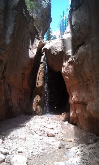
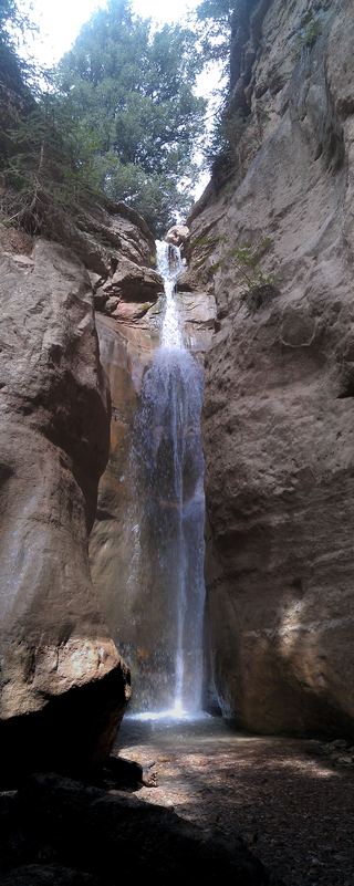
This listing is the second waterfall in the Kanarra Creek slot canyon above Kanarraville, the usual end of the hike for people without technical gear. A permit is required. From the parking lot, go through the hiker's gate and follow the old access road about 0.8 miles up into the canyon, crossing the stream several times. Where the road ends by the water well, continue up the creek, mostly walking in the water. The canyon narrows into a slot and reaches Kanarra Falls, the first waterfall, which has a ladder or staircase beside it; floods have changed this spot over the years. Above it, scramble up next to the falls and continue upstream to the second waterfall. Girl on a Hike says going beyond the second falls without technical gear is unsafe. Return the same way.
Plan your visit
Kanarra Falls trailhead lot at the east end of 100 North in Kanarraville, up the old access road and Kanarra Creek into the slot canyon, past Kanarra Falls (the first falls) to the second waterfall
Girl on a Hike gives 3.5 miles round trip to the first waterfall, 3.7 miles round trip to the second waterfall and 4.4 miles round trip to the turnaround. She Dreams of Alpine estimates about 2 to 2.5 miles one way to the second waterfall.
Creek walking in water usually less than a foot deep, in a narrow slot canyon. Ladder or stairs at the first falls and a scramble above it; slippery, uneven rock.
Where to start
Town of Kanarraville trailhead lot at the end of 100 North, reached from I-15 exit 51 and Old Highway 91. Parking is free with a permit. Do not park in front of homes or driveways.
Timing & water
Open all year. Flash floods can happen at any time and are most common in July, August and September; do not hike if rain is likely. Dogs are not allowed because the creek is the town water supply.
Before you go
Permit required: $15 per person, credit or debit card only, from kanarrafalls.com or at the trailhead. Many peak-season days sell out in advance.
Visitor informationVisit sources
- Visit Cedar City: Kanarra Falls Hike and Permits
- Visit Cedar City: Kanarra Falls Hike and Permits
- Visit Cedar City: Kanarra Falls Hike and Permits
- Kanarraville Town: Local Trails
- Girl on a Hike: Kanarra Falls
- Girl on a Hike: Kanarra Falls
- Girl on a Hike: Kanarra Falls
- She Dreams of Alpine: Kanarra Falls
- Bureau of Land Management: Kanarra Falls
More waterfalls nearby
Within 40 straight-line miles. Road and trail distances will differ.
 Lower Kanarra FallsPartial guide: permit hike documented; which drop this listing marks is not confirmedIron County, UT0.2 miW
 Lake Creek WaterfallIron County, UT15 miNE
 Rattlesnake Creek WaterfallNational forest trail route documented; long descent to a view from the top of the fallsIron County, UT15 miNE
- R2 - Bolted Rappel Anchor: 6 ft.Washington County, UT17 miS
- R3 - Keyhole Falls - Bolted Rappel Anchor: 10 ft.Washington County, UT17 miS
- Archangel FallsPartial guide: off-trail wilderness route; permit requiredWashington County, UT17 miS
- Toquerville FallsRough dirt road to BLM falls; short walk without four-wheel drive10 ft (3 m) · Washington County, UT17 miS
- Barrier FallsPartial guide: long off-trail creek route on a social trailWashington County, UT19 miS
- Double FallsPartial guide: long off-trail creek route on a social trailWashington County, UT19 miS