Lower Pine Creek Waterfall
Washington County, Utah
Your visit at a glance
- Waterfall height
- Not recorded
- Location
- Washington County, Utah
- Access status
- Partial guide: unsigned social trail with boulder-hopping
- The walk
- About 0.8 mile round trip, per a Zion hiking guide
- Ground & access
- Flat, unmarked social trail, then boulder-hopping, a little scrambling and possible wading. About 100 feet of gentle climb.
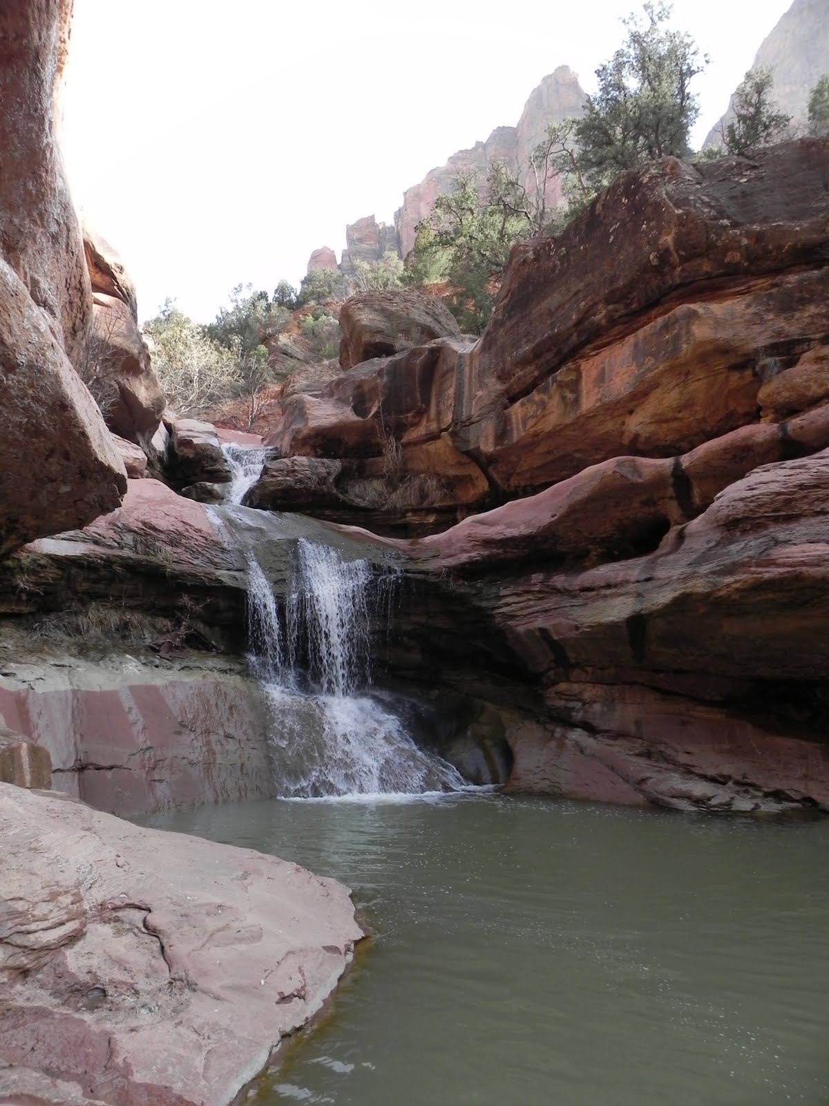
Lower Pine Creek Falls is a small waterfall, about 10 to 15 feet tall, with a shallow pool, in Lower Pine Creek in Zion National Park. The park does not sign or advertise this walk. Drive east from Canyon Junction on Route 9 toward the Zion-Mount Carmel Tunnel and park on the wide shoulder before the Pine Creek Bridge at the first switchback. Follow the well-worn path east into the canyon. Near the end you boulder-hop, scramble a little and may wade to reach the falls. Stay on the established path and respect any signs closing side areas. Dogs are not allowed. Do not go if rain is possible: this is a flash-flood canyon. Return the same way.
Plan your visit
Roadside pull-out by the Pine Creek Bridge at the first switchback of Route 9 east of Canyon Junction, then an unmarked social trail east up Lower Pine Creek, with boulder-hopping and some wading to the falls
Joe's Guide to Zion gives .8 miles total. Hike St George lists 0.7 mile round trip.
Flat, unmarked social trail, then boulder-hopping, a little scrambling and possible wading. About 100 feet of gentle climb.
Where to start
Small pull-out or wide road shoulder just before the Pine Creek Bridge at the first switchback on Route 9, about half a mile east of the Canyon Junction shuttle stop.
Timing & water
Year round, but snow and ice are possible in winter. Do not hike if there is any threat of rain.
Before you go
Zion entrance fee: $35 per private vehicle. No permit is needed, per a hiking site. No booking is needed.
Visitor informationVisit sources
- Joe's Guide to Zion: Lower Pine Creek
- Joe's Guide to Zion: Lower Pine Creek
- Joe's Guide to Zion: Lower Pine Creek
- Joe's Guide to Zion: Lower Pine Creek
- Canyoneering USA: Lower Pine Creek
- Canyoneering USA: Lower Pine Creek
- Canyoneering USA: Lower Pine Creek
- Hike St George: Lower Pine Creek Falls
- Hike St George: Lower Pine Creek Falls
- Live That Adventure: Lower Pine Creek Falls
- Zion National Park: Fees and Passes
More waterfalls nearby
Within 40 straight-line miles. Road and trail distances will differ.
- Menu FallsGuide: road walk from Big Bend to a viewing deckWashington County, UT4.5 miN
- Double FallsPartial guide: long off-trail creek route on a social trailWashington County, UT5.7 miNW
- Barrier FallsPartial guide: long off-trail creek route on a social trailWashington County, UT5.7 miNW
- Mystery Canyon FallsNational park trail and river route documented; flash flood risk131 ft (40 m) · Washington County, UT5.8 miN
- R2 - Bolted Rappel Anchor: 6 ft.Washington County, UT8.2 miNW
- R3 - Keyhole Falls - Bolted Rappel Anchor: 10 ft.Washington County, UT8.2 miNW
- Archangel FallsPartial guide: off-trail wilderness route; permit requiredWashington County, UT8.2 miNW
- Toquerville FallsRough dirt road to BLM falls; short walk without four-wheel drive10 ft (3 m) · Washington County, UT17 miW
- Cascade FallsSource-reviewed route and parkingKane County, UT23 miNE