Steelhead Falls
Jefferson County, Oregon
Your visit at a glance
- Waterfall height
- Not recorded
- Location
- Jefferson County, Oregon
- Access status
- Short BLM trail into the Deschutes canyon
- The walk
- About 0.5 mile one way (BLM); 2.2 miles round trip on the Oregon Hikers route
- Ground & access
- Short trail with one steep section on loose gravel and rock. Icy in winter and very hot in summer. Rattlesnakes and ticks.
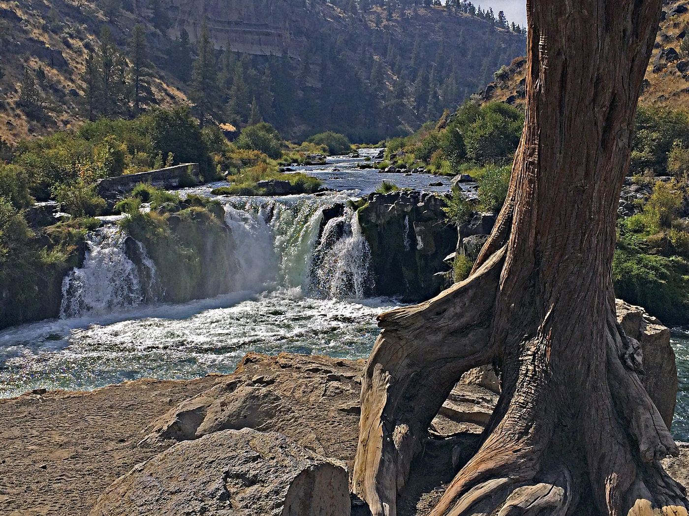
Photo credit
Photo: Maria Thi Mai; Bureau of Land Management Oregon and Washington, Public domain, via Wikimedia CommonsSteelhead Falls is a 15- to 20-foot drop on the Deschutes River in the Deschutes Canyon-Steelhead Falls Wilderness Study Area. From the trailhead kiosk, follow the main trail down into the canyon. It passes a short side trail to a rock ledge at the river, then runs above the top of the falls. A little farther, past a big old juniper, a trail leads down to a clifftop promontory that is a good viewpoint. Return the same way. Jumping into the pool is not advised while the water is cold.
Plan your visit
Steelhead Falls Trailhead at the end of River Road near Crooked River Ranch, trail down the Deschutes River canyon to a viewpoint of Steelhead Falls
BLM says it is about 0.5 mile from the trailhead to Steelhead Falls. Oregon Hikers gives 2.2 miles round trip with 175 feet of elevation gain for its route to a clifftop viewpoint just past the falls.
Short trail with one steep section on loose gravel and rock. Icy in winter and very hot in summer. Rattlesnakes and ticks.
Where to start
Steelhead Falls Trailhead and free primitive campground at the end of River Road, reached from Terrebonne via Lower Bridge Way, 43rd Street, Chinook Drive, Badger Road and Quail Road. Outhouse; no water.
Timing & water
BLM lists the site as open year round.
Before you go
BLM lists no fees.
Visitor informationVisit sources
More waterfalls nearby
Within 40 straight-line miles. Road and trail distances will differ.
- Big FallsDeschutes County, OR3.1 miS
- Dry FallsPartial guide: the dry falls on the trail are a probable match to this listing; the distance to the spur is not publishedJefferson County, OR3.3 miNW
 Cline FallsSource-reviewed route and parking20 ft (6.1 m) · Deschutes County, OR9.8 miS
- Cline FallsShort riverside trail from the state scenic viewpoint to BLM land at the fallsDeschutes County, OR10 miS
- Awbrey FallsDeschutes County, OR15 miS
- Whychus Creek FallsCanyon trail hike to a small creek waterfallDeschutes County, OR20 miSW
- Chush FallsTrailhead parking and overlook approach documented; current conditions unverified67 ft (20.4 m) · Deschutes County, OR27 miSW
- The CascadesPartial guide: informal paths past Chush Falls; current trailhead location not confirmedDeschutes County, OR27 miSW
- Columnar Canyon Falls125 ft (38.1 m) · Deschutes County, OR27 miSW