Cline Falls
Deschutes County, Oregon
Your visit at a glance
- Waterfall height
- 20 ft (6.1 m)
- Location
- Deschutes County, Oregon
- Access status
- Source-reviewed route and parking
- The walk
- Approximately 1.5–1.6 miles round trip
- Ground & access
- Mostly flat dirt path with a rockier section below the highway bridge; cliff-edge rocks near the falls. Watch for rattlesnakes.
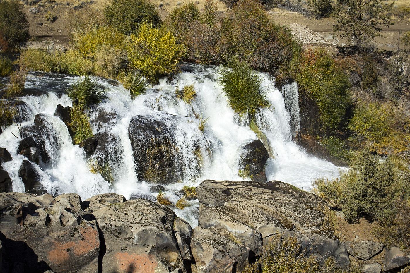
From the state park parking, walk up the entrance road to the trail following the Deschutes River downstream. Pass beneath the Highway 126 bridge, continue across the old highway alignment and follow the river to views of Cline Falls. Return the same way. The waterfall lies outside the developed park; it is not visible simply by stopping at the picnic area.
Plan your visit
Cline Falls State Scenic Viewpoint to Cline Falls
Visit Central Oregon gives 1.5 miles round trip; Trailkeepers gives 1.6 miles. Range preserves that small difference.
Mostly flat dirt path with a rockier section below the highway bridge; cliff-edge rocks near the falls. Watch for rattlesnakes.
Where to start
Enter Cline Falls State Scenic Viewpoint from Highway 126 west of Redmond, before the Deschutes bridge. Follow the entrance about 0.2 mile to parking near the restrooms or along the park loop road.
Timing & water
Winter and spring generally have more flow; irrigation withdrawals and lower runoff can greatly reduce summer flow.
Before you go
The current state park page requires a day-use parking permit, overriding the tourism listing’s older no-fee statement. One-day permits may be purchased on site.
Visitor informationVisit sources
More waterfalls nearby
Within 40 straight-line miles. Road and trail distances will differ.
- Cline FallsShort riverside trail from the state scenic viewpoint to BLM land at the fallsDeschutes County, OR0.5 miS
- Awbrey FallsDeschutes County, OR6.0 miS
- Big FallsDeschutes County, OR6.7 miN
 Steelhead FallsShort BLM trail into the Deschutes canyonJefferson County, OR9.8 miN
- Dry FallsPartial guide: the dry falls on the trail are a probable match to this listing; the distance to the spur is not publishedJefferson County, OR12 miN
- Whychus Creek FallsCanyon trail hike to a small creek waterfallDeschutes County, OR17 miW
 Tumalo FallsResearched visit notes89 ft (27.1 m) · Deschutes County, OR23 miSW
- Double FallsForest trail past Tumalo Falls to cliff-top viewpointsDeschutes County, OR23 miSW
- Chush FallsTrailhead parking and overlook approach documented; current conditions unverified67 ft (20.4 m) · Deschutes County, OR23 miSW