Dry Falls
Jefferson County, Oregon
Your visit at a glance
- Waterfall height
- Not recorded
- Location
- Jefferson County, Oregon
- Access status
- Partial guide: the dry falls on the trail are a probable match to this listing; the distance to the spur is not published
- The walk
- Distance to the spur is not published
- Ground & access
- Rocky, steep sections on the descent; little shade. Water flows over the dry falls only in wetter months.
Two descriptions of the Alder Springs Trail mention a dry waterfall reached by a short spur. Oregon Hikers notes a short spur up to a cleft with a dry waterfall, and the Deschutes River Conservancy describes a nearly hidden spur on the right, after a rocky and steep section, leading to the dry falls, where water may pour over the rock in wetter months. Neither source gives coordinates, so the match to this listing is probable but not confirmed. From the trailhead, descend through juniper grassland, climb rock steps to a stony plateau, then drop off the plateau and round a rocky promontory below the cliffs; watch for the spur on the right before the trail reaches Whychus Creek.
Plan your visit
Alder Springs Trailhead, Alder Springs Trail #855, then a short spur on the right to a dry waterfall cleft
No source gives the distance from the trailhead to the dry falls spur. The full out-and-back hike to the Whychus Creek and Deschutes River confluence is 7.2 miles (Oregon Hikers); the spur comes before the trail reaches the creek ford.
Rocky, steep sections on the descent; little shade. Water flows over the dry falls only in wetter months.
Where to start
Alder Springs Trailhead at the end of a narrow, rocky 0.7-mile spur off Forest Road 6360, reached from Holmes Road. Part of the gravel approach crosses private property.
Timing & water
A gate on Forest Service Road 6360 is closed and locked December 1 through March 31 for deer winter range; hiking and biking past the gate are allowed during the closure.
Before you go
The Forest Service lists the trailhead as a free facility.
Visitor informationVisit sources
More waterfalls nearby
Within 40 straight-line miles. Road and trail distances will differ.
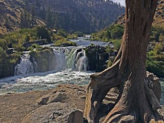 Steelhead FallsShort BLM trail into the Deschutes canyonJefferson County, OR3.3 miSE
- Big FallsDeschutes County, OR5.5 miSE
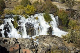 Cline FallsSource-reviewed route and parking20 ft (6.1 m) · Deschutes County, OR12 miS
- Cline FallsShort riverside trail from the state scenic viewpoint to BLM land at the fallsDeschutes County, OR13 miS
- Awbrey FallsDeschutes County, OR17 miS
- Whychus Creek FallsCanyon trail hike to a small creek waterfallDeschutes County, OR19 miSW
- Chush FallsTrailhead parking and overlook approach documented; current conditions unverified67 ft (20.4 m) · Deschutes County, OR26 miSW
- The CascadesPartial guide: informal paths past Chush Falls; current trailhead location not confirmedDeschutes County, OR26 miSW
- Columnar Canyon Falls125 ft (38.1 m) · Deschutes County, OR26 miSW