Butte Creek Falls
Clackamas County, Oregon
Your visit at a glance
- Waterfall height
- 79 ft (24 m)
- Location
- Clackamas County, Oregon
- Access status
- Signed state forest trail and trailhead documented
- The walk
- About 1.1 mile loop
- Ground & access
- Wide, well-maintained trail that drops steeply at first. The viewpoint is on top of a cliff; keep children close. A rough use path to the base is dangerous, especially when wet, and is not recommended.
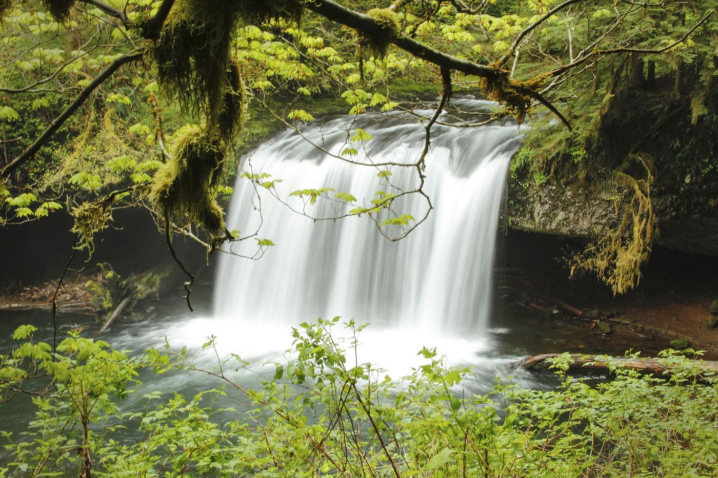
From the trailhead restrooms, head left toward the falls. After about 0.2 mile a spur on the right leads to Upper Butte Creek Falls. Back on the loop, continue straight downhill through forest, cross a log footbridge, and reach a rock bluff overlooking Butte Creek Falls. Return to the junction and turn right uphill past stone steps to the trailhead.
Plan your visit
Butte Creek Falls Trailhead loop to the viewpoint above Butte Creek Falls
Oregon Hikers gives a 1.1 mile loop with 320 feet of elevation gain. The loop also visits Upper Butte Creek Falls.
Wide, well-maintained trail that drops steeply at first. The viewpoint is on top of a cliff; keep children close. A rough use path to the base is dangerous, especially when wet, and is not recommended.
Where to start
Butte Creek Falls Trailhead in Santiam State Forest, 0.6 mile past Butte Creek Campground. Approach from Scotts Mills via Maple Grove Road, Sawtell Road and gravel Family Camp Road, following small Butte Creek Falls signs at three forks. The trailhead has a pit toilet and space for several vehicles. Crooked Finger Road is closed to vehicles and is no longer a route.
Timing & water
Oregon Hikers lists the loop as year-round. Approach roads cross private forest land and may be closed in bad weather and during logging operations.
Before you go
No fee is mentioned.
Visitor informationVisit sources
More waterfalls nearby
Within 40 straight-line miles. Road and trail distances will differ.
 Lower Butte Creek FallsClackamas County, OR0.0 miN
 Upper Butte Creek FallsShort state forest trail to a walk-behind waterfall26 ft (8 m) · Clackamas County, OR0.1 miSE
- Upper Abiqua FallsMarion County, OR2.3 miW
- Abiqua FallsPartial guide: private land open to the public by the owners; rough unofficial path; state purchase pending92 ft (28 m) · Marion County, OR2.7 miW
- Upper North FallsSigned state park trail to the base documented66 ft (20 m) · Marion County, OR5.7 miSW
- North FallsState park trail and stairs behind the falls135 ft (41 m) · Marion County, OR6.0 miSW
- Twin FallsState park trail to a side view of the falls30 ft (9 m) · Marion County, OR6.7 miSW
- Middle North FallsState park trail with a side trail behind the falls105 ft (32 m) · Marion County, OR6.8 miW
 Winter FallsState park trail from a highway trailhead to the base of the falls135 ft (41 m) · Marion County, OR6.8 miSW