Waterfalls near Paradise, CA
19 named waterfalls within 30 miles of Paradise, closest first. Distances are straight-line from the town center.
Visits with route details
Read the walking route, starting point and current access notes.
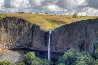 Phantom FallsApproach verified on the official map; paths are unmaintained.164 ft (50 m) · Butte County, CA
- Little Phantom FallsPartial guide: no coordinates published for this fall, and reserve boundaries along the route are not confirmed124 ft (37.8 m) · Butte County, CA
- Lower Ravine FallsPublished reserve route and official parking documented; faint paths; Lands Pass required40 ft (12.2 m) · Butte County, CA
- Ravine FallsPublished reserve route and official parking documented; Lands Pass required76 ft (23.2 m) · Butte County, CA
- Ravine Twin FallsPartial guide: unmarked cross-country route, and reserve boundaries along the route are not confirmed46 ft (14 m) · Butte County, CA
- Hollow FallsShort reserve trail; Lands Pass required45 ft (13.7 m) · Butte County, CA
- Crevice FallsPartial guide: no marked route or single-falls distance; cross-country approach from one visitor account30 ft (9.1 m) · Butte County, CA
- Ranch FallsPartial guide: unmarked cross-country route, and reserve boundaries along the route are not confirmed157 ft (47.9 m) · Butte County, CA
- Coon FallsPartial guide: no marked route or single-falls distance; cross-country approach from one visitor account41 ft (12.5 m) · Butte County, CA
- Curtain FallsPartial guide: trail length not published; base requires a river swimButte County, CA
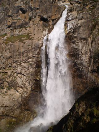 Feather FallsTrail reopened; campground closed410 ft (125 m) · Butte County, CA
- Lower Deer Creek FallsPublished creekside route; crosses private land, respect posted signsTehama County, CA
All 19 waterfalls
- Phantom FallsApproach verified on the official map; paths are unmaintained.164 ft (50 m) · Butte County, CA11 miS
- Little Phantom FallsPartial guide: no coordinates published for this fall, and reserve boundaries along the route are not confirmed124 ft (37.8 m) · Butte County, CA11 miS
- Lower Ravine FallsPublished reserve route and official parking documented; faint paths; Lands Pass required40 ft (12.2 m) · Butte County, CA11 miS
- Ravine FallsPublished reserve route and official parking documented; Lands Pass required76 ft (23.2 m) · Butte County, CA11 miS
- Ravine Twin FallsPartial guide: unmarked cross-country route, and reserve boundaries along the route are not confirmed46 ft (14 m) · Butte County, CA11 miS
- Western Falls120 ft (36.6 m) · Butte County, CA11 miS
- Little Hollow FallsButte County, CA12 miS
- Beatson Falls104 ft (31.7 m) · Butte County, CA12 miS
- Hollow FallsShort reserve trail; Lands Pass required45 ft (13.7 m) · Butte County, CA12 miS
- Ladder Falls47 ft (14.3 m) · Butte County, CA12 miS
- Crevice Twin Falls134 ft (40.8 m) · Butte County, CA13 miS
- Crevice FallsPartial guide: no marked route or single-falls distance; cross-country approach from one visitor account30 ft (9.1 m) · Butte County, CA13 miS
- Ranch FallsPartial guide: unmarked cross-country route, and reserve boundaries along the route are not confirmed157 ft (47.9 m) · Butte County, CA13 miS
- Coon FallsPartial guide: no marked route or single-falls distance; cross-country approach from one visitor account41 ft (12.5 m) · Butte County, CA13 miS
- Schirmer Falls96 ft (29.3 m) · Butte County, CA13 miS
- Schirmer Cascade200 ft (61 m) · Butte County, CA13 miS
- Curtain FallsPartial guide: trail length not published; base requires a river swimButte County, CA18 miE
- Feather FallsTrail reopened; campground closed410 ft (125 m) · Butte County, CA20 miSE
- Lower Deer Creek FallsPublished creekside route; crosses private land, respect posted signsTehama County, CA28 miN