Curtain Falls
Butte County, California
Your visit at a glance
- Waterfall height
- Not recorded
- Location
- Butte County, California
- Access status
- Partial guide: trail length not published; base requires a river swim
- The walk
- Steep canyon trail; walking distance not published by the source
- Ground & access
- Strenuous descent and climb out. Strong swimming skills are needed to reach the base. River water is cold all year. No cell service in the canyon.
From Oroville take Highway 162 toward Berry Creek, turn onto Bald Rock Road, then the dirt road signed for the Dome Trail. Hike 31 switchbacks down to the river. The falls can be seen from the trail end. Reaching the main falls requires a swim across the river.
Plan your visit
Dome Trailhead (Road 21N51Y) down the Dome Trail to the Middle Fork Feather River; Curtain Falls is a quarter mile upstream
Explore Butte County describes 31 switchbacks down to the river and says the falls are a quarter mile upstream of the trail end, but gives no total trail length. No distance is stated here.
Strenuous descent and climb out. Strong swimming skills are needed to reach the base. River water is cold all year. No cell service in the canyon.
Where to start
Park at the Dome Trailhead after turning left at the marked junction about 2.7 miles down Road 21N51Y.
Timing & water
The county suggests May and September. A visitor report says the crossing is only possible when the river is low in summer.
Before you go
Current fees and permits not stated in the reviewed sources.
Visitor informationVisit sources
More waterfalls nearby
Within 40 straight-line miles. Road and trail distances will differ.
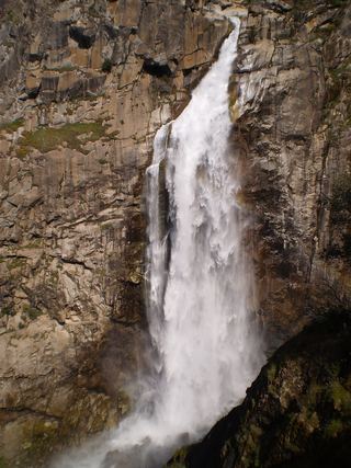 Feather FallsTrail reopened; campground closed410 ft (125 m) · Butte County, CA2.1 miSE
- Little Hollow FallsButte County, CA14 miW
- Hollow FallsShort reserve trail; Lands Pass required45 ft (13.7 m) · Butte County, CA14 miW
- Ravine Twin FallsPartial guide: unmarked cross-country route, and reserve boundaries along the route are not confirmed46 ft (14 m) · Butte County, CA14 miW
- Ravine FallsPublished reserve route and official parking documented; Lands Pass required76 ft (23.2 m) · Butte County, CA14 miW
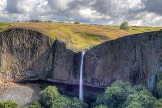 Phantom FallsApproach verified on the official map; paths are unmaintained.164 ft (50 m) · Butte County, CA14 miW
- Little Phantom FallsPartial guide: no coordinates published for this fall, and reserve boundaries along the route are not confirmed124 ft (37.8 m) · Butte County, CA14 miW
- Schirmer Cascade200 ft (61 m) · Butte County, CA14 miSW
- Schirmer Falls96 ft (29.3 m) · Butte County, CA14 miSW