Phantom Falls
Butte County, California
Your visit at a glance
- Waterfall height
- 164 ft (50 m)
- Location
- Butte County, California
- Access status
- Approach verified on the official map; paths are unmaintained.
- The walk
- Approximately 1.32 miles one way; 2.64 miles return
- Ground & access
- Unmaintained dirt paths across exposed basalt country; respect mapped reserve boundaries and private land.
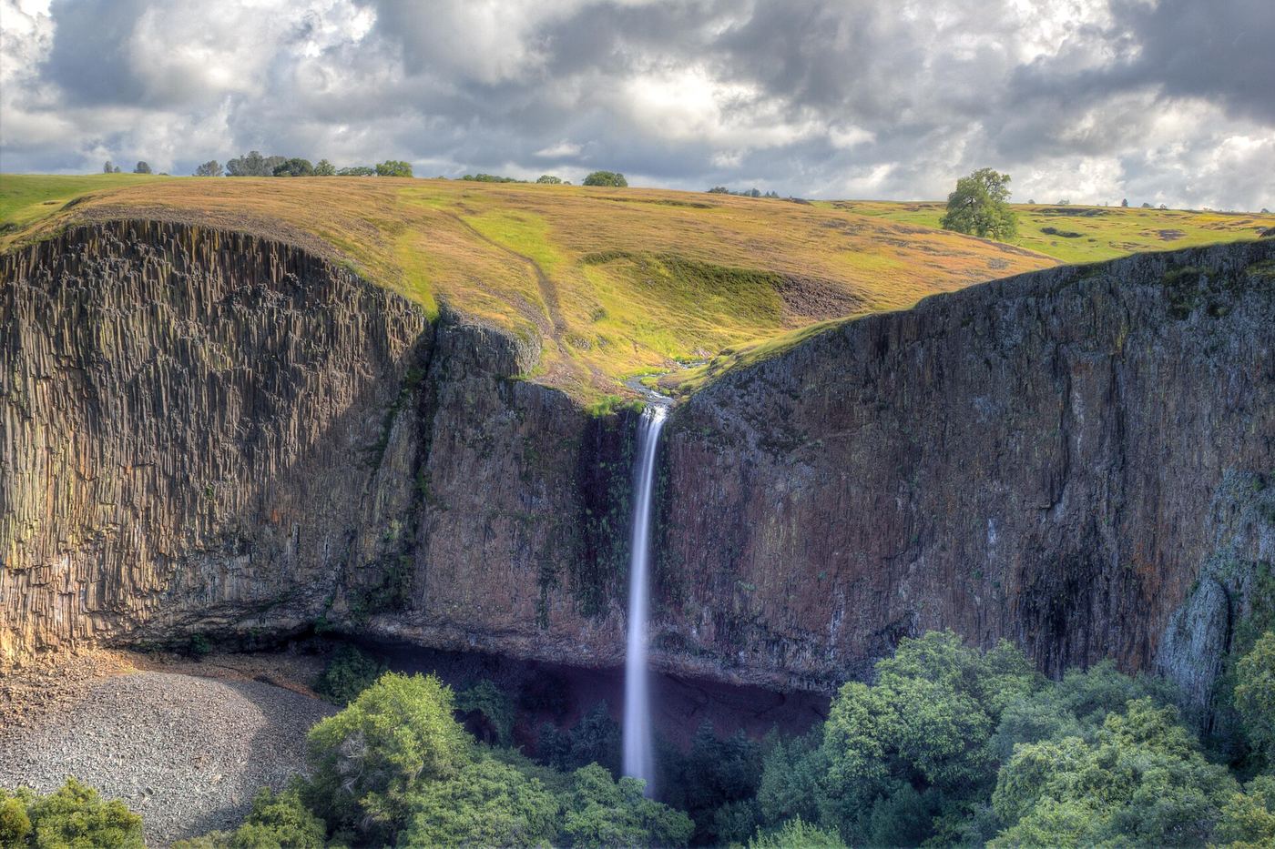
Phantom Falls is labeled Coal Canyon Falls on CDFW's reserve map.
Plan your visit
Follow the CDFW map's dashed path from the Cherokee Road parking lot northwest to Fern Falls, then north to Coal Canyon Falls, labeled Phantom Falls. Return on the mapped path.
Calculated from the official map's consecutive 1-mile and 0.32-mile segments. These are map estimates, not a maintained signed-trail measurement.
Unmaintained dirt paths across exposed basalt country; respect mapped reserve boundaries and private land.
Where to start
Use the small gravel lot at 2488 Cherokee Road, about 8 miles north of Oroville. Roadside parking on Cherokee Road is prohibited.
Timing & water
Seasonal waterfalls; reserve open sunrise to sunset. Current water flow unknown.
Before you go
Visitors 16 and older need a CDFW Lands Pass unless covered by an exemption, including their own valid California hunting or fishing license.
Visitor informationVisit sources
More waterfalls nearby
Within 40 straight-line miles. Road and trail distances will differ.
- Little Phantom FallsPartial guide: no coordinates published for this fall, and reserve boundaries along the route are not confirmed124 ft (37.8 m) · Butte County, CA0.1 miS
- Ravine FallsPublished reserve route and official parking documented; Lands Pass required76 ft (23.2 m) · Butte County, CA0.5 miS
- Ravine Twin FallsPartial guide: unmarked cross-country route, and reserve boundaries along the route are not confirmed46 ft (14 m) · Butte County, CA0.5 miS
- Lower Ravine FallsPublished reserve route and official parking documented; faint paths; Lands Pass required40 ft (12.2 m) · Butte County, CA0.8 miSW
- Little Hollow FallsButte County, CA0.9 miS
- Hollow FallsShort reserve trail; Lands Pass required45 ft (13.7 m) · Butte County, CA1.2 miS
- Beatson Falls104 ft (31.7 m) · Butte County, CA1.7 miSW
- Western Falls120 ft (36.6 m) · Butte County, CA1.8 miSW
- Schirmer Falls96 ft (29.3 m) · Butte County, CA2.3 miS