Ravine Twin Falls
Butte County, California
Your visit at a glance
- Waterfall height
- 46 ft (14 m)
- Location
- Butte County, California
- Access status
- Partial guide: unmarked cross-country route, and reserve boundaries along the route are not confirmed
- The walk
- About 1.1 miles one way to the viewpoint; about 2.2 miles return (doubled)
- Ground & access
- No established trails; cross-country walking over grassland and basalt with few landmarks. Carry a map and compass or GPS. Cattle graze here; CDFW says stay at least 300 feet from them. Cliff edges are unfenced in places.
From the parking lot, follow the north side of the wash west for about 0.3 miles, then turn northwest. At about 1 mile, cross the creek at a small stand of trees to its north side, then head west downhill to the brink of Ravine Fall. Ravine Twin Falls is visible to the east-northeast. This is a separate fall from Ravine Fall, also called Fern Falls.
Plan your visit
North Table Mountain Ecological Reserve parking lot, cross-country west then northwest to the brink of Ravine Fall, with a view of Ravine Twin Falls to the east-northeast
Z and B Johnson give about 1.1 miles from the parking lot to the brink of Ravine Fall, where Ravine Twin Falls is in view. The return figure is that distance doubled. A closer view means walking around the small canyon; that extra distance is not given.
No established trails; cross-country walking over grassland and basalt with few landmarks. Carry a map and compass or GPS. Cattle graze here; CDFW says stay at least 300 feet from them. Cliff edges are unfenced in places.
Where to start
Use the reserve parking lot on the west side of Cherokee Road, about 6.3 miles north of Table Mountain Boulevard (CDFW directions). CDFW says the lot is small, fills on busy days, and parking along Cherokee Road is not permitted.
Timing & water
The falls have small drainages and flow well only after a lot of rain, usually winter to early spring; they are usually dry in summer.
Before you go
CDFW requires a Lands Pass for anyone 16 or older, unless the person holds a valid California hunting or fishing license. Open daily, sunrise to sunset. Dogs on a leash of 10 feet or less.
Visitor informationVisit sources
More waterfalls nearby
Within 40 straight-line miles. Road and trail distances will differ.
- Ravine FallsPublished reserve route and official parking documented; Lands Pass required76 ft (23.2 m) · Butte County, CA0.0 miW
- Little Phantom FallsPartial guide: no coordinates published for this fall, and reserve boundaries along the route are not confirmed124 ft (37.8 m) · Butte County, CA0.4 miNW
- Little Hollow FallsButte County, CA0.4 miSE
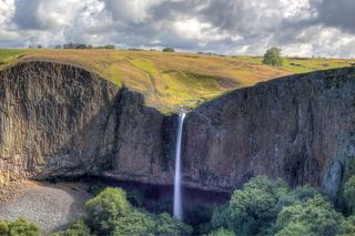 Phantom FallsApproach verified on the official map; paths are unmaintained.164 ft (50 m) · Butte County, CA0.5 miN
- Hollow FallsShort reserve trail; Lands Pass required45 ft (13.7 m) · Butte County, CA0.7 miS
- Lower Ravine FallsPublished reserve route and official parking documented; faint paths; Lands Pass required40 ft (12.2 m) · Butte County, CA0.7 miW
- Beatson Falls104 ft (31.7 m) · Butte County, CA1.5 miSW
- Western Falls120 ft (36.6 m) · Butte County, CA1.7 miW
- Schirmer Falls96 ft (29.3 m) · Butte County, CA1.8 miS