Waterfalls near Athens, TN
27 named waterfalls within 30 miles of Athens, closest first. Distances are straight-line from the town center.
Visits with route details
Read the walking route, starting point and current access notes.
- Lowry FallsPartial guide: national forest trail documented; distance and the exact named falls are not confirmedPolk County, TN
- Conasauga FallsRoute and parking researchedMonroe County, TN
- Benton FallsResearched route and starting areaPolk County, TN
- Coker Creek Falls (4) 45Partial guide: Forest Service trailhead documented; which drop in the series this listing marks is not confirmedPolk County, TN
- Rock Creek FallsNational forest trail route documented; two creek crossingsPolk County, TN
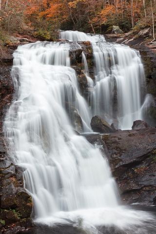 Bald River FallsRoadside viewing area and parking documented; USFS reports open.Monroe County, TN
- Baby FallsPartial notes: parking documented; pedestrian approach unverified.Monroe County, TN
- Upper Piney Falls 80Guide: state natural area trail to the falls and ledgeRhea County, TN
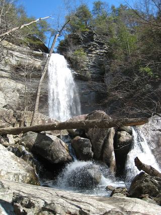 Laurel Falls 80State natural area trail route documentedRhea County, TN
- White Pine Cascades 28Guide: long Cumberland Trail hike from Shut-In Gap RoadRhea County, TN
- Snow Falls 12State natural area trail route documented; long hike with a creek fordRhea County, TN
- Stinging Fork Falls 60State natural area trail and parking documentedRhea County, TN
- North Shoal Creek FallsPartial: no trail for the first part; short steep bushwhack on national forest landCherokee County, NC
- McGill Creek FallsGuide: Cumberland Trail in-and-out hike to the fallsHamilton County, TN
All 27 waterfalls
- Lowry FallsPartial guide: national forest trail documented; distance and the exact named falls are not confirmedPolk County, TN16 miS
- Conasauga FallsRoute and parking researchedMonroe County, TN18 miSE
- Benton FallsResearched route and starting areaPolk County, TN21 miS
- Coker Creek Falls (4) 45Partial guide: Forest Service trailhead documented; which drop in the series this listing marks is not confirmedPolk County, TN21 miSE
- Rock Creek FallsNational forest trail route documented; two creek crossingsPolk County, TN22 miS
- Big Lost Falls164 ft (50 m) · Polk County, TN22 miS
- Bald River FallsRoadside viewing area and parking documented; USFS reports open.Monroe County, TN25 miE
- Baby FallsPartial notes: parking documented; pedestrian approach unverified.Monroe County, TN25 miE
- Paine Creek Falls 10Rhea County, TN25 miW
- Lower Piney Falls 40Rhea County, TN25 miNW
- Upper Piney Falls 80Guide: state natural area trail to the falls and ledgeRhea County, TN25 miNW
- Hemlock FallsRhea County, TN25 miNW
- Pine Branch FallsRhea County, TN25 miNW
- Laurel Falls 80State natural area trail route documentedRhea County, TN25 miW
- Deep Pool Cascades 8Rhea County, TN25 miNW
- White Pine Cascades 28Guide: long Cumberland Trail hike from Shut-In Gap RoadRhea County, TN26 miNW
- North Pole Falls 17Rhea County, TN26 miW
- Snow Falls 12State natural area trail route documented; long hike with a creek fordRhea County, TN26 miW
- Sale Creek Falls 40Rhea County, TN27 miW
- Stinging Fork Falls 60State natural area trail and parking documentedRhea County, TN27 miNW
- Morphy Falls 12Rhea County, TN27 miW
- North Shoal Creek FallsPartial: no trail for the first part; short steep bushwhack on national forest landCherokee County, NC27 miSE
- Ray FallsRhea County, TN27 miNW
- Wildcat Hollow FallsRhea County, TN29 miW
- Brush Creek Falls 20Rhea County, TN29 miW
- South Shoal Creek FallsCherokee County, NC29 miSE
- McGill Creek FallsGuide: Cumberland Trail in-and-out hike to the fallsHamilton County, TN30 miW