Waterfalls in Arizona
49 named waterfalls in 12 counties. Browse mapped locations and recorded heights. A map listing does not confirm public access or a walking route.
Visits with route details
Read the walking route, starting point and current access notes.
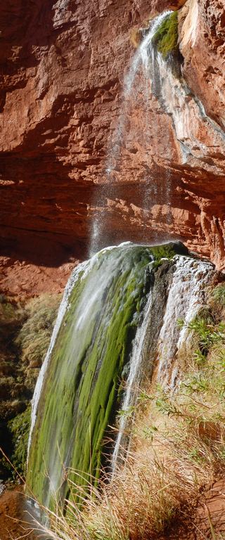 Ribbon FallsNorth Kaibab corridor closed after floodingCoconino County, AZ
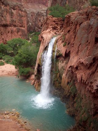 Havasu FallsResearched visit notes92 ft (28 m) · Coconino County, AZ
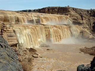 Grand FallsClosed to public184 ft (56 m) · Coconino County, AZ
 Deer Creek FallsTrailhead parking not confirmedCoconino County, AZ
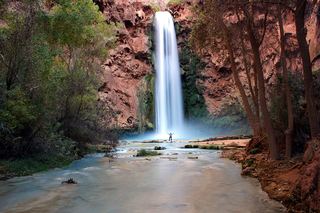 Mooney FallsPartial: distance from the campground to the falls is not given by the tribeCoconino County, AZ
- Seven FallsResearched visit notes35 ft (10.7 m) · Pima County, AZ
- Workman Creek FallsResearched visit notesGila County, AZ
- Winn FallsWalking distance to the overlook not confirmed364 ft (111 m) · Cochise County, AZ
- Carr Canyon WaterfallPartial: the viewpoint pullout is not mapped to the original pinCochise County, AZ
- Cheyava FallsRim trailhead and parking not confirmedCoconino County, AZ
- Seven CatarctsPartial: viewpoint location from a guidebook site; pass requirement and current road status unconfirmedPima County, AZ
- Massacre FallsPartial guide: current trailhead and fee conflict between sourcesPinal County, AZ
- Echo Peaks FallPartial: Navajo permit required; mostly off-trail route from one guide; permit details need checkingCoconino County, AZ
- Camp Creek FallsParking and approach documentedMaricopa County, AZ
- Beaver FallsPartial: reservation required; official sources give no distance from the campground to Beaver FallsCoconino County, AZ
- Ernie's FallsPartial guide: junction details and distance rest on one non-official trail guidePima County, AZ
- Tanque Verde FallsResearched route and starting areaPima County, AZ
- Sycamore FallsRoute and parking researchedCoconino County, AZ
- Chiva FallsPartial guide: exact parking spot on rough Redington Road is unconfirmedPima County, AZ
- Thunder River FallsPartial: trailhead parking details and day-use permit rules are not confirmedCoconino County, AZ
- Bridal Wreath FallsSource-reviewed route and parkingPima County, AZ
- Wolf Creek FallsPartial: one firsthand account; side paths unmarked and exact parking not mappedYavapai County, AZ
Closest to you
Recorded waterfall heights
- Winn FallsWalking distance to the overlook not confirmed364 ft (111 m) · Cochise County
- Grand FallsClosed to public184 ft (56 m) · Coconino County
- Lower Twin Falls125 ft (38 m) · Apache County
- Havasu FallsResearched visit notes92 ft (28 m) · Coconino County
- Seven FallsResearched visit notes35 ft (10.7 m) · Pima County
- Walter's Cascade33 ft (10 m) · Pima County
- Pine Canyon Falls30 ft (9 m) · Cochise County
Waterfalls near a town
By county
Coconino County 16
- Beaver FallsPartial: reservation required; official sources give no distance from the campground to Beaver FallsCoconino County
- Black FallsCoconino County
- Cheyava FallsRim trailhead and parking not confirmedCoconino County
- Deer Creek FallsTrailhead parking not confirmedCoconino County
- Echo Peaks FallPartial: Navajo permit required; mostly off-trail route from one guide; permit details need checkingCoconino County
- Fiftyfoot FallsCoconino County
- Grand FallsClosed to public184 ft (56 m) · Coconino County
- Havasu FallsResearched visit notes92 ft (28 m) · Coconino County
- Mooney FallsPartial: distance from the campground to the falls is not given by the tribeCoconino County
- Navajo FallsCoconino County
- Ribbon FallsNorth Kaibab corridor closed after floodingCoconino County
- Sycamore FallsRoute and parking researchedCoconino County
- Thunder River FallsPartial: trailhead parking details and day-use permit rules are not confirmedCoconino County
- Upper Ribbon FallsCoconino County
- Upper Upper Ribbon FallsCoconino County
- Whitmore RapidsCoconino County
Cochise County 12
- Brushy Canyon FallsCochise County
- Callahan FallsCochise County
- Carr Canyon WaterfallPartial: the viewpoint pullout is not mapped to the original pinCochise County
- Jhus FallsCochise County
- Lower Cave Creek FallsCochise County
- North Fork FallsCochise County
- Pine Canyon Falls30 ft (9 m) · Cochise County
- Sheila FallsCochise County
- Upper Cave Creek FallsCochise County
- Upper East Turkey Creek WaterfallCochise County
- Winn FallsWalking distance to the overlook not confirmed364 ft (111 m) · Cochise County
- Wood Canyon WaterfallCochise County
Pima County 8
- Bridal Wreath FallsSource-reviewed route and parkingPima County
- Chiva FallsPartial guide: exact parking spot on rough Redington Road is unconfirmedPima County
- Ernie's FallsPartial guide: junction details and distance rest on one non-official trail guidePima County
- Jaguar Canyon Water FallsPima County
- Seven CatarctsPartial: viewpoint location from a guidebook site; pass requirement and current road status unconfirmedPima County
- Seven FallsResearched visit notes35 ft (10.7 m) · Pima County
- Tanque Verde FallsResearched route and starting areaPima County
- Walter's Cascade33 ft (10 m) · Pima County