Rocky Mouth Canyon Waterfall
Salt Lake County, Utah
Your visit at a glance
- Waterfall height
- Not recorded
- Location
- Salt Lake County, Utah
- Access status
- Guide: short trail from Wasatch Boulevard
- The walk
- About 1 mile round trip, per a hiking blog
- Ground & access
- Steep wooden stairs, a residential sidewalk, then a short climbing dirt trail. About 300 feet of elevation gain, per a hiking site.
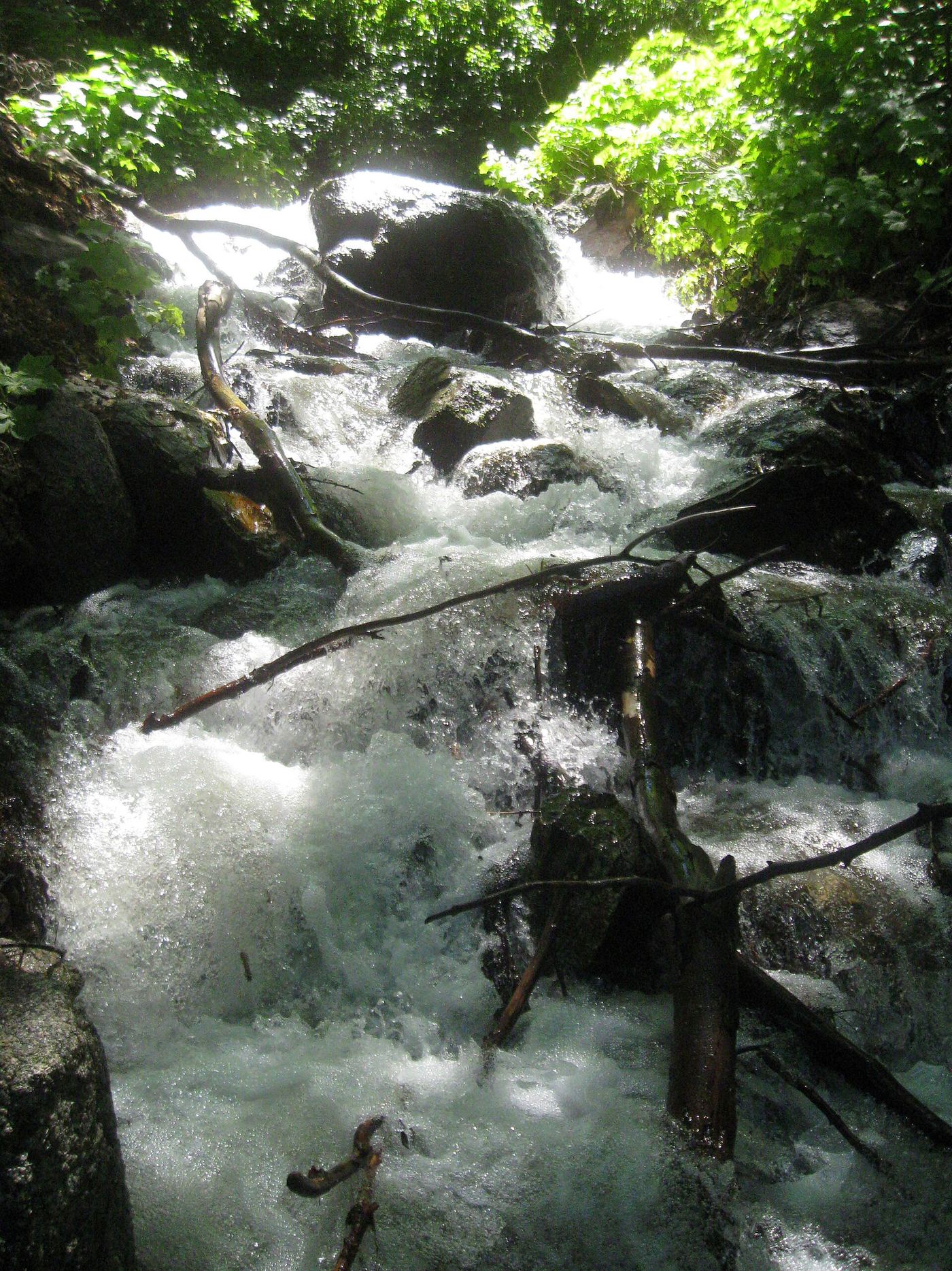
Rocky Mouth Falls is a spring-fed waterfall at the mouth of Rocky Mouth Canyon above Sandy, in Salt Lake County. Park in the small signed trailhead lot on the east side of Wasatch Boulevard, across from a church. Climb the stairs to a residential street, turn right as the sign directs, and walk up the sidewalk past several homes to more trail signs and a path between two homes. The path climbs, then levels off to the falls. You may no longer park on Eagle View Drive, and signs at the upper trail entrance say there is no trailhead parking. The first half of the walk goes through a neighborhood, so respect the homes. Dogs are not allowed because the canyon is watershed. Return the same way.
Plan your visit
Rocky Mouth trailhead parking on the east side of Wasatch Boulevard in Sandy, up the stairs to a residential street, along the sidewalk to the signed trail between two homes, then up Rocky Mouth Canyon to the falls
A hiking blog calls it a 1 mile round trip. Hiking Project lists the trail as 0.4 miles point to point.
Steep wooden stairs, a residential sidewalk, then a short climbing dirt trail. About 300 feet of elevation gain, per a hiking site.
Where to start
Small signed trailhead lot on the east side of South Wasatch Boulevard at about 11300 South (one blog gives 11248 S. Wasatch Boulevard), across from a church. Do not park on Eagle View Drive.
Timing & water
The falls are spring-fed and flow all summer, per a hiking site. Check conditions in winter.
Before you go
No fee is mentioned. No booking is needed.
Visitor informationVisit sources
- Willhiteweb: Rocky Mouth Trail, Sandy
- Willhiteweb: Rocky Mouth Trail, Sandy
- Willhiteweb: Rocky Mouth Trail, Sandy
- Dirt In My Shoes: Rocky Mouth Waterfall
- Dirt In My Shoes: Rocky Mouth Waterfall
- Random Rambler: Rocky Mouth Falls
- Random Rambler: Rocky Mouth Falls
- Stav is Lost: Rocky Mouth Falls
- Hiking Project: Rocky Mouth Falls Trail
More waterfalls nearby
Within 40 straight-line miles. Road and trail distances will differ.
 Lower Bells Canyon WaterfallSteep canyon trail from a signed trailhead to a short spurSalt Lake County, UT2.1 miNE
- Upper Bells Canyon WaterfallSteep canyon trail from a signed trailhead; upper falls beyond the Lower Falls junctionSalt Lake County, UT2.5 miNE
- Ghost FallsSigned Corner Canyon trails from a trailhead lot; shared with bikesSalt Lake County, UT3.4 miS
- Lisa FallsRoute and parking researchedSalt Lake County, UT4.5 miNE
- Upper Lisa FallsSalt Lake County, UT4.9 miNE
- Horsetail FallsResearched visit notesUtah County, UT5.0 miSE
- Gloria FallsResearched visit notesSalt Lake County, UT6.2 miE
- Hidden FallsResearched visit notesSalt Lake County, UT7.6 miNE
- Moss Ledge WaterfallPartial guide: short unmaintained social trail with scramblingSalt Lake County, UT8.0 miNE