Lower Provo River Falls
Summit County, Utah
Your visit at a glance
- Waterfall height
- Not recorded
- Location
- Summit County, Utah
- Access status
- Short trail from a signed highway parking area; recreation pass required
- The walk
- Distance not stated
- Ground & access
- Short paved and improved trail with rock slabs beside the river. Rock near the water is slippery.
The lower falls is the last of three main drops of the Provo River at the Provo River Falls stop on the Mirror Lake Highway in the Uinta Mountains. From the parking area, a trail goes down to the upper falls, which can be seen from the lot, then continues downstream past cascades and the middle falls to the lower falls. Random Rambler notes there is a paved trail, though many visitors scramble down the rocks. Return the same way. Visit Utah says visitors can swim and wade in the lower pools of the falls.
Plan your visit
Provo River Falls parking area on UT-150 (Mirror Lake Highway), down the trail past the upper and middle falls to the lower falls
Climb-Utah says the first viewpoints are about a hundred feet east of the parking area on an improved trail. Random Rambler estimates the main trail is probably only a quarter mile or so. No source gives the distance to this drop itself.
Short paved and improved trail with rock slabs beside the river. Rock near the water is slippery.
Where to start
Signed Provo River Falls parking area on the west side of UT-150 (Mirror Lake Highway) at mile post 23.9, about 24 miles east of Kamas. Paved lot with a pit toilet.
Timing & water
Mirror Lake Highway is closed to cars in winter. Road Trip Ryan says the gate is typically open from Memorial Day until late October.
Before you go
A Mirror Lake Highway recreation pass is required to stop at recreation sites; three-day, seven-day and annual passes are sold online at yourpassnow.com, at self-service fee tubes along the highway (cash or check) and at ranger stations. America the Beautiful passes are honored.
Visitor informationVisit sources
More waterfalls nearby
Within 40 straight-line miles. Road and trail distances will differ.
- Middle Provo River FallsShort trail from a signed highway parking area; recreation pass requiredSummit County, UT0.0 miN
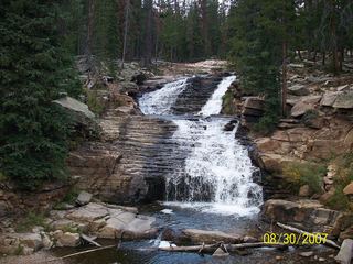 Upper Provo River FallsRoadside viewpoint at a signed highway parking area; recreation pass requiredSummit County, UT0.1 miN
- Little Deer Creek FallsPartial guide: rough 4x4 road to the base; walking distance not confirmedDuchesne County, UT3.7 miSE
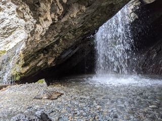 Donut FallsSummer parking and signed approach verified; winter gate changes the starting point.20 ft (6 m) · Salt Lake County, UT37 miW
- Blackjack WaterfallSalt Lake County, UT37 miW
- Stewart FallsVisitor route and trailhead documented; recreation fee at the Alpine Loop fee boothUtah County, UT39 miSW
- Gloria FallsResearched visit notesSalt Lake County, UT39 miW
- Scout FallsNational forest trail route documented; recreation pass and weekend timed entryUtah County, UT40 miSW