Donut Falls
Salt Lake County, Utah
Your visit at a glance
- Waterfall height
- 20 ft (6 m)
- Location
- Salt Lake County, Utah
- Access status
- Summer parking and signed approach verified; winter gate changes the starting point.
- The walk
- Approximately 0.8 mile one way; 1.6 miles return
- Ground & access
- Trail with slippery rocks near the waterfall. Snow changes the route and introduces avalanche exposure.
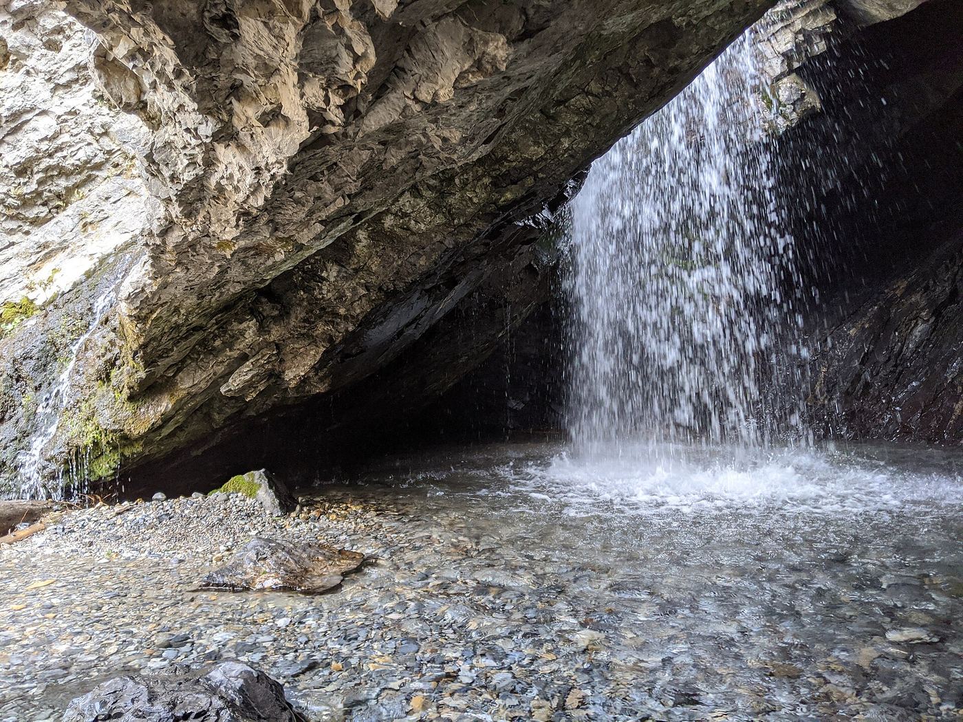
Visit Utah documents the short summer approach to the waterfall's circular rock formation.
Plan your visit
When the upper trailhead road is open, start at Donut Falls trailhead parking and follow the signed Donut Falls trail to the waterfall, then return the same way. Stop at the designated trail end.
Visit Utah gives 0.8 mile from the upper trailhead to the falls. Starting at lower canyon-road parking adds about 2 miles total; do not confuse the two starting points.
Trail with slippery rocks near the waterfall. Snow changes the route and introduces avalanche exposure.
Where to start
Drive about 9 miles up Big Cottonwood Canyon, turn toward Jordan Pines at Mill D, pass the summer homes and continue to the upper trailhead lot. If full, use the larger lower lot and allow for the longer walk.
Timing & water
Summer through early autumn is the tourism guide's preferred season. The upper trailhead is gated in winter; the falls and final approach are exposed to avalanches.
Before you go
UDOT lists Donut Falls as a summer fee area and Cardiff Fork as year-round. Parking inside posted fee areas requires a valid day-use or accepted recreation pass.
Visitor informationVisit sources
More waterfalls nearby
Within 40 straight-line miles. Road and trail distances will differ.
- Moss Ledge WaterfallPartial guide: short unmaintained social trail with scramblingSalt Lake County, UT3.0 miW
- Blackjack WaterfallSalt Lake County, UT3.5 miS
- Hidden FallsResearched visit notesSalt Lake County, UT3.6 miW
- Gloria FallsResearched visit notesSalt Lake County, UT5.0 miS
- Upper Lisa FallsSalt Lake County, UT5.1 miSW
- Lisa FallsRoute and parking researchedSalt Lake County, UT5.5 miSW
- Upper Bells Canyon WaterfallSteep canyon trail from a signed trailhead; upper falls beyond the Lower Falls junctionSalt Lake County, UT7.5 miSW
 Lower Bells Canyon WaterfallSteep canyon trail from a signed trailhead to a short spurSalt Lake County, UT7.8 miSW
- Horsetail FallsResearched visit notesUtah County, UT9.9 miSW