Obsidian Falls
Lane County, Oregon
Your visit at a glance
- Waterfall height
- Not recorded
- Location
- Lane County, Oregon
- Access status
- Long wilderness trail; limited-entry permit required
- The walk
- On a 12-mile loop; no separate one-way distance to the falls is given
- Ground & access
- Long wilderness trail with about 1,700 feet of climbing, a lava-flow crossing and a steep descent if you take Glacier Way. High elevation; snow lingers into summer.
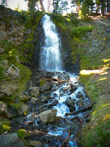
Photo credit
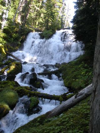
Photo: U.S. Forest Service- Pacific Northwest Region, Public domain, via Wikimedia CommonsObsidian Falls is on Obsidian Creek beside the Pacific Crest Trail in the Three Sisters Wilderness, inside the Obsidian Limited Entry Area. From the Obsidian Trailhead near Frog Camp, follow the Obsidian Trail up along White Branch Creek through forest and across a lava flow. At about four miles it crosses White Branch Creek and forks in a meadow. Take the right fork toward Linton Meadows; about 1.7 miles up, it meets the Pacific Crest Trail. Turn left (north) on the PCT to Obsidian Falls. The PCT climbs the cliff beside the falls and crosses the creek above them. Return the same way, or continue north past Arrowhead Lakes and descend the steep Glacier Way back to the meadow fork to close the loop.
Plan your visit
Obsidian Trailhead on the McKenzie Pass Highway (OR 242), Obsidian Trail to the Pacific Crest Trail, then north on the PCT to Obsidian Falls
The Nugget Newspaper gives about 4 miles to the White Branch Creek crossing and meadow fork, 1.7 miles up the right fork to the Pacific Crest Trail, and a total of about 12 miles for the loop that passes Obsidian Falls. No separate distance from the PCT junction to the falls is given.
Long wilderness trail with about 1,700 feet of climbing, a lava-flow crossing and a steep descent if you take Glacier Way. High elevation; snow lingers into summer.
Where to start
Obsidian Trailhead, on the east side of OR 242 about 6 miles west of the McKenzie Pass summit. A federal parking pass is required.
Timing & water
Travel Oregon says the road to the trailhead does not open to motor vehicles until the third Monday in June at the earliest; OR 242 closes for snow in winter. Permits cover the season from late May to October 31.
Before you go
A limited-entry permit is required for the Obsidian area: 30 day hikers and 40 overnight visitors per day, reserved through Recreation.gov. The Recreation.gov overnight permit reservation fee is $6. A federal parking pass is also required at the trailhead.
Visitor informationVisit sources
- The Nugget Newspaper: Obsidian Trail is a unique path into the Three Sisters Wilderness
- The Nugget Newspaper: Obsidian Trail is a unique path into the Three Sisters Wilderness
- The Nugget Newspaper: Obsidian Trail is a unique path into the Three Sisters Wilderness
- The Nugget Newspaper: Obsidian Trail is a unique path into the Three Sisters Wilderness
- Travel Oregon: Obsidian Limited Entry Area
- Travel Oregon: Obsidian Limited Entry Area
- Recreation.gov: Central Cascades Wilderness Overnight Permits
- Oregon Hikers Field Guide: Obsidian Falls
More waterfalls nearby
Within 40 straight-line miles. Road and trail distances will differ.
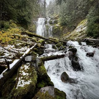 Linton FallsPartial guide: distant view from across Linton Lake; the exact viewpoint is not described and the base has no official trail600 ft (182.9 m) · Lane County, OR3.3 miW
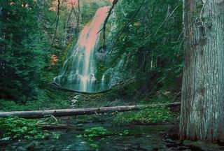 Upper Proxy FallsLoop and roadside trailhead parking documented.129 ft (39.3 m) · Lane County, OR5.3 miW
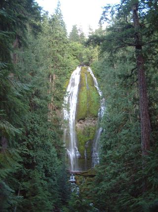 Proxy FallsSeasonal highway access226 ft (68.9 m) · Lane County, OR5.5 miW
 Indian Hole FallsLane County, OR5.9 miSW
- Phoenix Falls110 ft (33.5 m) · Deschutes County, OR6.4 miE
- Howlaak Falls70 ft (21.3 m) · Deschutes County, OR6.4 miE
- Columnar Canyon Falls125 ft (38.1 m) · Deschutes County, OR6.4 miE
- The CascadesPartial guide: informal paths past Chush Falls; current trailhead location not confirmedDeschutes County, OR6.7 miE
- Chush FallsTrailhead parking and overlook approach documented; current conditions unverified67 ft (20.4 m) · Deschutes County, OR6.8 miE