Waterfalls near Sweetwater, TN
17 named waterfalls within 30 miles of Sweetwater, closest first. Distances are straight-line from the town center.
Visits with route details
Read the walking route, starting point and current access notes.
- Conasauga FallsRoute and parking researchedMonroe County, TN
- Upper Piney Falls 80Guide: state natural area trail to the falls and ledgeRhea County, TN
- Baby FallsPartial notes: parking documented; pedestrian approach unverified.Monroe County, TN
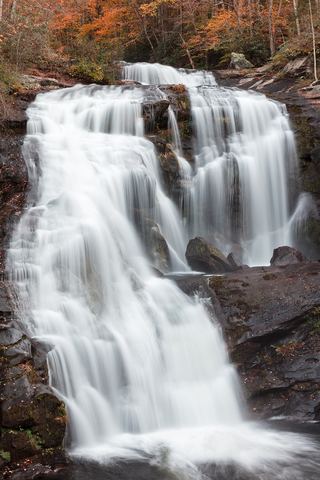 Bald River FallsRoadside viewing area and parking documented; USFS reports open.Monroe County, TN
- Lowry FallsPartial guide: national forest trail documented; distance and the exact named falls are not confirmedPolk County, TN
- White Pine Cascades 28Guide: long Cumberland Trail hike from Shut-In Gap RoadRhea County, TN
- Stinging Fork Falls 60State natural area trail and parking documentedRhea County, TN
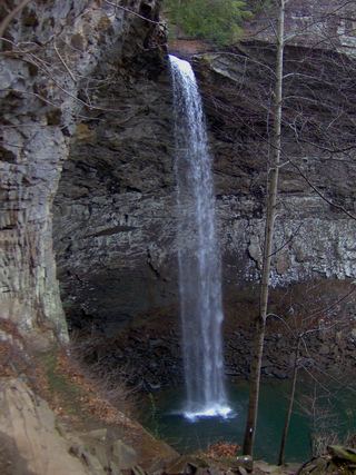 Ozone FallsResearched walking route112 ft (34 m) · Cumberland County, TN
- Falls Branch FallsResearched visit notes98 ft (30 m) · Monroe County, TN
- Coker Creek Falls (4) 45Partial guide: Forest Service trailhead documented; which drop in the series this listing marks is not confirmedPolk County, TN
- Lower FallsGuide: wilderness trail with a creek fordMonroe County, TN
All 17 waterfalls
- Conasauga FallsRoute and parking researchedMonroe County, TN22 miS
- Upper Piney Falls 80Guide: state natural area trail to the falls and ledgeRhea County, TN24 miW
- Lower Piney Falls 40Rhea County, TN24 miW
- Ray FallsRhea County, TN25 miNW
- Baby FallsPartial notes: parking documented; pedestrian approach unverified.Monroe County, TN25 miSE
- Bald River FallsRoadside viewing area and parking documented; USFS reports open.Monroe County, TN25 miSE
- Pine Branch FallsRhea County, TN26 miW
- Hemlock FallsRhea County, TN26 miW
- Lowry FallsPartial guide: national forest trail documented; distance and the exact named falls are not confirmedPolk County, TN27 miS
- Deep Pool Cascades 8Rhea County, TN27 miW
- White Pine Cascades 28Guide: long Cumberland Trail hike from Shut-In Gap RoadRhea County, TN27 miW
- Stinging Fork Falls 60State natural area trail and parking documentedRhea County, TN27 miW
- Ozone FallsResearched walking route112 ft (34 m) · Cumberland County, TN27 miNW
- Falls Branch FallsResearched visit notes98 ft (30 m) · Monroe County, TN28 miSE
- Coker Creek Falls (4) 45Partial guide: Forest Service trailhead documented; which drop in the series this listing marks is not confirmedPolk County, TN28 miS
- Wildcat FallsMonroe County, TN29 miSE
- Lower FallsGuide: wilderness trail with a creek fordMonroe County, TN29 miE