Waterfalls near Lake Arrowhead, CA
11 named waterfalls within 30 miles of Lake Arrowhead, closest first. Distances are straight-line from the town center.
Visits with route details
Read the walking route, starting point and current access notes.
- Aztec FallsClosed by Forest Order through June 7, 2027San Bernardino County, CA
- Monkeyface FallsPartial: climbing-area approach; exact falls and parking rules not confirmedSan Bernardino County, CA
- Bonita FallsApproach or parking partly unconfirmed98 ft (30 m) · San Bernardino County, CA
- Etiwanda FallsEstablished preserve trail and lot; paid parking reportedSan Bernardino County, CA
- Big FallsUpper falls area closed; overlook route onlySan Bernardino County, CA
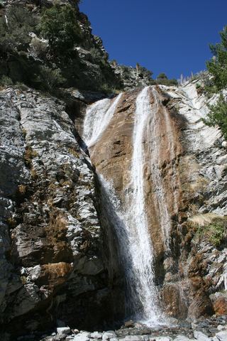 San Antonio FallsPermitted parking and current access unconfirmedSan Bernardino County, CA
All 11 waterfalls
- Aztec FallsClosed by Forest Order through June 7, 2027San Bernardino County, CA4.1 miNE
- Hesperia FallsSan Bernardino County, CA6.5 miN
- Middleman FallsSan Bernardino County, CA13 miW
- Monkeyface FallsPartial: climbing-area approach; exact falls and parking rules not confirmedSan Bernardino County, CA17 miSE
- Monkeyface CreekSan Bernardino County, CA17 miSE
- Bonita FallsApproach or parking partly unconfirmed98 ft (30 m) · San Bernardino County, CA18 miW
- Etiwanda FallsEstablished preserve trail and lot; paid parking reportedSan Bernardino County, CA20 miW
- Big FallsUpper falls area closed; overlook route onlySan Bernardino County, CA20 miSE
- Silverwood FallsSan Bernardino County, CA24 miSE
- Canyon FallsSan Bernardino County, CA24 miW
- San Antonio FallsPermitted parking and current access unconfirmedSan Bernardino County, CA25 miW