Bonita Falls
San Bernardino County, California
Your visit at a glance
- Waterfall height
- 98 ft (30 m)
- Location
- San Bernardino County, California
- Access status
- Approach or parking partly unconfirmed
- The walk
- Measured current approach unconfirmed
- Ground & access
- River-rock field, uphill canyon and poison oak. USFS warns of sudden rockfall; avoid standing beneath cliff faces or unstable slopes.
USFS describes crossing a river-rock field and then climbing toward the lower waterfall, with poison oak on the approach. Its April 2024 project report proposed a paved day-use parking lot and creek-access path, but that construction announcement alone does not verify the completed lot or a signed waterfall route.
Plan your visit
Bonita Falls canyon approach from Lytle Creek Road
Only the stated source distance is supported; mapped proximity is not a walking distance.
River-rock field, uphill canyon and poison oak. USFS warns of sudden rockfall; avoid standing beneath cliff faces or unstable slopes.
Where to start
Current authorized arrangement unconfirmed. USFS documented shoulder-parking congestion and a replacement lot under construction in 2024. Do not treat construction plans as proof that the lot is available.
Timing & water
USFS rockfall alert dated July 24, 2026 lists an end date of December 31, 2026. It is a hazard notice, not proof of parking availability.
Before you go
Unknown: current fees or reservation requirements were not established in the reviewed source.
Visitor informationVisit sources
More waterfalls nearby
Within 40 straight-line miles. Road and trail distances will differ.
- Etiwanda FallsEstablished preserve trail and lot; paid parking reportedSan Bernardino County, CA3.2 miS
- Middleman FallsSan Bernardino County, CA5.0 miE
- Canyon FallsSan Bernardino County, CA6.5 miW
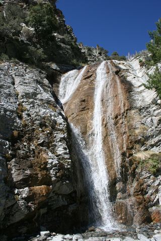 San Antonio FallsPermitted parking and current access unconfirmedSan Bernardino County, CA7.9 miW
- Wolfskill FallsLos Angeles County, CA14 miW
- Hesperia FallsSan Bernardino County, CA19 miNE
- Dorr Canyon Falls33 ft (10 m) · Los Angeles County, CA19 miNW
- Aztec FallsClosed by Forest Order through June 7, 2027San Bernardino County, CA22 miE
- West Fork WaterfallLos Angeles County, CA22 miW