Waterfalls near Gloversville, NY
21 named waterfalls within 30 miles of Gloversville, closest first. Distances are straight-line from the town center.
Visits with route details
Read the walking route, starting point and current access notes.
- Canajoharie FallsVillage park trail to an observation deckMontgomery County, NY
- Rynex Kill FallsPartial guide: view of the top only from the Red Trail; base route not described39 ft (12 m) · Schenectady County, NY
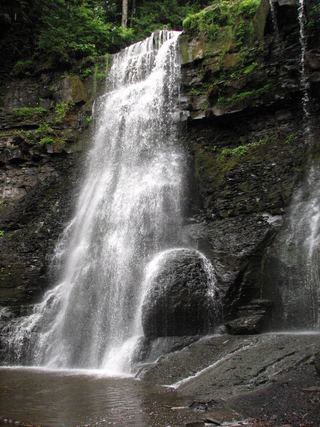 Upper Plotter Kill FallsCounty preserve overlook; steep marked path to the base59 ft (18 m) · Schenectady County, NY
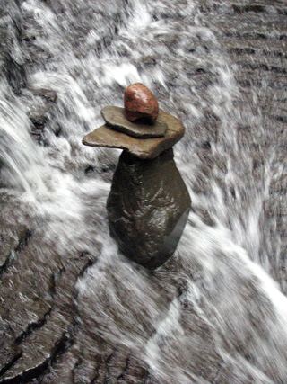 Lower Plotter Kill FallsPartial guide: view from near the top edge only; base route not described39 ft (12 m) · Schenectady County, NY
- Jacob's Ladder FallsPartial guide: preserve trail to a nearby cascade; the last part follows the stream bed and the name's extent is unclearSchenectady County, NY
- first fallsPartial guide: probable match to Tenant Creek First Falls; marked DEC trailHamilton County, NY
- second fallsPartial guide: probable match to Tenant Creek 2nd Falls; herd path beyond the first fallsHamilton County, NY
- Bozen KIll FallsPartial guide: preserve trail documented; this listing is probably the Christman Sanctuary falls, but no source ties it to this location49 ft (15 m) · Schenectady County, NY
- Judds FallsPartial: roadside view from the crest; land ownership not confirmed121 ft (37 m) · Otsego County, NY
- Auger FallsForest Preserve trail; short walk to cliff-top overlooksHamilton County, NY
- Palmer FallsSeasonal hydro company overlook trail; flow controlled by the plantSaratoga County, NY
All 21 waterfalls
- West Stoney Creek FallsHamilton County, NY14 miN
- Canajoharie FallsVillage park trail to an observation deckMontgomery County, NY16 miSW
- Rynex Kill FallsPartial guide: view of the top only from the Red Trail; base route not described39 ft (12 m) · Schenectady County, NY21 miSE
- Upper Plotter Kill FallsCounty preserve overlook; steep marked path to the base59 ft (18 m) · Schenectady County, NY21 miSE
- Lower Plotter Kill FallsPartial guide: view from near the top edge only; base route not described39 ft (12 m) · Schenectady County, NY22 miSE
- Sergeant FallsSchenectady County, NY22 miSE
- Jacob's Ladder FallsPartial guide: preserve trail to a nearby cascade; the last part follows the stream bed and the name's extent is unclearSchenectady County, NY22 miSE
- first fallsPartial guide: probable match to Tenant Creek First Falls; marked DEC trailHamilton County, NY22 miN
- second fallsPartial guide: probable match to Tenant Creek 2nd Falls; herd path beyond the first fallsHamilton County, NY22 miNE
- third fallsHamilton County, NY22 miNE
- First Falls7 ft (2 m) · Saratoga County, NY24 miSE
- Second Falls10 ft (3 m) · Saratoga County, NY25 miSE
- Bozen KIll FallsPartial guide: preserve trail documented; this listing is probably the Christman Sanctuary falls, but no source ties it to this location49 ft (15 m) · Schenectady County, NY25 miSE
- Eggleston FallsSaratoga County, NY25 miNE
- Third Falls3 ft (1 m) · Saratoga County, NY25 miSE
- Judds FallsPartial: roadside view from the crest; land ownership not confirmed121 ft (37 m) · Otsego County, NY25 miSW
- Buttermilk Falls33 ft (10 m) · Albany County, NY29 miSE
- Star Falls39 ft (12 m) · Albany County, NY29 miSE
- Auger FallsForest Preserve trail; short walk to cliff-top overlooksHamilton County, NY29 miN
- Snook Kill FallsSaratoga County, NY30 miE
- Palmer FallsSeasonal hydro company overlook trail; flow controlled by the plantSaratoga County, NY30 miNE