Hedge Creek Falls
Siskiyou County, California
Your visit at a glance
- Waterfall height
- Not recorded
- Location
- Siskiyou County, California
- Access status
- City trail with documented trailhead parking
- The walk
- About 0.6 to 1 mile return (sources differ)
- Ground & access
- Short descent of about 130 to 160 feet; narrow and uneven in spots.
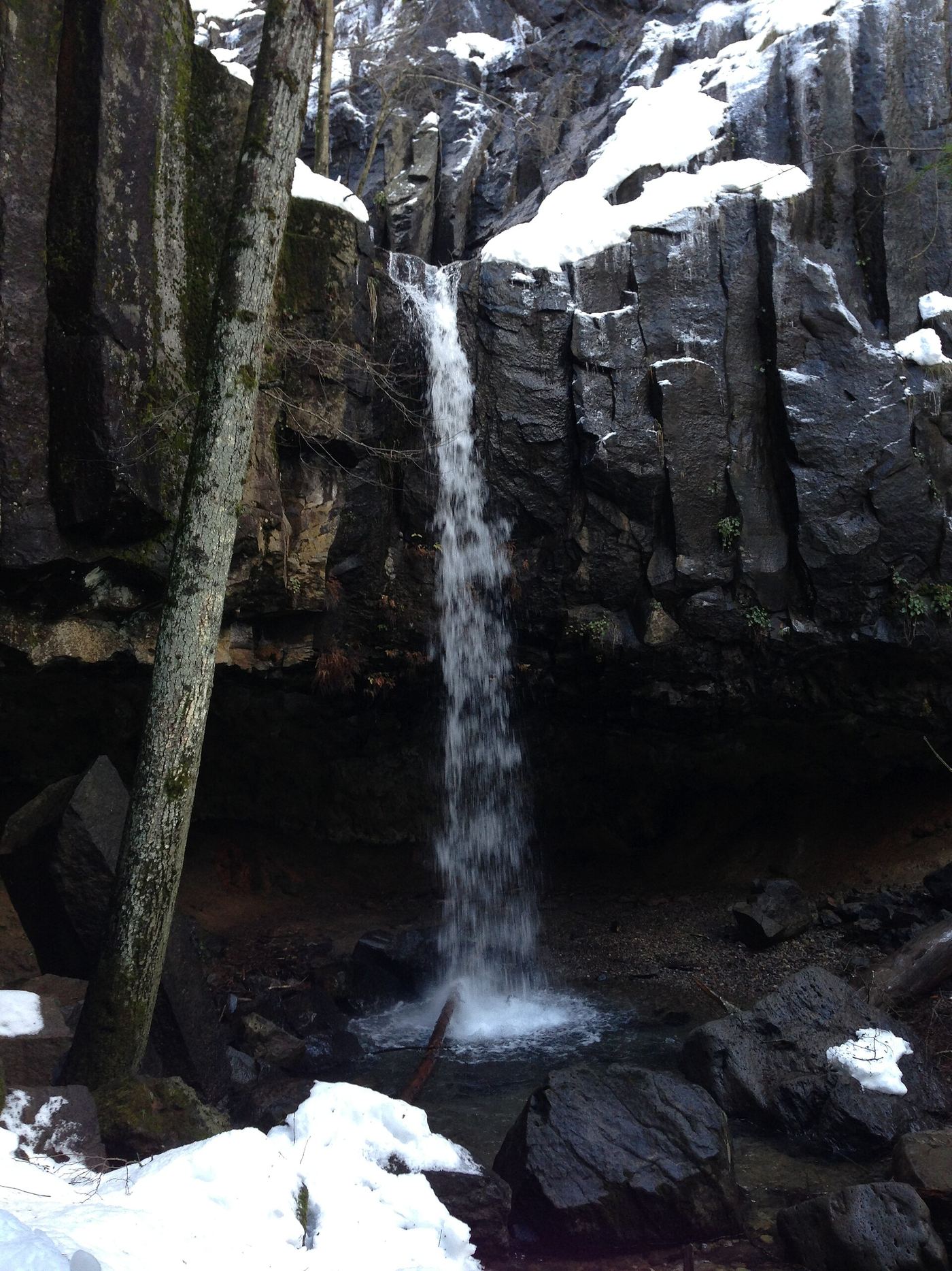
Leave I-5 at exit 732 in Dunsmuir. Trailhead parking is at the corner of Siskiyou Avenue and Dunsmuir Avenue, at the end of the offramp. The trail descends to the falls, passes behind the waterfall under the rock overhang, and continues down to a Sacramento River overlook. Return the same way.
Plan your visit
Siskiyou Avenue and Dunsmuir Avenue trailhead (I-5 exit 732) to Hedge Creek Falls and the Sacramento River overlook
Hikespeak gives 0.6 mile round trip including the river overlook. Mount Shasta Trail Association lists 1 mile round trip.
Short descent of about 130 to 160 feet; narrow and uneven in spots.
Where to start
Trailhead parking at the corner of Siskiyou Avenue and Dunsmuir Avenue at the end of the exit 732 offramp. Space is limited.
Timing & water
Year-round per the trail association. Flow is strongest in spring.
Before you go
No fee or reservation is mentioned in the sources.
Visitor informationVisit sources
More waterfalls nearby
Within 40 straight-line miles. Road and trail distances will differ.
 Mossbrae FallsPublic trail proposed; legal approach unverifiedSiskiyou County, CA0.3 miN
- Faery FallsPublished hiking route and parking documented; steep final side trailSiskiyou County, CA3.8 miNW
- Root Creek FallsPartial guide: last section is an unofficial use trail to a precarious viewpointShasta County, CA5.2 miSW
- Burstarse FallsPublished hiking route and trailhead documented; faint use trail to main dropSiskiyou County, CA6.5 miSW
- Lewisia FallsShasta County, CA9.9 miSE
- Mud Creek FallsPartial guide: distance to the rim vista not stated; distant view onlySiskiyou County, CA11 miNE
- Lower FallsResearched route and starting areaSiskiyou County, CA13 miE
- Ash Creek FallsSiskiyou County, CA13 miNE
 Upper FallsVehicle access closed October 5, 2026–May 1, 2027; winter walking approach unverified.Siskiyou County, CA13 miE