Bechler Falls
Teton County, Wyoming
Your visit at a glance
- Waterfall height
- 15 ft (4.6 m)
- Location
- Teton County, Wyoming
- Access status
- October 27, 2026: regional snow and ice reported; Cave Falls Road condition unverified
- The walk
- 2.6 miles return
- Ground & access
- Woodland riverside trail with small rises and descents. Fast, cold rivers; this route does not require the dangerous Fall River ford on the South Boundary Trail. Carry bear spray and stay on established trails.
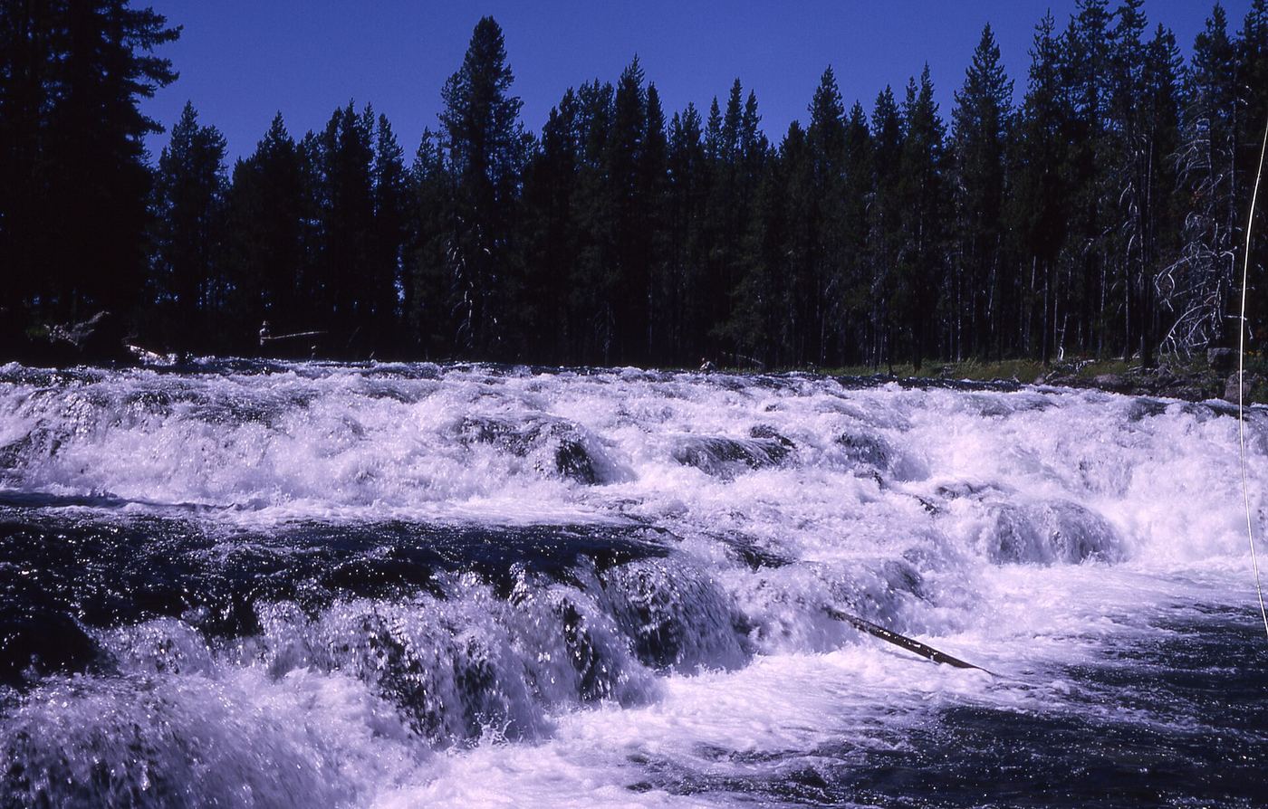
Photo credit
Photo: R. G. Johnsson, Public domain, via Wikimedia CommonsFrom the parking area at the end of Cave Falls Road, follow the Bechler River Trail north past the confluence of the Fall and Bechler rivers to Bechler Falls. Return on the same trail. Route and distance are documented by The American Southwest.
Plan your visit
Cave Falls trailhead to Bechler Falls
The American Southwest documents 1.3 miles one way to Bechler Falls; return distance doubles that route.
Woodland riverside trail with small rises and descents. Fast, cold rivers; this route does not require the dangerous Fall River ford on the South Boundary Trail. Carry bear spray and stay on established trails.
Where to start
Use the parking area at the end of Cave Falls Road for the Bechler River Trail. The American Southwest describes the road approach from Highway 47 near Ashton, Idaho. Current road condition is unverified.
Timing & water
NPS reported snow and ice developing on Bechler Meadows trails on October 27, 2026, alongside a parkwide snow/ice warning. This regional report does not specifically confirm the short Cave Falls–Bechler Falls segment or Cave Falls Road. Summer/fall is the firsthand guide’s usual season; obtain current road and trail conditions.
Before you go
NPS requires permits for overnight camping; day-hike booking and entrance-charge details are not established by these sources.
Visitor informationVisit sources
More waterfalls nearby
Within 40 straight-line miles. Road and trail distances will differ.
- Cave FallsSource-reviewed route and parkingTeton County, WY0.8 miSE
- Ouzel FallsPartial guide: distant view from a long meadow trail; no trail to the falls and the distance to the viewing point is not statedTeton County, WY6.2 miN
- Silver Scarf FallsLong national park day hike with fords; falls a short walk from the Dunanda Falls junctionTeton County, WY6.8 miN
- Dunanda FallsLong Yellowstone backcountry day hike from the Bechler Ranger Station; stream crossings that may need wadingTeton County, WY6.9 miN
- Lower Colonnade FallsPartial guide: long backcountry trail with deep fords; distance from the trailhead not stated66 ft (20 m) · Teton County, WY6.9 miNE
- Upper Colonnade FallsPartial guide: long backcountry trail with deep fords; distance from the trailhead not stated36 ft (11 m) · Teton County, WY7.0 miNE
 Iris FallsSnow and ice reported; historical route and parking gap45 ft (13.7 m) · Teton County, WY7.2 miNE
 Terraced FallsShort signed national park trail from a Grassy Lake Road trailheadTeton County, WY7.2 miE
 Union FallsResearched visit notesTeton County, WY7.6 miNE