Silver Scarf Falls
Teton County, Wyoming
Your visit at a glance
- Waterfall height
- Not recorded
- Location
- Teton County, Wyoming
- Access status
- Long national park day hike with fords; falls a short walk from the Dunanda Falls junction
- The walk
- About 8.4 miles one way to Dunanda Falls (The American Southwest); 17 miles round trip to visit both Dunanda and Silver Scarf Falls
- Ground & access
- Long, mostly level trail through forest and meadow, then a moderately steep climb near the falls. Wading fords, marshy sections and heavy mosquitoes. The slopes beside the cascade are steep and loose.
Silver Scarf Falls is a long whitewater cascade where a warm tributary of Boundary Creek slides about 250 feet down the edge of the Madison Plateau, beside Dunanda Falls in the Bechler area of south-west Yellowstone. From the Bechler Ranger Station, head north on the Bechler Meadows Trail and after 1.6 miles take the Boundary Creek Trail north-west. Ford Bartlett Slough (2 to 3 1/2 feet deep depending on season) into Bechler Meadows, continue north and ford Boundary Creek near campsite 9A1, then climb to the junction with the spur to Dunanda Falls. From that junction, Silver Scarf Falls is visible to the east and reached by a short walk through the trees. Return the same way. This is a long day hike.
Plan your visit
Bechler Ranger Station Trailhead, the Bechler Meadows Trail and Boundary Creek Trail across Bechler Meadows to the Dunanda Falls junction, then a short walk east through the trees to Silver Scarf Falls
The American Southwest gives 8.4 miles one way to Dunanda Falls and 17 miles round trip to visit both falls. The NPS brochure gives 16 miles round trip for Dunanda Falls. Silver Scarf Falls is a short walk from the Dunanda junction; that distance is not stated.
Long, mostly level trail through forest and meadow, then a moderately steep climb near the falls. Wading fords, marshy sections and heavy mosquitoes. The slopes beside the cascade are steep and loose.
Where to start
Bechler Ranger Station Trailhead on Cave Falls Road, just north of the southern park boundary.
Timing & water
Ford depths vary with the time of year; check at the Bechler Ranger Station for trail and stream conditions.
Before you go
Yellowstone National Park entrance pass: $35 per private vehicle, valid for seven consecutive days. Permits are not required for day hiking; overnight stays need a backcountry permit.
Visitor informationVisit sources
- The American Southwest: Boundary Creek Trail
- The American Southwest: Boundary Creek Trail
- The American Southwest: Boundary Creek Trail
- The American Southwest: Boundary Creek Trail
- The American Southwest: Boundary Creek Trail
- Hike734: Dunanda Falls
- National Park Service: Day Hikes in the Bechler Area (brochure copy)
- National Park Service: Day Hikes in the Bechler Area (brochure copy)
- National Park Service: Day Hikes in the Bechler Area (brochure copy)
- National Park Service: Day Hikes in the Bechler Area (brochure copy)
- National Park Service: Bechler Ranger Station Trailhead (9K1)
- National Park Service: Yellowstone fees and passes
- National Park Service: Bechler Backcountry Office
More waterfalls nearby
Within 40 straight-line miles. Road and trail distances will differ.
- Dunanda FallsLong Yellowstone backcountry day hike from the Bechler Ranger Station; stream crossings that may need wadingTeton County, WY0.2 miNW
- Ouzel FallsPartial guide: distant view from a long meadow trail; no trail to the falls and the distance to the viewing point is not statedTeton County, WY2.4 miE
- Lower Colonnade FallsPartial guide: long backcountry trail with deep fords; distance from the trailhead not stated66 ft (20 m) · Teton County, WY3.7 miE
- Upper Colonnade FallsPartial guide: long backcountry trail with deep fords; distance from the trailhead not stated36 ft (11 m) · Teton County, WY3.7 miE
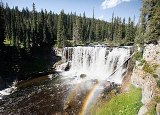 Iris FallsSnow and ice reported; historical route and parking gap45 ft (13.7 m) · Teton County, WY3.9 miE
- Albright FallsTeton County, WY6.2 miE
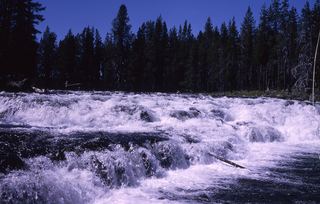 Bechler FallsOctober 27, 2026: regional snow and ice reported; Cave Falls Road condition unverified15 ft (4.6 m) · Teton County, WY6.8 miS
- Ragged FallsTeton County, WY7.1 miNE
- Cave FallsSource-reviewed route and parkingTeton County, WY7.2 miS