Iris Falls
Teton County, Wyoming
Your visit at a glance
- Waterfall height
- 45 ft (13.7 m)
- Location
- Teton County, Wyoming
- Access status
- Snow and ice reported; historical route and parking gap
- The walk
- 18–20 miles return (historic guide)
- Ground & access
- Forest and meadow trail followed by a gradual canyon climb; unbridged crossings, bears and seasonal snow or ice.
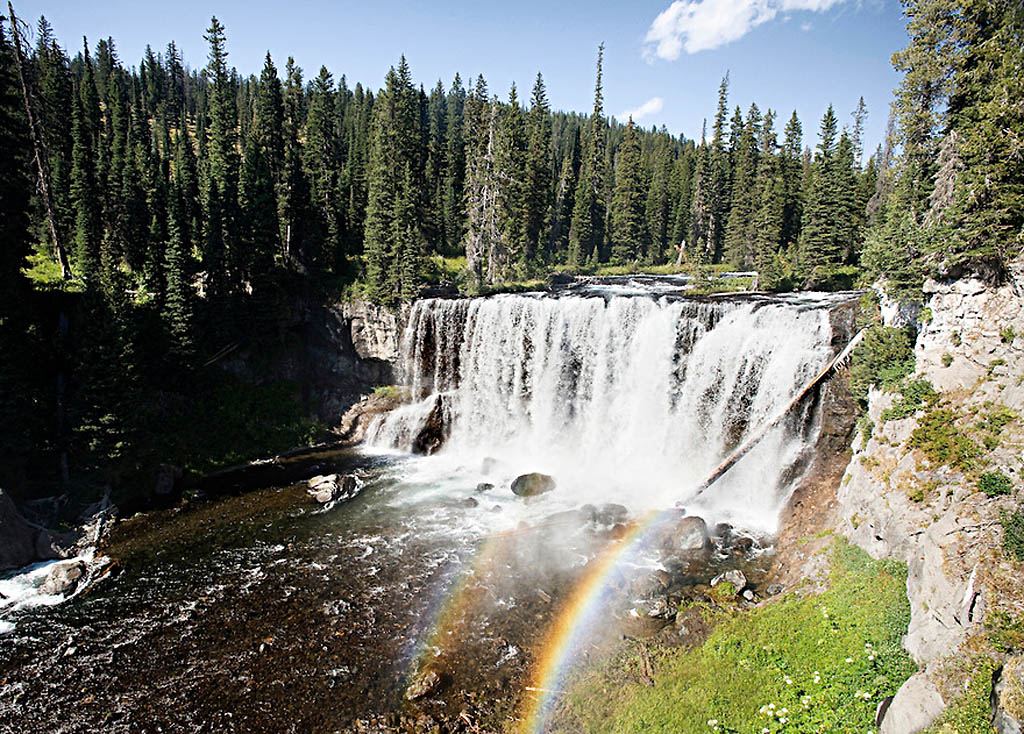
Long backcountry route with river fords. NPS reported snow and ice forming in Bechler Meadows on October 27, 2026.
Plan your visit
The NPS 2008 brochure describes starting at Bechler Ranger Station, following Bechler Meadows Trail north through the meadows, crossing Boundary Creek and fording Bechler River, then continuing up Bechler Canyon past Colonnade Falls to Iris Falls another mile upstream. Return the same way. Confirm this historical itinerary with rangers before travel.
NPS brochure Yell 240, March 2008, gives 18–20 miles round trip for the combined Colonnade and Iris Falls hike and 400 feet elevation change. No newer waterfall-specific mileage verified.
Forest and meadow trail followed by a gradual canyon climb; unbridged crossings, bears and seasonal snow or ice.
Where to start
NPS confirms Bechler Ranger Station trailhead off Cave Falls Road. Exact current parking layout and parking-to-trail connection were not verified.
Timing & water
October 27, 2026: NPS reports Bechler Meadows trails becoming a mix of snow and ice. Its July 28 canyon report is older and does not establish current conditions.
Before you go
NPS requires a permit for overnight backcountry stays, but not day hiking. Park entrance admission is separate.
Visitor informationVisit sources
More waterfalls nearby
Within 40 straight-line miles. Road and trail distances will differ.
- Upper Colonnade FallsPartial guide: long backcountry trail with deep fords; distance from the trailhead not stated36 ft (11 m) · Teton County, WY0.2 miSW
- Lower Colonnade FallsPartial guide: long backcountry trail with deep fords; distance from the trailhead not stated66 ft (20 m) · Teton County, WY0.3 miSW
- Ouzel FallsPartial guide: distant view from a long meadow trail; no trail to the falls and the distance to the viewing point is not statedTeton County, WY1.6 miW
- Albright FallsTeton County, WY3.2 miNE
- Silver Scarf FallsLong national park day hike with fords; falls a short walk from the Dunanda Falls junctionTeton County, WY3.9 miW
- Wahhi FallsTeton County, WY4.0 miNE
- Dunanda FallsLong Yellowstone backcountry day hike from the Bechler Ranger Station; stream crossings that may need wadingTeton County, WY4.0 miW
- Sluiceway FallsTeton County, WY4.1 miNE
- Ragged FallsTeton County, WY4.2 miNE