Martin Creek Falls
Unicoi County, Tennessee
Your visit at a glance
- Waterfall height
- Not recorded
- Location
- Unicoi County, Tennessee
- Access status
- Partial guide: parking at the gated road is not confirmed; unmarked side path
- The walk
- About a mile, per a visitor account; another account gives a little over 2 miles round trip
- Ground & access
- Old road, then an unmarked side path that can be hard to follow. Short, steep descent to the base of the falls.
Martin Creek Falls (also called Martin's Creek Falls) is a 20-foot waterfall in the Cherokee National Forest just outside Erwin. From the gated forest service road at the end of Martins Creek Road, walk the old road about a mile. A side path leads off to the left of the old road; it is not signed and is sometimes marked only with tape, so it is easy to miss. The side path comes out at the top of the falls, and a short, steep climb leads down to the pool at the base. Return the same way. Where to park at the gate is not documented: an older account describes an unmarked spot for about one car, and a later visitor found a locked vehicle gate beside a private home. No source confirms where to park.
Plan your visit
End of Martins Creek Road in Erwin at the gated forest road, old road about a mile up Martin Creek, then an unmarked side path on the left down to the falls
RATtreks describes a one mile hike from the gated forest service road to the falls. Hiking Adventures With Us gives a little over 2 miles round trip.
Old road, then an unmarked side path that can be hard to follow. Short, steep descent to the base of the falls.
Where to start
Not confirmed. From Okolona Drive in Erwin, turn left on Martins Creek Road; the last 0.9 mile is gravel and ends at a gated forest road. Visitor accounts describe very limited roadside space near the gate. Do not block the gate or private driveways.
Timing & water
The falls can be reduced to a trickle in dry periods.
Before you go
No fee is mentioned.
Visitor informationVisit sources
More waterfalls nearby
Within 40 straight-line miles. Road and trail distances will differ.
- Big Creek FallsRoadside waterfall with pullout and short bank pathYancey County, NC5.4 miS
- Red Fork FallsPartial guide: unofficial path and a dangerous scramble to the base; land manager not confirmedUnicoi County, TN7.5 miE
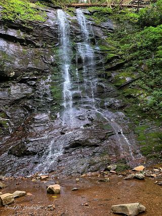 Sill Branch FallsGuide: short forest trail; keep left at the forkUnicoi County, TN7.7 miW
- Josiah FallsUnicoi County, TN8.2 miW
- Lower Higgins Creek FallsForest road route and parking documented; steep scramble to the baseUnicoi County, TN8.3 miW
- Pine Ridge FallsNational forest trail route documented by visitor accounts; creek crossingUnicoi County, TN8.3 miW
- Hell Hollow FallsUnicoi County, TN8.3 miW
- Birchfield Camp FallsPartial guide: total distance not stated; creek crossings without bridgesUnicoi County, TN8.5 miW
- Wilderness FallsUnicoi County, TN8.7 miW