Sill Branch Falls
Unicoi County, Tennessee
Your visit at a glance
- Waterfall height
- Not recorded
- Location
- Unicoi County, Tennessee
- Access status
- Guide: short forest trail; keep left at the fork
- The walk
- 0.56 mile one way (1.12 miles round trip)
- Ground & access
- Fairly well worn path with some rocks; one stream crossing on flat rocks, then a short steep climb. Rated easy by the hiking club.
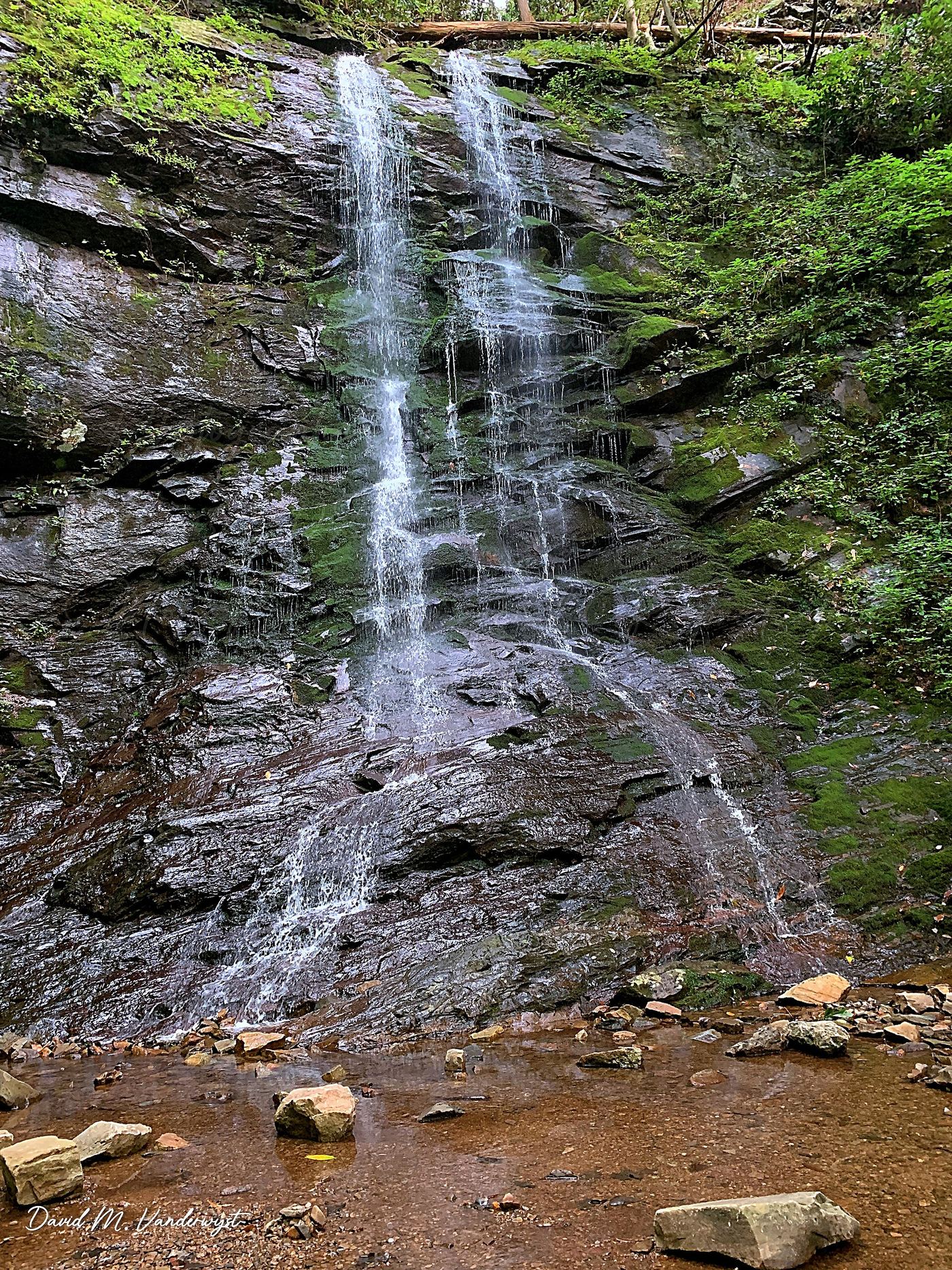
Sill Branch Falls is a remote waterfall on Sill Branch in the Clarks Creek area of Cherokee National Forest near Erwin. From the trailhead on Clarks Creek Road, follow Forest Service Trail 115 mostly uphill. At the junction of two blue-blazed trails, keep left, cross the creek on flat stepping stones, and climb a short steep section to the falls. The right fork is the Sill Branch South Trail toward Rich Mountain. The falls shrink to a trickle in dry spells, so go after rain. Return the same way.
Plan your visit
Clarks Creek Road trailhead, Sill Branch Trail (Forest Service Trail 115), left at the fork across the creek to Sill Branch Falls
The Tennessee Eastern Hiking Club trail page gives 0.56 mile of trail and 1.12 miles round trip from the car.
Fairly well worn path with some rocks; one stream crossing on flat rocks, then a short steep climb. Rated easy by the hiking club.
Where to start
From TN 107, take Clarks Creek Road about 3.1 miles; the last 1.7 miles are gravel. The trailhead is on the left with parking for 4 to 6 vehicles on the right, per the hiking club.
Timing & water
Best after decent rain; the falls can be a trickle in dry spells. No AT&T cell service, per the hiking club.
Before you go
No fee required, per the hiking club. No booking is needed.
Visitor informationVisit sources
More waterfalls nearby
Within 40 straight-line miles. Road and trail distances will differ.
- Pine Ridge FallsNational forest trail route documented by visitor accounts; creek crossingUnicoi County, TN0.7 miSW
- Josiah FallsUnicoi County, TN0.8 miSW
- Hell Hollow FallsUnicoi County, TN0.9 miNW
- Wilderness FallsUnicoi County, TN1.6 miSW
- Longarm Branch FallsUnicoi County, TN2.1 miSW
- Lower Higgins Creek FallsForest road route and parking documented; steep scramble to the baseUnicoi County, TN2.5 miS
- Birchfield Camp FallsPartial guide: total distance not stated; creek crossings without bridgesUnicoi County, TN2.6 miS
- Squibb Creek FallsResearched route and starting areaGreene County, TN6.5 miSW
- Pete's Branch FallsRoad and creek-crossing approach; total distance unconfirmedGreene County, TN7.4 miW