Lower Punch Bowl Falls
Hood River County, Oregon
Your visit at a glance
- Waterfall height
- 12 ft (3.7 m)
- Location
- Hood River County, Oregon
- Access status
- Canyon trail and spur to the shoreline beside the falls
- The walk
- About 1.7 miles to the spur junction, then a little under a quarter mile down the spur
- Ground & access
- Main trail blasted from cliffs in places, with cable handrails and drop-offs. The spur is moderately steep. Logjam and landslide debris at the creek. Crowded on summer days.
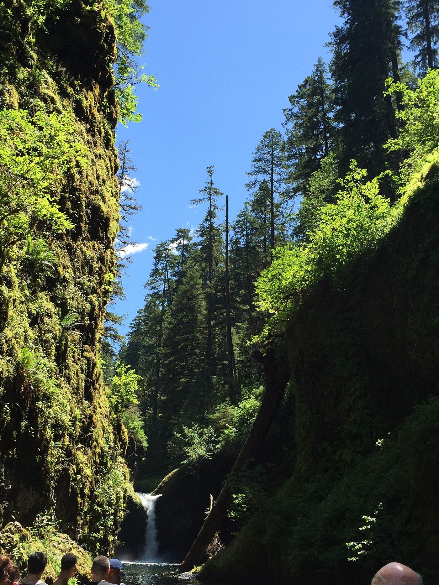
Lower Punch Bowl Falls is a 12 to 15 foot drop on Eagle Creek just below Punch Bowl Falls. From the Eagle Creek Trailhead, follow the Eagle Creek Trail above the creek, along cliff sections with cable handrails, past views of Metlako Falls, and across Sorenson Creek. At the clearing at the junction with the Lower Punch Bowl Trail #440B, go right and switchback down to the rocky shoreline beside the falls. A landslide above the falls has turned the old shoreline walk toward Punch Bowl Falls into a rocky scramble; for Punch Bowl Falls itself, use the overlook on the main trail. Return the same way.
Plan your visit
Eagle Creek Trailhead, Eagle Creek Trail #440 to the Lower Punch Bowl Trail #440B, then down to the shoreline beside the falls
Oregon Hikers places the Lower Punch Bowl Trail junction about 1.7 miles from the trailhead, with a drop of a little under a quarter mile to the shoreline. The Northwest Waterfall Survey gives 1/5 mile for the spur. Return the same way, uphill on the spur.
Main trail blasted from cliffs in places, with cable handrails and drop-offs. The spur is moderately steep. Logjam and landslide debris at the creek. Crowded on summer days.
Where to start
Eagle Creek Trailhead at the end of the road from I-84 Exit 41, which has no westbound exit. If the lot is full, use the Eagle Creek Day Use Trailhead.
Timing & water
Oregon Hikers lists the hike as year round.
Before you go
Oregon Hikers: Northwest Forest Pass (or America the Beautiful Pass) required; a drop box at the trailhead sells day passes.
Visitor informationVisit sources
More waterfalls nearby
Within 40 straight-line miles. Road and trail distances will differ.
 Punch Bowl FallsResearched visit notes36 ft (11 m) · Hood River County, OR0.1 miS
- Sorenson FallsDistant trail view of the lower tier documented164 ft (50 m) · Hood River County, OR0.2 miN
 Metlako FallsCollapsed overlook; limited main-trail sighting reported102 ft (31 m) · Hood River County, OR0.2 miNW
- Wauna FallsHood River County, OR0.8 miNW
 Loowit FallsEstablished cliffside trail to a viewpoint across the canyon78 ft (23.8 m) · Hood River County, OR1.1 miSE
- Skoonichuk FallsEstablished cliffside trail to a trailside view48 ft (14.6 m) · Hood River County, OR1.5 miSE
- Four Mile Falls95 ft (28.9 m) · Hood River County, OR1.7 miSE
- Tenas FallsLong trail to a bridge-side view documented18 ft (5.5 m) · Hood River County, OR1.9 miSE
- Lower Ruckel Creek FallsPartial guide: parking start and walking distance not describedHood River County, OR1.9 miNW