Elowah Falls
Multnomah County, Oregon
Your visit at a glance
- Waterfall height
- 213 ft (64.9 m)
- Location
- Multnomah County, Oregon
- Access status
- Established trail to the base of the falls; broken footbridge at the creek
- The walk
- No separate distance to the falls; the Oregon Hikers loop past the falls is 2.1 miles
- Ground & access
- Gravel and natural-surface trail with switchbacks and a steep descent into the McCord Creek ravine. Landslide debris and a broken footbridge at the falls; the creek crossing is slippery in winter.
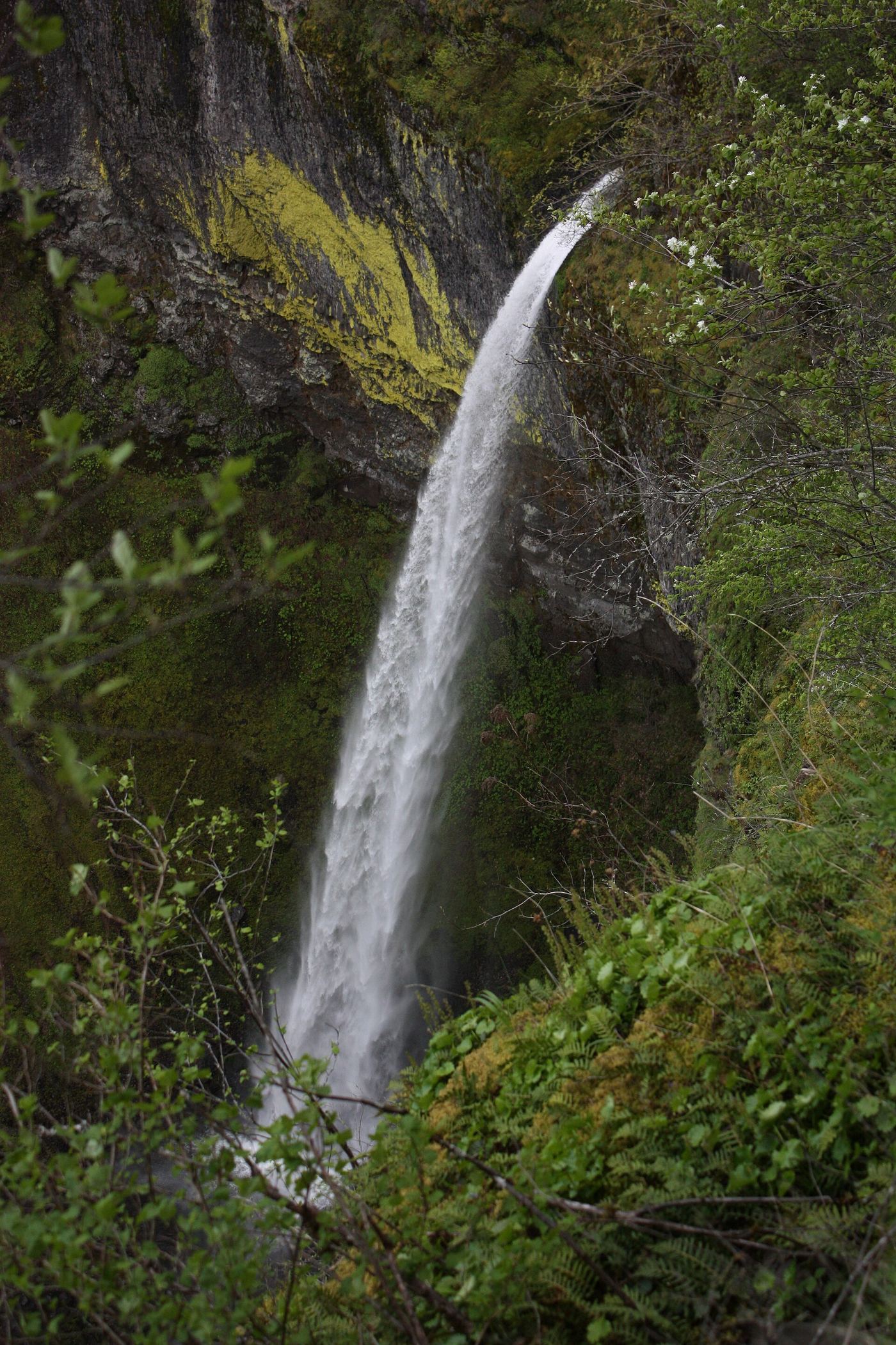
Elowah Falls drops 213 feet on McCord Creek. From the John B. Yeon trailhead, the wide trail climbs past a wooden water tank and the Nesmith Point Trail junction to the junction for Upper McCord Creek Falls. Keep left. The trail drops by switchbacks and traverses above McCord Creek to the plunge pool of the falls. The footbridge below the falls was mostly destroyed by a landslide; the creek can be crossed with care only when water is low. Return the same way, or cross and continue on the Gorge Trail to the Historic Columbia River Highway State Trail and back to the trailhead.
Plan your visit
John B. Yeon State Scenic Corridor trailhead, Gorge Trail 400 to the base of Elowah Falls on McCord Creek
Oregon Hikers gives 2.1 miles with 340 feet of elevation gain for the loop past Elowah Falls that returns on the Historic Columbia River Highway State Trail. It gives no separate distance from the trailhead to the falls.
Gravel and natural-surface trail with switchbacks and a steep descent into the McCord Creek ravine. Landslide debris and a broken footbridge at the falls; the creek crossing is slippery in winter.
Where to start
John B. Yeon trailhead on NE Frontage Road, about 2.1 miles east of I-84 Exit 35, or about 1/4 mile from Exit 37 for drivers from the east. About 13 spaces. No restrooms.
Timing & water
Oregon Hikers lists the hike as year-round except during winter storms.
Before you go
USFS lists John Yeon State Park as no fee.
Visitor informationVisit sources
More waterfalls nearby
Within 40 straight-line miles. Road and trail distances will differ.
 Upper McCord Creek FallsCliffside trail to a viewpoint of the falls64 ft (19.5 m) · Multnomah County, OR0.0 miSE
- Upper Wahe Falls50 ft (15.2 m) · Multnomah County, OR1.3 miE
- Wahe Falls80 ft (24.3 m) · Multnomah County, OR1.4 miE
 Wahclella FallsSource-reviewed route and parking127 ft (38.7 m) · Multnomah County, OR2.1 miE
- Munra FallsShort walk on an established trail from the Wahclella Falls Trailhead68 ft (20.7 m) · Multnomah County, OR2.2 miNE
- Hardy FallsSigned state park trail to a viewpoint above the falls; Discover Pass required90 ft (27.4 m) · Skamania County, WA2.3 miNW
- Rodney FallsState park trail to the falls and the Pool of the Winds viewpoint45 ft (13.7 m) · Skamania County, WA2.4 miNW
- Upper Rodney Falls35 ft (10.7 m) · Skamania County, WA2.4 miNW
- Upper Munra FallsMultnomah County, OR2.7 miE