Benham Falls
Deschutes County, Oregon
Your visit at a glance
- Waterfall height
- Not recorded
- Location
- Deschutes County, Oregon
- The walk
- Approximately 50 yards down
- Ground & access
- The trail descends to the platform; the source does not identify this route as wheelchair accessible.
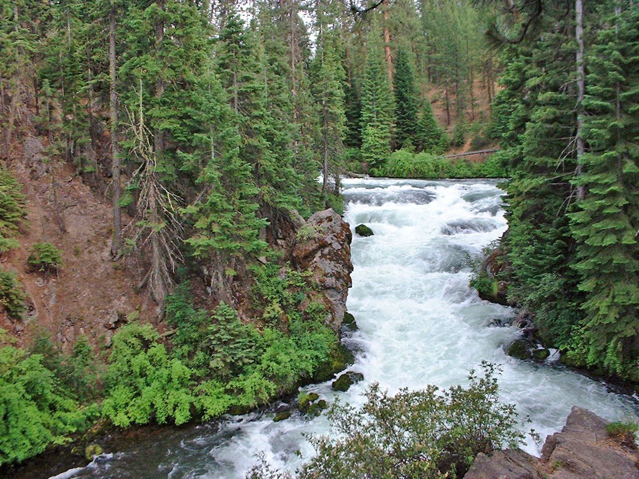
Photo credit
Photo: PJ Blalock, Public domain, via Wikimedia CommonsUse the west-side trailhead for the short descent to the falls viewing platform.
Plan your visit
Benham Falls West viewing platform
The short approach starts at Benham Falls West, not the separate East day-use area. Return uphill the same way.
The trail descends to the platform; the source does not identify this route as wheelchair accessible.
Where to start
Choose Benham Falls West Day Use & Trailhead, reached from Forest Roads 41 and 4120.
Timing & water
Day use only. Check forest road conditions before travelling in snow or ice.
Before you go
$5 per vehicle or accepted recreation pass.
Visitor informationMore waterfalls nearby
Within 40 straight-line miles. Road and trail distances will differ.
 Dillon FallsResearched visit notesDeschutes County, OR1.3 miN
 Tumalo FallsResearched visit notes89 ft (27.1 m) · Deschutes County, OR10 miNW
- Double FallsForest trail past Tumalo Falls to cliff-top viewpointsDeschutes County, OR11 miNW
- Fall River FallsState park trail to the fallsDeschutes County, OR12 miSW
- Upper Tumalo FallsForest trail to a partly obscured viewpoint documentedDeschutes County, OR12 miNW
- McKay Crossing FallsPartial guide: day-use parking at the campground bridge and off-season road access are not confirmedDeschutes County, OR15 miS
- Pringle FallsPublic access not establishedDeschutes County, OR17 miSW
 Paulina FallsResearched walking routeDeschutes County, OR17 miSE
- Fall Creek FallsEstablished wilderness trail; permit required in summerDeschutes County, OR17 miNW