Upper Tumalo Falls
Deschutes County, Oregon
Your visit at a glance
- Waterfall height
- Not recorded
- Location
- Deschutes County, Oregon
- Access status
- Forest trail to a partly obscured viewpoint documented
- The walk
- Distance to this viewpoint not stated; the full loop is 7 miles
- Ground & access
- Steady climb on a busy trail shared with mountain bikes going uphill.
Upper Tumalo Falls, also called Middle Tumalo Falls, is a 43-foot plunge on Tumalo Creek. From the parking lot, pass the Tumalo Falls viewpoint and climb the North Fork Trail past the overlook at the top of Tumalo Falls and two viewpoints of Double Falls. Continue up beside the creek to a side viewpoint of this falls, partly blocked by trees. Return the same way. Do not scramble down the steep slope.
Plan your visit
Tumalo Falls Trailhead via the North Fork Trail to the Upper (Middle) Tumalo Falls viewpoint
Oregon Hikers gives 7 miles for the full Tumalo Falls loop. It does not give a separate distance to this viewpoint.
Steady climb on a busy trail shared with mountain bikes going uphill.
Where to start
Tumalo Falls Trailhead at the end of gravel Forest Road 4603, off Skyliners Road west of Bend. If full, park along the road below the bridge.
Timing & water
No seasonal dates are given. Dogs must be leashed on the North Fork Trail.
Before you go
Northwest Forest Pass required.
Visitor informationVisit sources
More waterfalls nearby
Within 40 straight-line miles. Road and trail distances will differ.
- Double FallsForest trail past Tumalo Falls to cliff-top viewpointsDeschutes County, OR0.8 miSE
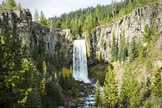 Tumalo FallsResearched visit notes89 ft (27.1 m) · Deschutes County, OR1.6 miSE
- Fall Creek FallsEstablished wilderness trail; permit required in summerDeschutes County, OR6.9 miW
- Upper Chush FallsPartial guide: final approach is an unmaintained user trail with no measured distance223 ft (68 m) · Deschutes County, OR8.0 miNW
- Phoenix Falls110 ft (33.5 m) · Deschutes County, OR8.0 miNW
- The CascadesPartial guide: informal paths past Chush Falls; current trailhead location not confirmedDeschutes County, OR8.3 miNW
- Chush FallsTrailhead parking and overlook approach documented; current conditions unverified67 ft (20.4 m) · Deschutes County, OR8.3 miNW
- Howlaak Falls70 ft (21.3 m) · Deschutes County, OR8.4 miNW
- Columnar Canyon Falls125 ft (38.1 m) · Deschutes County, OR8.5 miNW