Waterfalls near Morrilton, AR
16 named waterfalls within 30 miles of Morrilton, closest first. Distances are straight-line from the town center.
Visits with route details
Read the walking route, starting point and current access notes.
- Cedar FallsSource-reviewed route and parking95 ft (29 m) · Conway County, AR
- Seven Hollows GrottoSource-reviewed route and parking18 ft (5.5 m) · Conway County, AR
- Brown Creek CascadeFirsthand parking and approach documented; distance conflict unresolved8 ft (2.4 m) · Perry County, AR
- Forked Mountain FallsResearched visit notes10 ft (3.1 m) · Saline County, AR
- Schoolhouse FallsCurrent lower parking access unconfirmed30 ft (9.2 m) · Van Buren County, AR
- Lizard Log FallsResearched visit notes47 ft (14.3 m) · Van Buren County, AR
- Blue Hole CascadesApproach or parking partly unconfirmedPope County, AR
- Green Grotto FallsPartial guide: historical clearing parking lacks verified authorization21 ft (6.4 m) · Pope County, AR
- Iris FallsRoadside parking permission unconfirmed64 ft (19.5 m) · Van Buren County, AR
- Fiddlehead FallsCreek approach documented; current parking unverifiedPope County, AR
- Ladderbucket FallsRoute documented; current parking permission unverified36 ft (11 m) · Van Buren County, AR
- John Mountain FallsPartial guide: route documented; parking and permitted access beside the private gate unverified84 ft (25.6 m) · Van Buren County, AR
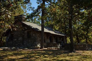 Mt Nebo FallsResearched walking route32 ft (9.8 m) · Yell County, AR
All 16 waterfalls
- Cedar FallsSource-reviewed route and parking95 ft (29 m) · Conway County, AR11 miW
- Seven Hollows GrottoSource-reviewed route and parking18 ft (5.5 m) · Conway County, AR12 miW
- Brown Creek CascadeFirsthand parking and approach documented; distance conflict unresolved8 ft (2.4 m) · Perry County, AR21 miSW
- Forked Mountain FallsResearched visit notes10 ft (3.1 m) · Saline County, AR26 miSW
- Schoolhouse FallsCurrent lower parking access unconfirmed30 ft (9.2 m) · Van Buren County, AR26 miN
- Twist Cascade12 ft (3.7 m) · Saline County, AR27 miSW
- Lizard Log FallsResearched visit notes47 ft (14.3 m) · Van Buren County, AR27 miN
- Whiskey Chute Falls83 ft (25.3 m) · Pope County, AR27 miN
- Blue Hole CascadesApproach or parking partly unconfirmedPope County, AR27 miN
- Green Grotto FallsPartial guide: historical clearing parking lacks verified authorization21 ft (6.4 m) · Pope County, AR27 miN
- Voices Falls44 ft (13.4 m) · Pope County, AR27 miN
- Iris FallsRoadside parking permission unconfirmed64 ft (19.5 m) · Van Buren County, AR27 miN
- Fiddlehead FallsCreek approach documented; current parking unverifiedPope County, AR27 miN
- Ladderbucket FallsRoute documented; current parking permission unverified36 ft (11 m) · Van Buren County, AR28 miN
- John Mountain FallsPartial guide: route documented; parking and permitted access beside the private gate unverified84 ft (25.6 m) · Van Buren County, AR28 miN
- Mt Nebo FallsResearched walking route32 ft (9.8 m) · Yell County, AR29 miW