Waterfalls near Geneseo, NY
17 named waterfalls within 30 miles of Geneseo, closest first. Distances are straight-line from the town center.
Visits with route details
Read the walking route, starting point and current access notes.
- Keshequa Creek FallsPartial guide: DEC trail to an unnamed waterfall spur; match to this falls probableLivingston County, NY
- Reynolds Gully FallsPartial guide: short public creek walk; larger falls on private land; exact drop uncertainLivingston County, NY
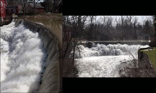 Honeoye FallsVillage viewpoint and public parking documentedMonroe County, NY
- Warsaw WaterfallCreek-bed route from the village park; private land outside the creekWyoming County, NY
- Lower FallsState park trail and parking documentedLivingston County, NY
- Middle FallsState park overlook beside the parking area; Gorge Trail continues past the fallsLivingston County, NY
- Upper FallsState park overlook near the Portageville entrance; vehicle feeWyoming County, NY
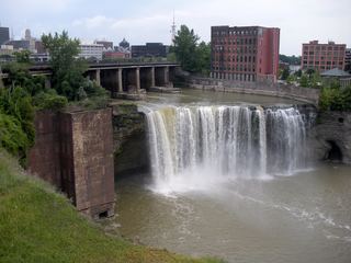 High FallsCity pedestrian bridge and overlooks; paved, short walk95 ft (29 m) · Monroe County, NY
- Postcard FallsTown park trail to a viewing area above the falls3 ft (1 m) · Monroe County, NY
- Middle FallsCity park trail to the dam that now caps Middle FallsMonroe County, NY
- Lower FallsCity bridge and park viewpoints; short walkMonroe County, NY
- Norton’s FallsShort gorge trail from public fishing access parkingMonroe County, NY
All 17 waterfalls
- Fall Brook FallsLivingston County, NY1.6 miS
- Triphammer FallsLivingston County, NY5.2 miNE
- Keshequa Creek FallsPartial guide: DEC trail to an unnamed waterfall spur; match to this falls probableLivingston County, NY9.4 miS
- Reynolds Gully FallsPartial guide: short public creek walk; larger falls on private land; exact drop uncertainLivingston County, NY15 miSE
- Honeoye FallsVillage viewpoint and public parking documentedMonroe County, NY16 miNE
- Buttermilk FallsGenesee County, NY16 miNW
- Warsaw WaterfallCreek-bed route from the village park; private land outside the creekWyoming County, NY18 miW
- Lower FallsState park trail and parking documentedLivingston County, NY18 miSW
- Middle FallsState park overlook beside the parking area; Gorge Trail continues past the fallsLivingston County, NY19 miSW
- Upper FallsState park overlook near the Portageville entrance; vehicle feeWyoming County, NY19 miSW
- Upper FallsOntario County, NY25 miE
- Upper FallsMonroe County, NY27 miNE
- High FallsCity pedestrian bridge and overlooks; paved, short walk95 ft (29 m) · Monroe County, NY27 miN
- Postcard FallsTown park trail to a viewing area above the falls3 ft (1 m) · Monroe County, NY28 miNE
- Middle FallsCity park trail to the dam that now caps Middle FallsMonroe County, NY28 miN
- Lower FallsCity bridge and park viewpoints; short walkMonroe County, NY28 miN
- Norton’s FallsShort gorge trail from public fishing access parkingMonroe County, NY29 miN