Waterfalls near Fremont, CA
13 named waterfalls within 30 miles of Fremont, closest first. Distances are straight-line from the town center.
Visits with route details
Read the walking route, starting point and current access notes.
- Murietta FallsRegional park trail; strenuous all-day hike108 ft (33 m) · Alameda County, CA
- Peter's Creek FallsPartial guide: final half mile is an unofficial path; permission not confirmedSan Mateo County, CA
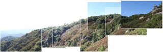 Castle Rock FallsPublished state park trail route and fee documented; viewing platformSanta Cruz County, CA
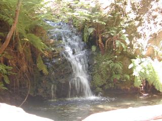 Tip Toe FallsPublished trail route documented; state park day-use fee appliesSan Mateo County, CA
- Sempervirens FallsOfficial reopened trail and parking rules documentedSanta Cruz County, CA
- Abrigo FallsFinal scramble is an informal route15 ft (4.5 m) · Contra Costa County, CA
All 13 waterfalls
- Tehan Falls60 ft (18.3 m) · Alameda County, CA9.0 miN
- Murietta FallsRegional park trail; strenuous all-day hike108 ft (33 m) · Alameda County, CA15 miE
- Peter's Creek FallsPartial guide: final half mile is an unofficial path; permission not confirmedSan Mateo County, CA20 miSW
- Gerow's WaterfallSanta Cruz County, CA21 miSW
- Castle Rock FallsPublished state park trail route and fee documented; viewing platformSanta Cruz County, CA23 miS
- Tip Toe FallsPublished trail route documented; state park day-use fee appliesSan Mateo County, CA24 miSW
- Grey Fox Creek FountainSan Francisco County, CA26 miNW
- Butano FallsSan Mateo County, CA28 miSW
- Sempervirens FallsOfficial reopened trail and parking rules documentedSanta Cruz County, CA28 miSW
- Abrigo FallsFinal scramble is an informal route15 ft (4.5 m) · Contra Costa County, CA29 miN
- Silver FallsSanta Cruz County, CA30 miSW
- The CascadesSanta Cruz County, CA30 miSW
- Golden FallsSanta Cruz County, CA30 miSW