Waterfalls near Fayetteville, AR
15 named waterfalls within 30 miles of Fayetteville, closest first. Distances are straight-line from the town center.
Visits with route details
Read the walking route, starting point and current access notes.
- Twin FallsOfficial trail and firsthand visitor-center parking approach documentedWashington County, AR
- Artist Point FallsClosure reported; reopening unverified15 ft (4.6 m) · Crawford County, AR
- Dockery Gap FallsResearched visit notes36 ft (11 m) · Crawford County, AR
- Jack White FallsHistorical route; current parking access unverified41 ft (12.5 m) · Franklin County, AR
- Glory B FallsCurrent parking access unconfirmed16 ft (4.9 m) · Madison County, AR
- Tea Kettle FallsPartial: route is poorly marked and two reviewers reported a private-property problem near the access road46 ft (14 m) · Madison County, AR
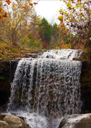 Tanyard Creek FallsPartial: distance from the parking lot to the falls is not stated12 ft (3.7 m) · Benton County, AR
- White Rock Creek CascadePartial guide: historical roadside start lacks verified safe parking10 ft (3 m) · Franklin County, AR
- Robinson FallsPartial guide: historical Ragtown clearing parking authorization unverifiedFranklin County, AR
- Spirit Creek FallsCurrent parking access unconfirmed8 ft (2.4 m) · Franklin County, AR
- Senyard FallsPartial guide: trailhead documented; final creek crossing and bluff descent unverified29 ft (8.8 m) · Franklin County, AR
- Dripping SpringsState park accessible overlook and steps to the base; entrance fee77 ft (23.4 m) · Delaware County, OK
All 15 waterfalls
- Twin FallsOfficial trail and firsthand visitor-center parking approach documentedWashington County, AR20 miS
- Artist Point FallsClosure reported; reopening unverified15 ft (4.6 m) · Crawford County, AR24 miS
- Dockery Gap FallsResearched visit notes36 ft (11 m) · Crawford County, AR25 miS
- Jack White FallsHistorical route; current parking access unverified41 ft (12.5 m) · Franklin County, AR27 miSE
- Glory B FallsCurrent parking access unconfirmed16 ft (4.9 m) · Madison County, AR28 miE
- Tea Kettle FallsPartial: route is poorly marked and two reviewers reported a private-property problem near the access road46 ft (14 m) · Madison County, AR28 miNE
- Tanyard Creek FallsPartial: distance from the parking lot to the falls is not stated12 ft (3.7 m) · Benton County, AR29 miN
- White Rock Creek Falls31 ft (9.5 m) · Franklin County, AR29 miS
- White Rock Creek CascadePartial guide: historical roadside start lacks verified safe parking10 ft (3 m) · Franklin County, AR29 miS
- Phipps Branch Falls23 ft (7 m) · Franklin County, AR29 miSE
- Robinson FallsPartial guide: historical Ragtown clearing parking authorization unverifiedFranklin County, AR29 miSE
- Spirit Creek FallsCurrent parking access unconfirmed8 ft (2.4 m) · Franklin County, AR29 miSE
- Murray Falls37 ft (11.3 m) · Franklin County, AR29 miSE
- Senyard FallsPartial guide: trailhead documented; final creek crossing and bluff descent unverified29 ft (8.8 m) · Franklin County, AR30 miSE
- Dripping SpringsState park accessible overlook and steps to the base; entrance fee77 ft (23.4 m) · Delaware County, OK30 miW