Tangerine Falls
Santa Barbara County, California
Your visit at a glance
- Waterfall height
- Not recorded
- Location
- Santa Barbara County, California
- Access status
- Visitor route and parking documented; unmaintained final section
- The walk
- About 2.2 to 2.5 miles return
- Ground & access
- Steep; unmarked junctions, creek crossings, a steep rock face beside cascades and boulder scrambling at the end. Poison oak along the trail.
Hikespeak describes walking a quarter mile up the East Fork Trail, crossing to the West Fork Trail, then after about 0.6 mile turning right at an unmarked junction onto the unmaintained but well-worn Middle Fork path. Follow the creek, crossing it a few times, then climb over boulders to the base of the falls. Return the same way.
Plan your visit
Cold Spring trailhead on Mountain Drive via the West Fork and Middle Fork paths to the base of Tangerine Falls
Hikespeak gives 2.5 miles out and back with 875 feet of gain; Santa Barbara County Trails Council gives 2.2 miles out and back. Not measured here.
Steep; unmarked junctions, creek crossings, a steep rock face beside cascades and boulder scrambling at the end. Poison oak along the trail.
Where to start
Roadside on Mountain Drive where Cold Springs Creek flows over the road, about 1 mile from Hot Springs Road per Hikespeak. The Trails Council says street parking is limited.
Timing & water
Seasonal. Flows after rain and may be dry in summer or drought.
Before you go
Hikespeak states no fee or permit is required. Not confirmed by the Forest Service.
Visitor informationVisit sources
More waterfalls nearby
Within 40 straight-line miles. Road and trail distances will differ.
- Hot Springs FallsSanta Barbara County, CA1.4 miSE
- Seven FallsTrail organization route and parking documented; creek scrambleSanta Barbara County, CA2.7 miW
- Wellhouse FallsSanta Barbara County, CA8.4 miNW
- Sisquoc FallsSanta Barbara County, CA19 miN
- 33 FallsVentura County, CA23 miE
- Rose Valley FallsResearched route and starting areaVentura County, CA28 miE
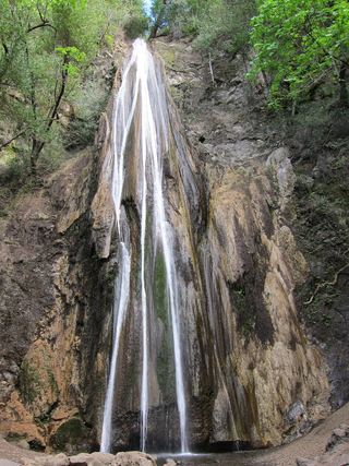 Nojoqui FallsPublished county park route and parking documentedSanta Barbara County, CA30 miW
- White Swift Falls59 ft (18 m) · Ventura County, CA34 miE
- Punch BowlPartial guide: probable match; pass rules and current trail start not confirmedVentura County, CA34 miE